Old Maps of Madison, Indiana
Explore 35 old maps of Madison, spanning from 1939 to today. These high-resolution historic maps reveal how streets, neighborhoods, landmarks, and natural features evolved over time — perfect for genealogy, metal detecting, research, and local history exploration.
What you can do with these maps:
- See how Madison changed over time: Compare historical maps to modern-day views to trace roads, homesites, rail lines & more.
- View detailed metadata: Each map includes creators, publishers, year, scale, and archive source.
- Overlay maps with satellite & LiDAR: Visualize the past alongside modern tools to explore terrain & human change.
- Trusted historical sources: Maps sourced from the USGS, Library of Congress, and other archives.
- Access maps your way: View online, download high-res files, or order prints for personal or research use.
Start exploring old maps of Madison to uncover forgotten places, hidden landmarks, and the deep history beneath your feet.
Madison, IN maps
(35)- 1939 Map of Madison West
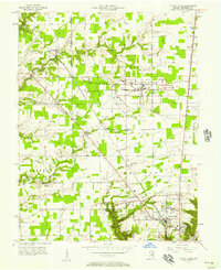
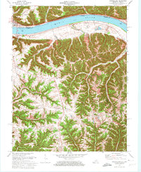
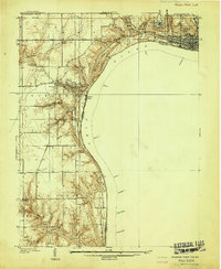 1939 Madison West1939 Print · USGSThe river bluffs of Jefferson County are captured here just before the Second World War, showing the steep topography of the Ohio River valley. Researchers can trace local landmarks like Hanover College, Clifty Falls State Park, and rural sites like Antioch Grange.3 unique versions available
 - 1948 Map of Madison West
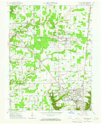
 1948 Madison West1948 Print · USGSThe river bluffs of Jefferson County are captured here in the late 1930s, showing the early development of Clifty Falls State Park and Hanover College. Researchers can trace the Pennsylvania railroad tracks or locate early landmarks like Antioch Grange and Springdale Cem.2 unique versions available
 - 1953 Map of Madison West, 1954 Print
 1953 Madison West1954 Print · USGSThe bluffs of the Ohio River define this mid-century portrait of the Indiana and Kentucky borderlands. Genealogists and local historians can trace the foundations of Hanover College, find rural landmarks like Old Bethel Cem, and locate the old path of the Pennsylvania RR.2 unique versions available
 - 1953 Map of Madison East, 1955 Print
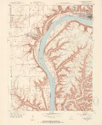
 1953 Madison East1955 Print · USGSThe Ohio River valley and the Kentucky uplands are captured in the early fifties, documenting a landscape of ridge-top farms and river towns. Genealogists can trace family connections through numerous rural landmarks like Mt Carmel Ch, Hunters Bottom, and Locust Sch.2 unique versions available
 - 1956 Map of Clifty Falls, 1957 Print
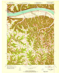
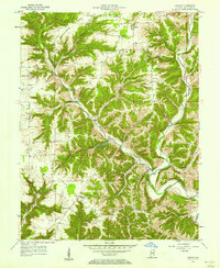
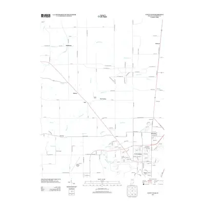
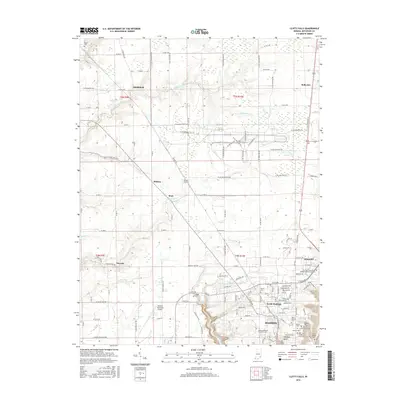
 1956 Clifty Falls1957 Print · USGSJefferson County in the late fifties was a landscape of stark contrasts, where the deep canyons of Clifty Falls State Park met the secured perimeter of the Jefferson Proving Ground. Genealogists and local historians can map out rural life via Smyrna, the Wirt Sta railroad stop, and family grounds like Higbie Cem.
 - 1956 Map of Canaan, 1958 Print
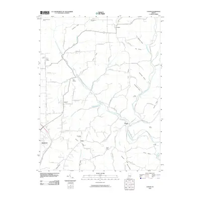
 1956 Canaan1958 Print · USGSJefferson County’s rural highlands are captured here in the mid-fifties, showing a landscape defined by ridges and deep hollows. Researchers can locate family landmarks like the Eagle Springs Grange Hall, Olive Branch Cem, and the community of Manville.
 - 1956 Map of Louisville, 1971 Print
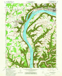
 1956 Louisville1971 Print · USGSThe Ohio River valley and the Kentucky Bluegrass are captured here during a period of rapid mid-century growth and industrial activity. Genealogists and historians can trace rail-centered towns and military land use at Fort Knox and the Jefferson Proving Ground.2 unique versions available
 - 1964 Map of Louisville
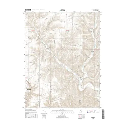
 1964 Louisville1964 Print · USGSThe Ohio River valley and Kentucky Bluegrass are captured in the mid-1960s, showing a region balanced between industrial growth and its agrarian roots. Genealogists and historians can trace the development of county seats like Shelbyville and Paris, or locate established institutions such as Georgetown College and Bernheim Forest.
 - 1964 Map of Clifty Falls, 1965 Print
 1964 Clifty Falls1965 Print · USGSMadison and its rugged creek valleys are captured in the mid-sixties, showcasing the area's transition from the sprawling military reservation to the Ohio River bluffs. Researchers can trace historic family burial sites like St Patricks Cem and landmarks such as Hanging Rock and Wirt Station.3 unique versions available
 - 1964 Map of Madison West, 1966 Print
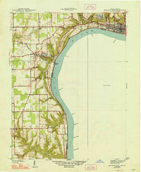
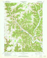
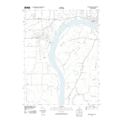
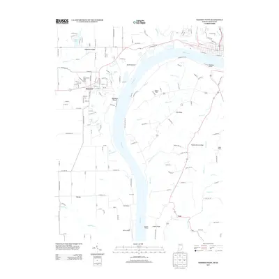
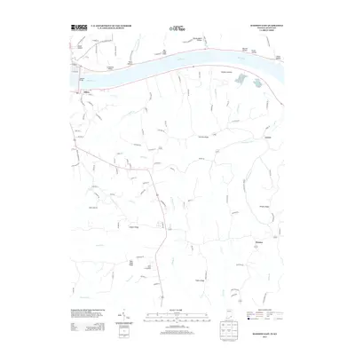
 1964 Madison West1966 Print · USGSThe Indiana-Kentucky borderlands come into focus during the mid-sixties, dominated by the winding river and the bluff-top campuses of the Madison area. Researchers can trace the grounds of Hanover College, the Madison State Hospital, and numerous family burial sites like Moffett Cem and Zion Cem.5 unique versions available
 - 1971 Map of Madison East, 1973 Print
 1971 Madison East1973 Print · USGSThe Ohio River corridor at the Indiana-Kentucky border is shown here in the early seventies, featuring the riverfront hub of Madison. Researchers can trace old ridge-top settlements and rural landmarks like St Peters Ch, Monitor, and Mt Carmel Ch.4 unique versions available
 - 1971 Map of Canaan, 1973 Print
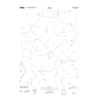
 1971 Canaan1973 Print · USGSJefferson County in the early seventies shows a landscape of ridge-top settlements and deep hollows. Genealogists can trace family roots through numerous sites like Hebron Ch Cem, the Eagle Springs Grange Hall, and the village of Manville.3 unique versions available
 - 1986 Map of Madison
 1986 Madison1986 Print · USGSSouthern Indiana and Northern Kentucky are shown here in the mid-eighties, centered on the river corridor and the sprawling Jefferson Proving Ground. Genealogists and historians can trace rail lines like the Seaboard System and locate river towns from Madison to Bethlehem.
 - 1990 Map of Madison, 1991 Print
 1990 Madison1991 Print · USGSThe Ohio River valley and the southern Indiana plains are documented here in the final decade of the twentieth century. Genealogists and historians can trace family-named crossroads and established rail towns like Dudleytown, Austin, and Crothersville along the P C RR line.
 - 1992 Map of Clifty Falls, 1995 Print
 1992 Clifty Falls1995 Print · USGSJefferson County in the early 1990s reveals a unique landscape shaped by military operations and dramatic river bluffs. Researchers can trace family sites like Higbie Cem and Liberty Ch or explore the massive Jefferson Proving Ground.
 - 2010 Map of Madison East, 2010 Print
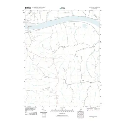 2010 Madison East2010 Print · USGSCovers Madison, including Milton, Monitor, and other nearby areas
 - 2010 Map of Clifty Falls, 2010 Print
 2010 Clifty Falls2010 Print · USGSCovers Madison, including Smyrna, Middlefork, and other nearby areas
 - 2010 Map of Madison West, 2010 Print
 2010 Madison West2010 Print · USGSCovers Madison, including Hanover, Saluda, and other nearby areas
 - 2010 Map of Canaan, 2010 Print
 2010 Canaan2010 Print · USGSCovers Madison, including Manville, Canaan, and other nearby areas
 - 2013 Map of Canaan, 2013 Print
 2013 Canaan2013 Print · USGSCovers Madison, including Manville, Canaan, and other nearby areas
 - 2013 Map of Clifty Falls, 2013 Print
 2013 Clifty Falls2013 Print · USGSCovers Madison, including Smyrna, Middlefork, and other nearby areas
 - 2013 Map of Madison West, 2013 Print
 2013 Madison West2013 Print · USGSCovers Madison, including Hanover, Saluda, and other nearby areas
 - 2013 Map of Madison East, 2013 Print
 2013 Madison East2013 Print · USGSCovers Madison, including Milton, Monitor, and other nearby areas
 - 2016 Map of Canaan, 2016 Print
 2016 Canaan2016 Print · USGSCovers Madison, including Manville, Canaan, and other nearby areas
 - 2016 Map of Clifty Falls, 2016 Print
 2016 Clifty Falls2016 Print · USGSCovers Madison, including Smyrna, Middlefork, and other nearby areas
Showing maps 1-25 of 35
Top cities near Madison
- Carrollton historical maps
- Hanover historical maps
- Lexington historical maps
- Lancaster historical maps
- Pleasant historical maps
- Saluda historical maps
See more
Top neighborhoods of Madison
Frequently asked questions
- What are the different types of historical maps available for Madison?
- What is the oldest map of Madison?
- Where can I purchase historical maps of Madison for my home or office?
- Where can I download high-res historical maps of Madison?
- Are there historical topographic maps available for Madison?
- Is there historical aerial imagery available for Madison?
- Where are historical maps of Madison sourced from?