2020s Maps of Madison, Indiana
Explore 4 historic maps of Madison from the 2020s. These maps offer a rare glimpse into what life looked like during the 2020s — showing old roads, neighborhoods, homes, and landmarks that have changed or disappeared over time.
Whether you're researching your family's past, planning a metal detecting trip, or studying how Madison's landscape evolved across the 2020s, these high-resolution maps are a powerful tool for exploring the history of this region.
- Focus on a specific era: All maps on this page are from the 2020s, giving you a focused view of this time period.
- See what’s changed: Compare century-old streets, trails, and buildings to today's modern landscape using overlays and satellite layers.
- Research with precision: Use these maps for genealogy, historical research, land use analysis, or educational projects.
- View, download, or print: Maps are fully viewable online in high resolution, and can be downloaded or printed for your own records.
Start exploring Madison's history through authentic maps from the 2020s. This is your window into the past.
Madison, IN maps
(4)- 2022 Map of Madison West, 2022 Print
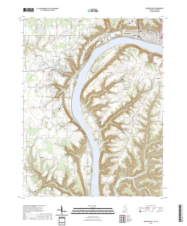 2022 Madison West2022 Print · USGSThe Indiana and Kentucky border along the Ohio River is captured here during a time of modern rural continuity. Genealogists and local historians can trace ancestral sites through Old Bethel Cemetery, Greenbriar Cemetery, and the historic streets of Hanover.
 - 2022 Map of Canaan, 2022 Print
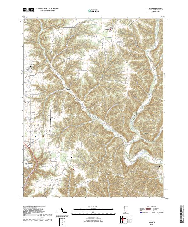 2022 Canaan2022 Print · USGSJefferson County ridgelands and rural settlements are documented here in the early twenty-first century. Genealogists can trace family roots through numerous burial grounds like Hebron Church Cem, Saint Anthony Cem, and Olive Branch Cem.
 - 2022 Map of Clifty Falls, 2022 Print
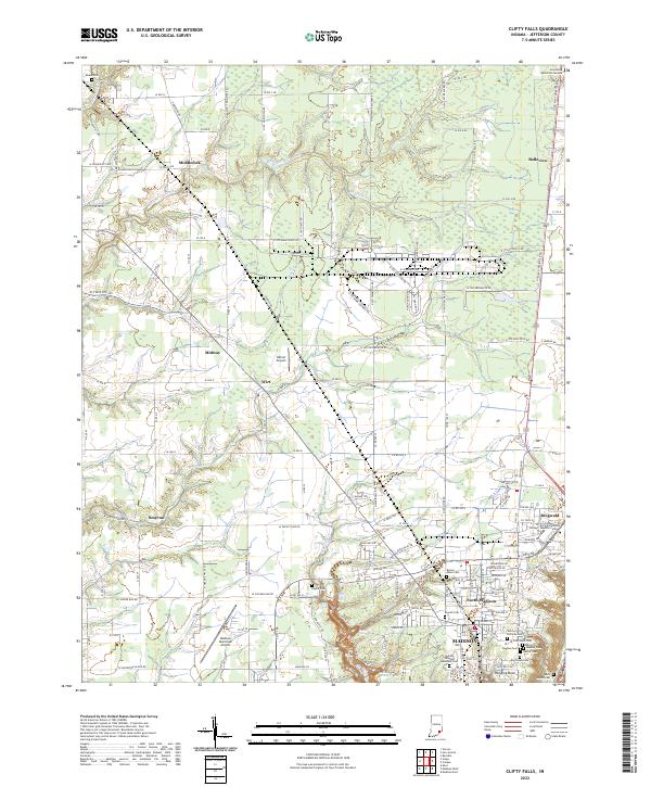 2022 Clifty Falls2022 Print · USGSMadison and the surrounding Jefferson County hills are shown in detail during the early 2020s, revealing a landscape of deep ravines and historic cemeteries. Researchers can locate family sites like Bayless Cem or trace the geography of Clifty Falls State Park.
 - 2022 Map of Madison East, 2022 Print
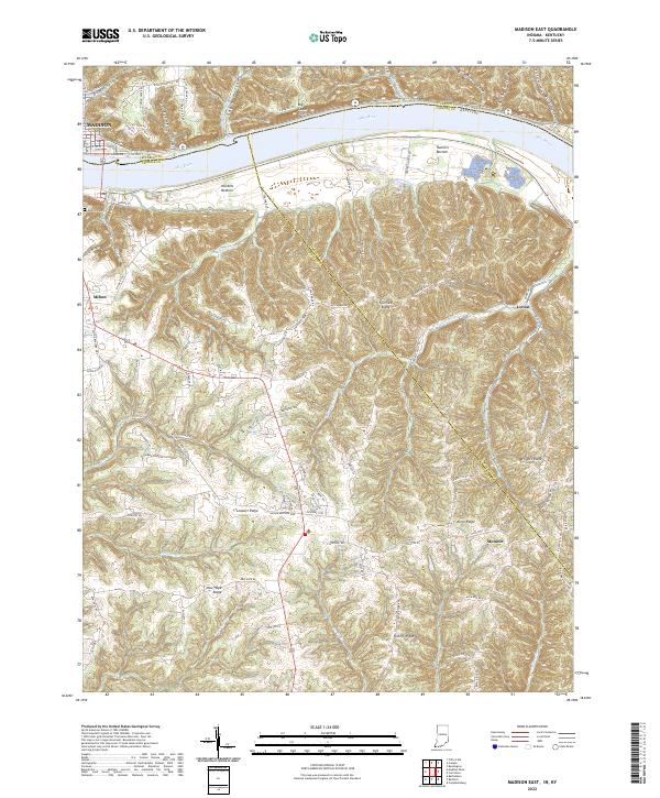 2022 Madison East2022 Print · USGSModern-day Indiana and Kentucky meet along the Ohio River in this detailed survey of the river valley. Researchers can trace land patterns around the historic river towns of Madison and Milton or locate rural landmarks like Moffett Cem.
End of results
Showing maps 1-4 of 4
Top cities near Madison
- Carrollton historical maps
- Hanover historical maps
- Lexington historical maps
- Lancaster historical maps
- Pleasant historical maps
- Saluda historical maps
See more
Top neighborhoods of Madison
Frequently asked questions
- What are the different types of historical maps available for Madison?
- What is the oldest map of Madison?
- Where can I purchase historical maps of Madison for my home or office?
- Where can I download high-res historical maps of Madison?
- Are there historical topographic maps available for Madison?
- Is there historical aerial imagery available for Madison?
- Where are historical maps of Madison sourced from?