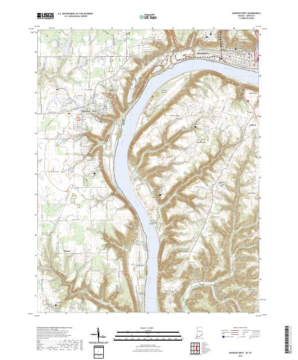
2022 Map of Madison West
USGS Topo · Published 2022About this map
Hanover and the western reaches of Madison overlook the Ohio River from the Indiana side of the border, where the land breaks into complex ridges and bottoms. This area is defined by sharp topographic shifts, such as the Devils Backbone and the numerous waterfalls like Chain Mill Falls and Fremont Falls that drop toward the river. The Kentucky shoreline in Trimble County is marked by fertile stretches like Coopers Bottom and Spring Creek Bottom, contrasting with the high ground of Liberty Ridge and Fisher Ridge. Genealogical interest is high throughout this landscape, with established burying grounds including Old Bethel Cem, Hanover Cem, and the more remote Zion Cem. The transition from the town grid of Madison to the rural expanses of Saluda illustrates the varying settlement patterns along the river corridor, supported by the presence of the Lee Bottom Airport and small hamlets like Trout on the Kentucky side.
Find a feature on this map
160 named features on this map. Tap any name to fly to it.
Don’t see what you’re looking for? This feature index may not catch every label — zoom into the map to look around manually.
Map Details
Editions of this 2022 Madison West Map
This is the sole edition of this map. No revisions or reprints were ever made.
Other maps of this area

1939 · Bethlehem
USGS Topo · 1:24,000

1939 · Madison West
USGS Topo · 1:24,000

1948 · Bethlehem
USGS Topo · 1:24,000

1948 · Madison West
USGS Topo · 1:24,000

1953 · Madison West
USGS Topo · 1:24,000

1953 · Bedford
USGS Topo · 1:24,000

1953 · Madison East
USGS Topo · 1:24,000

1953 · Bethlehem
USGS Topo · 1:24,000

1956 · Volga
USGS Topo · 1:24,000

1956 · Kent
USGS Topo · 1:24,000