Old Maps of Johnson County, Indiana
Explore 51 old maps of Johnson County, spanning from 1942 to today. These high-resolution historic maps reveal how streets, neighborhoods, landmarks, and natural features evolved over time — perfect for genealogy, metal detecting, research, and local history exploration.
What you can do with these maps:
- See how Johnson County changed over time: Compare historical maps to modern-day views to trace roads, homesites, rail lines & more.
- View detailed metadata: Each map includes creators, publishers, year, scale, and archive source.
- Overlay maps with satellite & LiDAR: Visualize the past alongside modern tools to explore terrain & human change.
- Trusted historical sources: Maps sourced from the USGS, Library of Congress, and other archives.
- Access maps your way: View online, download high-res files, or order prints for personal or research use.
Start exploring old maps of Johnson County to uncover forgotten places, hidden landmarks, and the deep history beneath your feet.
Johnson County, IN maps
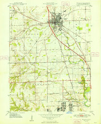
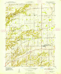
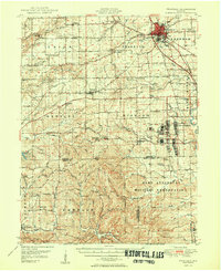
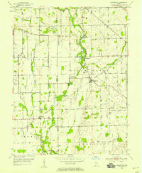
(51)- 1942 Map of Franklin
 1942 Franklin1942 Print · USGSCovers Johnson County, including Bloomington, Columbus, and other nearby areas
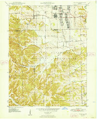
 - 1942 Map of Columbus
 1942 Columbus1942 Print · USGSCovers Johnson County, including Columbus, Shelbyville, and other nearby areas
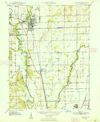
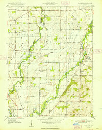
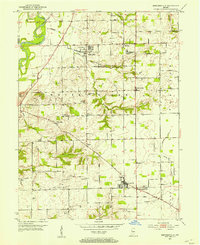
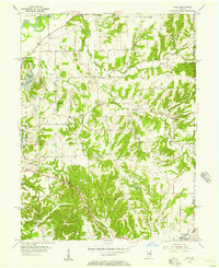
 - 1947 Map of Franklin, 1964 Print
 1947 Franklin1964 Print · USGSCovers Johnson County, including Franklin, Nineveh, and other nearby areas
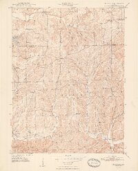
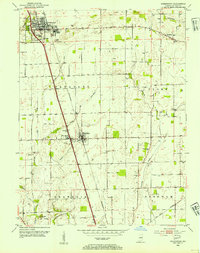
 - 1948 Map of Franklin
 1948 Franklin1948 Print · USGSCovers Johnson County, including Franklin, Hopewell, and other nearby areas2 unique versions available
 - 1948 Map of Edinburg
 1948 Edinburg1948 Print · USGSCovers Johnson County, including Columbus, Edinburgh, and other nearby areas
 - 1948 Map of Maywood
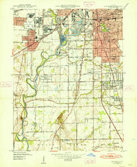 1948 Maywood1948 Print · USGSCovers Johnson County, including Indianapolis, Greenwood, and other nearby areas2 unique versions available
 - 1948 Map of Beech Grove
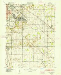 1948 Beech Grove1948 Print · USGSCovers Johnson County, including Indianapolis, Greenwood, and other nearby areas
 - 1948 Map of Trafalgar
 1948 Trafalgar1948 Print · USGSCovers Johnson County, including Trafalgar, Bud, and other nearby areas2 unique versions available
 - 1948 Map of Nineveh
 1948 Nineveh1948 Print · USGSCovers Johnson County, including Nineveh, Princes Lakes, and other nearby areas3 unique versions available
 - 1948 Map of Marietta
 1948 Marietta1948 Print · USGSCovers Johnson County, including Bengal, Mount Auburn, and other nearby areas2 unique versions available
 - 1948 Map of Fruitdale
 1948 Fruitdale1948 Print · USGSCovers Johnson County, including Gatesville, Taggart, and other nearby areas3 unique versions available
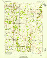
 - 1950 Map of Franklin
 1950 Franklin1950 Print · USGSCovers Johnson County, including Franklin, Nineveh, and other nearby areas2 unique versions available
 - 1950 Map of Edinburg
 1950 Edinburg1950 Print · USGSCovers Johnson County, including Columbus, Shelbyville, and other nearby areas2 unique versions available
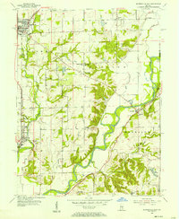
 - 1952 Map of Bargersville, 1953 Print
 1952 Bargersville1953 Print · USGSCovers Johnson County, including Greenwood, Bargersville, and other nearby areas
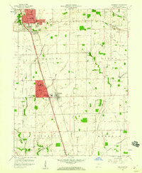
 - 1953 Map of Greenwood, 1954 Print
 1953 Greenwood1954 Print · USGSCovers Johnson County, including Greenwood, Franklin, and other nearby areas
 - 1953 Map of Acton, 1954 Print
 1953 Acton1954 Print · USGSCovers Johnson County, including Indianapolis, New Palestine, and other nearby areas
 - 1953 Map of Boggstown, 1954 Print
 1953 Boggstown1954 Print · USGSCovers Johnson County, including Needham, Fairland, and other nearby areas2 unique versions available
 - 1953 Map of Cincinnati, 1965 Print
 1953 Cincinnati1965 Print · USGSCovers Johnson County, including Indianapolis, Cincinnati, and other nearby areas3 unique versions available
 - 1953 Map of Indianapolis, 1965 Print
 1953 Indianapolis1965 Print · USGSCovers Johnson County, including Indianapolis, Carmel, and other nearby areas4 unique versions available
 - 1955 Map of Cope, 1957 Print
 1955 Cope1957 Print · USGSCovers Johnson County, including Adams, Morgantown, and other nearby areas
 - 1955 Map of Mooresville East, 1957 Print
 1955 Mooresville East1957 Print · USGSCovers Johnson County, including Mooresville, Bargersville, and other nearby areas
 - 1956 Map of Indianapolis
 1956 Indianapolis1956 Print · USGSCovers Johnson County, including Indianapolis, Carmel, and other nearby areas
 - 1957 Map of Indianapolis
 1957 Indianapolis1957 Print · USGSCovers Johnson County, including Indianapolis, Carmel, and other nearby areas2 unique versions available
 - 1957 Map of Cincinnati
 1957 Cincinnati1957 Print · USGSCovers Johnson County, including Indianapolis, Cincinnati, and other nearby areas
 - 1959 Map of Greenwood, 1960 Print
 1959 Greenwood1960 Print · USGSCovers Johnson County, including Greenwood, Franklin, and other nearby areas
Showing maps 1-25 of 51
Top cities of Johnson County
- Greenwood historical maps
- Franklin historical maps
- Needham historical maps
- New Whiteland historical maps
- Nineveh historical maps
- Whiteland historical maps
See more
Frequently asked questions
- What are the different types of historical maps available for Johnson County?
- What is the oldest map of Johnson County?
- Where can I purchase historical maps of Johnson County for my home or office?
- Where can I download high-res historical maps of Johnson County?
- Are there historical topographic maps available for Johnson County?
- Is there historical aerial imagery available for Johnson County?
- Where are historical maps of Johnson County sourced from?