Old Maps of Johnson County, Indiana for Hiking & Exploration
Hike through history with 121 historic maps of Johnson County. Explore old trails, ghost towns, and forgotten backroads — perfect for outdoor adventurers and local explorers.
- Rediscover forgotten places: Map out old mining camps, roads, and footpaths that no longer exist on modern maps.
- Layer with modern tools: Combine with LiDAR or satellite views to plan hikes through historical terrain.
- Made for exploration: Popular among hikers, overlanders, and local history lovers.
Use these maps to find adventure and explore the hidden past of Johnson County.
Johnson County, IN maps
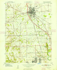
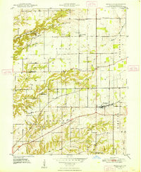
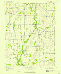
(121)- 1942 Map of Franklin
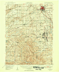
 1942 Franklin1942 Print · USGSCentral Indiana during the early years of the war shows a landscape of established rail towns and growing military installations. Genealogists can trace family names across small settlements like Nineveh, Bean Blossom, and Helmsburg, or locate the Indiana University Observatory.
 - 1942 Map of Columbus
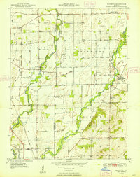
 1942 Columbus1942 Print · USGSBartholomew and Shelby counties are shown during the early years of the war, as military installations and rail lines reshaped the rural Indiana landscape. Genealogists can trace family-named sites and established communities like St Louis Crossing, Hope, and the sprawling Camp Atterbury.
 - 1947 Map of Franklin, 1964 Print
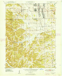
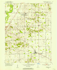
 1947 Franklin1964 Print · USGSMid-century Johnson County is captured here during a period of significant military activity and established civic life. Genealogists and local historians can locate Franklin College, the Prisoner of War Camp at Camp Atterbury, and numerous rural sites like Lick Spring Church and Hopewell Cem.
 - 1948 Map of Franklin
 1948 Franklin1948 Print · USGSFranklin and its surrounding townships are captured here in the late 1940s as the community expanded around its historic institutions and rail lines. Genealogy researchers can trace family landmarks like Mulligan's Cem, the Masonic Home, and Franklin Township School.2 unique versions available
 - 1948 Map of Edinburg
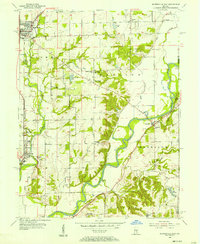
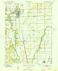 1948 Edinburg1948 Print · USGSThe Driftwood River valley transitions from agricultural heartland to a significant military installation in the late 1940s. Genealogists can trace family names at Rest Haven Cem and Treadway Cem or locate the rural Old Union Ch near the banks of Big Slough.
 - 1948 Map of Maywood
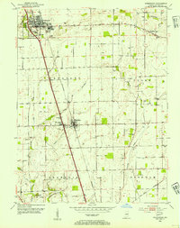
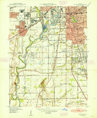 1948 Maywood1948 Print · USGSThe southern suburbs of Indianapolis are captured here in the post-war era as industrial centers and new neighborhoods expand toward the county line. Genealogists and historians can trace the foundations of Mars Hill, explore the campus of Indiana Central College, or locate family sites at Holy Cross Cem.2 unique versions available
 - 1948 Map of Beech Grove
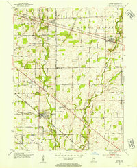
 1948 Beech Grove1948 Print · USGSSoutheast Marion County is captured here in the late 1940s as its rail-towns and suburban fringes expanded. Researchers can trace the massive Indianapolis Union RR yards or locate family roots near New Bethel, Southport, and New Crown Cem.
 - 1948 Map of Trafalgar
 1948 Trafalgar1948 Print · USGSTrafalgar and the surrounding Johnson County townships appear here during the late 1940s as rail-connected farming communities. Researchers can locate historic rural schoolhouses like Union Township Sch, small settlements at Bud and Anita, and old burial grounds including Harris Cem.2 unique versions available
 - 1948 Map of Nineveh
 1948 Nineveh1948 Print · USGSBartholomew and Johnson counties are captured here just after the war, when the landscape was defined by the massive Camp Atterbury Military Reservation. Genealogists and historians can trace the foundations of Nineveh and find significant sites like the Prisoner-of-War Cem and St Johns Ch.3 unique versions available
 - 1948 Map of Marietta
 1948 Marietta1948 Print · USGSShelby County farmland meets military history in the late 1940s as the Blue River winds through rural townships. Genealogists can trace family names at Smiley Cem or Conover Cem and locate rural landmarks like Jollity Ch and the Hendricks Township School.2 unique versions available
 - 1948 Map of Fruitdale
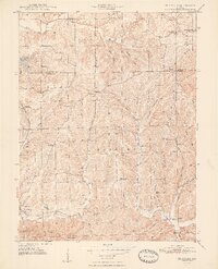 1948 Fruitdale1948 Print · USGSNear the border of Johnson and Brown counties in the late 1940s, this area shows a landscape of ridge-top roads and tucked-away hollows. Genealogists can trace family names through landmarks like Duncan Cem, Spearsville Sch, and the Illinois Central rail line.3 unique versions available
 - 1950 Map of Franklin
 1950 Franklin1950 Print · USGSMid-century Johnson County and Brown County come into focus here, showing the expansion of settlements and military infrastructure during the post-war years. Researchers can trace the layout of the Camp Atterbury Military Reservation, locate family names at Greenlawn Cemetery, or find vanished landmarks like the Prisoner of War Camp.2 unique versions available
 - 1950 Map of Edinburg
 1950 Edinburg1950 Print · USGSMid-century Shelby and Bartholomew Counties are captured here as the military presence at Atterbury meets a deeply rooted farming landscape. Researchers can locate dozens of country landmarks like Jollity Church, Tennehill Bridge, and the Shelby Township School.2 unique versions available
 - 1952 Map of Bargersville, 1953 Print
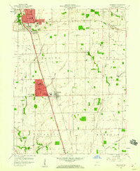
 1952 Bargersville1953 Print · USGSBargersville and the White River valley of Johnson County are shown here in the early fifties during a period of steady rural growth. Local researchers can trace family roots through numerous burial grounds like Old Bargersville Cem and Boles Cem, or locate landmarks such as Stones Crossing and Salem Ch.
 - 1953 Map of Greenwood, 1954 Print
 1953 Greenwood1954 Print · USGSGreenwood and Whiteland were growing rail-side communities in the early fifties, set against a backdrop of carefully managed Indiana farmland. Researchers can locate numerous family burial sites like Nolan Cem and Williams Cem, or trace the old path of the PENNSYLVANIA railroad.
 - 1953 Map of Acton, 1954 Print
 1953 Acton1954 Print · USGSSoutheastern Indiana farmland meets the rail lines of the early fifties in this detailed look at the rural landscape. Genealogists can locate family-named sites like Schildmeier Cem, Zion Sch, and the old rail stop at Acton.
 - 1953 Map of Boggstown, 1954 Print
 1953 Boggstown1954 Print · USGSShelby and Johnson Counties are captured here in the early 1950s as rural agriculture and small-town life centered on the river and rail. Researchers can trace family roots through numerous burial grounds like Hough Cem and Boggstown Cem or locate The Red Mills along Sugar Creek.2 unique versions available
 - 1953 Map of Cincinnati, 1965 Print
 1953 Cincinnati1965 Print · USGSThe Ohio River valley and the industrial heartland of Indiana and Ohio are captured here during the mid-century peak of rail and river commerce. Genealogists and historians can trace connections between Cincinnati and outlying military sites like Camp Atterbury and Bakalar AFB.3 unique versions available
 - 1953 Map of Indianapolis, 1965 Print
 1953 Indianapolis1965 Print · USGSCentral Indiana and the Illinois borderlands are captured in the mid-sixties, showing the growth of Indianapolis and its industrial rail corridors. Genealogists and historians can trace the development of outlying towns like Zionsville or Beech Grove and find landmarks such as Atterbury AAF and Turkey Run State Park.4 unique versions available
 - 1955 Map of Cope, 1957 Print
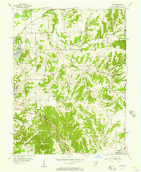 1955 Cope1957 Print · USGSMid-century Morgan County is captured here at a time when small communities like Cope and Exchange were central to rural life. Researchers can locate family landmarks such as Williams Cem, trace the Illinois Central rail line into Morgantown, or find the old Fish Hatchery.
 - 1955 Map of Mooresville East, 1957 Print
 1955 Mooresville East1957 Print · USGSMorgan County in the mid-fifties is captured here during a time of rural stability and industrial transition. Researchers can trace family history through the IOOF Cem, locate the Walnut Grove Sch, or find the mid-century Drive-in Theater near Mooresville.
 - 1956 Map of Indianapolis
 1956 Indianapolis1956 Print · USGSCentral Indiana in the mid-fifties is captured during a period of industrial growth and military presence. Genealogists and historians can trace the rail networks of the New York Central or locate regional landmarks like Fort Benjamin Harrison and Camp Atterbury.
 - 1957 Map of Indianapolis
 1957 Indianapolis1957 Print · USGSCentral Indiana in the mid-fifties is captured here as a crossroads of major rail lines and nascent federal highways. Genealogists and historians can trace family-named ridges like Poplar Ridge or locate strategic sites like Camp Atterbury and Speedway.2 unique versions available
 - 1957 Map of Cincinnati
 1957 Cincinnati1957 Print · USGSThe Ohio River valley and its surrounding highlands thrived during the mid-fifties industrial peak, centered on the bustling Cincinnati and Dayton metropolitan hubs. Researchers can trace the extensive rail networks and military sites like Wright-Patterson AFB and Camp Atterbury.
 - 1959 Map of Greenwood, 1960 Print
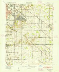
 1959 Greenwood1960 Print · USGSJohnson County was undergoing a residential transformation in the late fifties as suburban developments reached south of Greenwood. Genealogists can trace family names and locations through several rural burial grounds like Rocklane Cem and landmarks like Donalds Knoll.
Showing maps 1-25 of 121
Top cities of Johnson County
- Greenwood historical maps
- Franklin historical maps
- Needham historical maps
- New Whiteland historical maps
- Nineveh historical maps
- Whiteland historical maps
See more
Frequently asked questions
- What are the different types of historical maps available for Johnson County?
- What is the oldest map of Johnson County?
- Where can I purchase historical maps of Johnson County for my home or office?
- Where can I download high-res historical maps of Johnson County?
- Are there historical topographic maps available for Johnson County?
- Is there historical aerial imagery available for Johnson County?
- Where are historical maps of Johnson County sourced from?