2020s Maps of Johnson County, Indiana
Explore 14 historic maps of Johnson County from the 2020s. These maps offer a rare glimpse into what life looked like during the 2020s — showing old roads, neighborhoods, homes, and landmarks that have changed or disappeared over time.
Whether you're researching your family's past, planning a metal detecting trip, or studying how Johnson County's landscape evolved across the 2020s, these high-resolution maps are a powerful tool for exploring the history of this region.
- Focus on a specific era: All maps on this page are from the 2020s, giving you a focused view of this time period.
- See what’s changed: Compare century-old streets, trails, and buildings to today's modern landscape using overlays and satellite layers.
- Research with precision: Use these maps for genealogy, historical research, land use analysis, or educational projects.
- View, download, or print: Maps are fully viewable online in high resolution, and can be downloaded or printed for your own records.
Start exploring Johnson County's history through authentic maps from the 2020s. This is your window into the past.
Johnson County, IN maps
(14)- 2022 Map of Edinburgh, 2022 Print
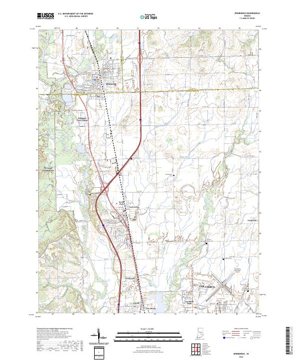 2022 Edinburgh2022 Print · USGSThe confluence of the Big Blue and Driftwood rivers south of Edinburgh is captured in this contemporary survey of the Indiana heartland. Genealogists can trace family sites at Rest Haven Cem and Tannehill Cem or explore the rail corridor of the L & I RR.
 - 2022 Map of Boggstown, 2022 Print
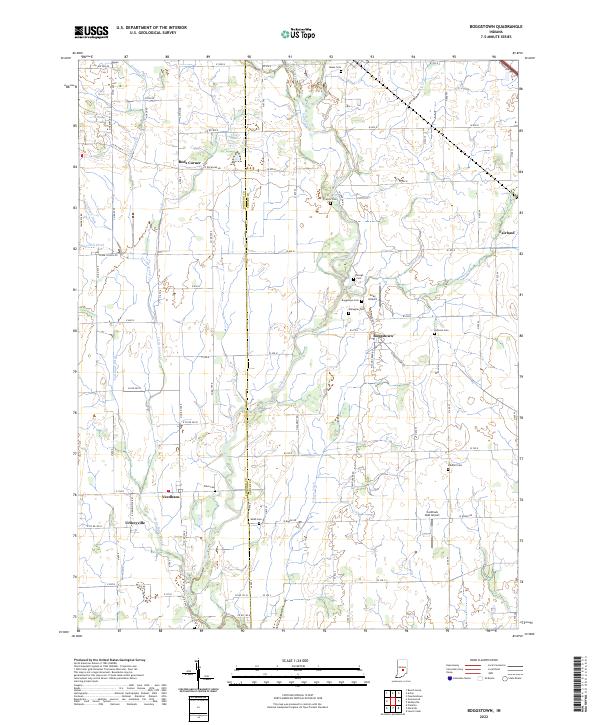 2022 Boggstown2022 Print · USGSShelby and Johnson counties come alive in this contemporary record of Indiana's rural agricultural heartland. Genealogists and local historians can trace family ties through numerous small burial sites like Sandhill Cem or Francis Cem and explore long-standing communities such as Boggstown and Fairland.
 - 2022 Map of Trafalgar, 2022 Print
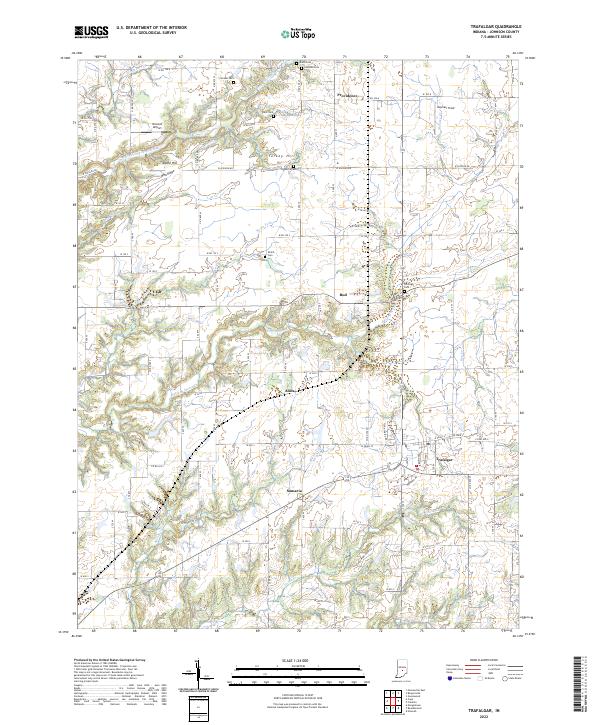 2022 Trafalgar2022 Print · USGSJohnson County’s rural landscape is captured here in the early twenty-first century, showing a network of small hamlets and family farmsteads. Researchers can locate several burial grounds like Shiloh Cem and Harris Cem or trace the early roots of Trafalgar and Samaria.
 - 2022 Map of Mooresville East, 2022 Print
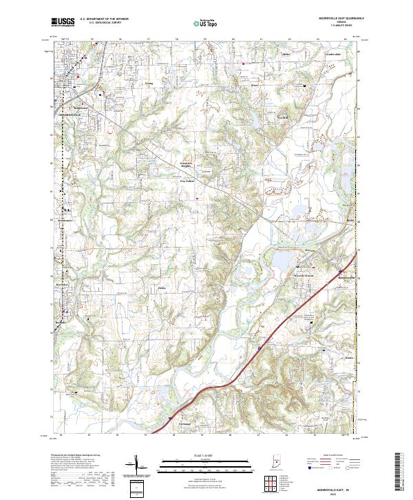 2022 Mooresville East2022 Print · USGSMorgan County in the early twenty-first century is a landscape shaped by the White River and its many tributaries. Genealogists and local historians can trace family roots through numerous sites like Whetzel Cem, Brooklyn Cem, and the Old Butterfield Cem.
 - 2022 Map of Marietta, 2022 Print
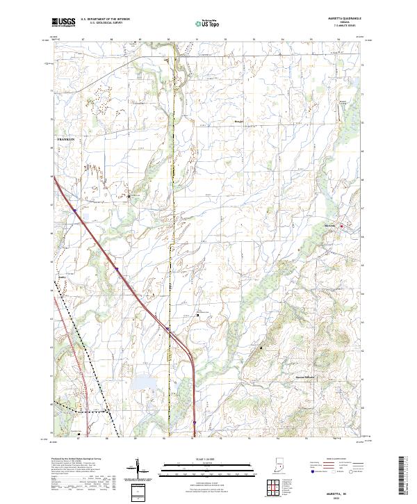 2022 Marietta2022 Print · USGSThe rural border of Johnson and Shelby Counties is documented here in the early 2020s, showing a landscape defined by its waterways and small settlements. Researchers can locate numerous local burial sites like Needham and Brockman Cemeteries or trace the routes through Marietta and Bengal.
 - 2022 Map of Acton, 2022 Print
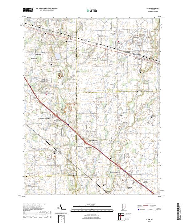 2022 Acton2022 Print · USGSThe rural communities southeast of Indianapolis are captured in this detailed study of the tri-county border area. Researchers can trace family roots through numerous burial grounds, including Mount Pleasant Methodist Church Cem and New Palestine Cem.
 - 2022 Map of Beech Grove, 2022 Print
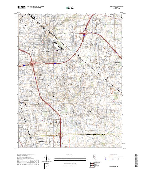 2022 Beech Grove2022 Print · USGSThe Beech Grove and Southport suburbs of Indianapolis are shown in high detail during the early 2020s. Researchers can locate numerous local burial grounds including New Crown Cem, Southport Cem, and the Zion United Church of Christ Cem.
 - 2022 Map of Beanblossom, 2022 Print
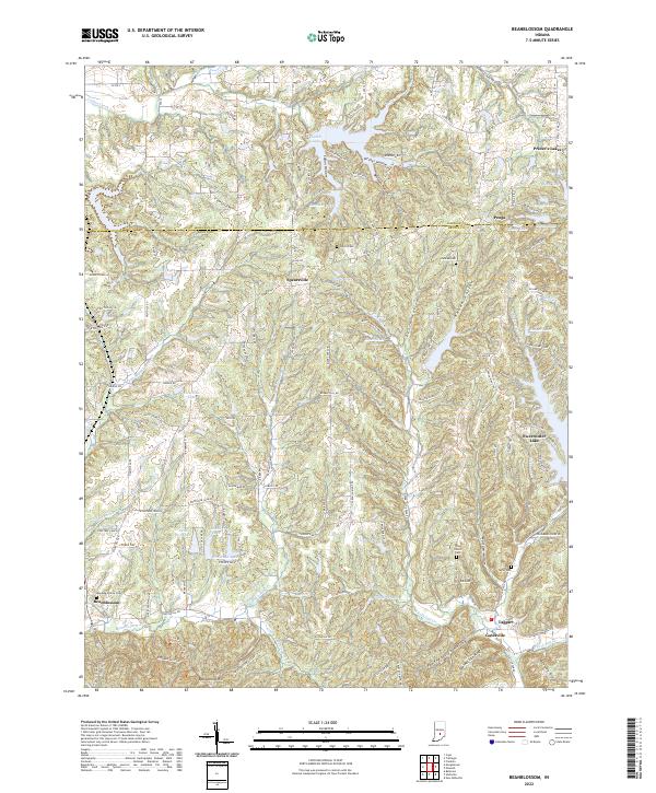 2022 Beanblossom2022 Print · USGSBrown County hills and hollows are documented here during the early twenty-first century. Genealogists and local historians can trace family sites at Calvin Cem and Zion Church or explore settlements like Peoga and Beanblossom.
 - 2022 Map of Greenwood, 2022 Print
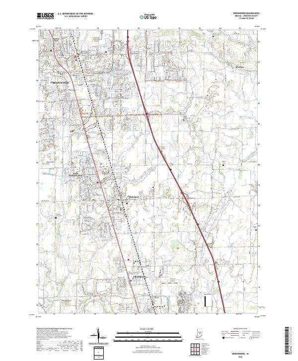 2022 Greenwood2022 Print · USGSThe northern Johnson County corridor comes into focus in the 2020s, showing the continued growth of GREENWOOD and Whiteland. Researchers can trace old family burial sites like Nolan Cem and Glade Dobbins Cem or follow the path of the L & I RR through the landscape.
 - 2022 Map of Cope, 2022 Print
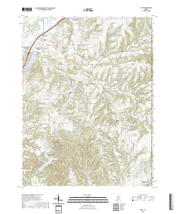 2022 Cope2022 Print · USGSMorgan County in the early 2020s shows a landscape defined by the winding White River and a network of small family cemeteries. Genealogists can trace local heritage at East Hill Cem and Brian Cem while exploring the development of Morgantown and Painted Hills.
 - 2022 Map of Bargersville, 2022 Print
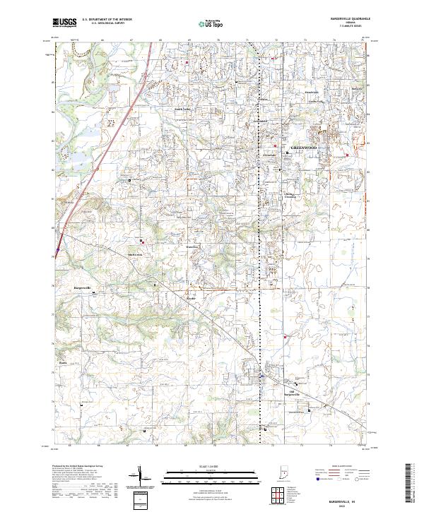 2022 Bargersville2022 Print · USGSBargersville and the western edge of Greenwood are shown here in the early 2020s as residential expansion reaches into traditional farmland. Local historians can trace family roots through numerous pioneer burial grounds like Salem Cem and Utterback Cem or locate the site of Old Bargersville.
 - 2022 Map of Franklin, 2022 Print
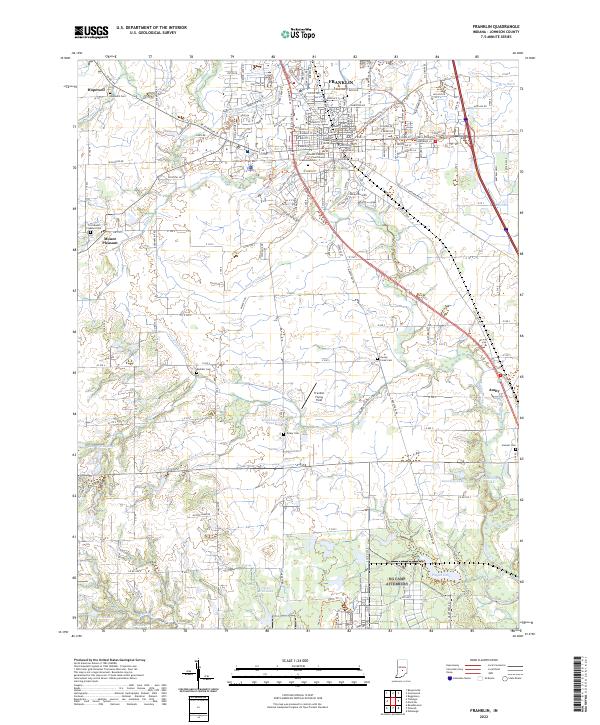 2022 Franklin2022 Print · USGSFranklin and the surrounding Johnson County countryside appear in great detail during the early 2020s. Researchers can locate family heritage sites like Hopewell Cem or trace the early aviation history at the Franklin Flying Field.
 - 2022 Map of Nineveh, 2022 Print
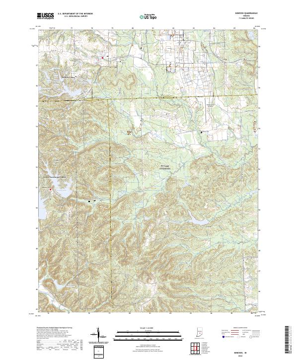 2022 Nineveh2022 Print · USGSBartholomew and Johnson counties are captured here in a period of established lakeside communities and rural aviation. Researchers can trace family history through sites like Old Nineveh Cemetery and Kansas Cemetery, or locate the Himsel Army Airfield.
 - 2022 Map of Maywood, 2022 Print
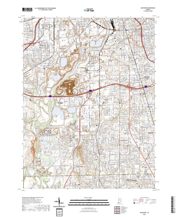 2022 Maywood2022 Print · USGSSouth of Indianapolis in the early 2020s, the river and rail corridors weave through long-established neighborhoods and expansive cemeteries. Genealogists and local historians can trace the grounds of Calvary Cemetery or locate the historic campus of the University of Indianapolis.
End of results
Showing maps 1-14 of 14
Top cities of Johnson County
- Greenwood historical maps
- Franklin historical maps
- Needham historical maps
- New Whiteland historical maps
- Nineveh historical maps
- Whiteland historical maps
See more
Frequently asked questions
- What are the different types of historical maps available for Johnson County?
- What is the oldest map of Johnson County?
- Where can I purchase historical maps of Johnson County for my home or office?
- Where can I download high-res historical maps of Johnson County?
- Are there historical topographic maps available for Johnson County?
- Is there historical aerial imagery available for Johnson County?
- Where are historical maps of Johnson County sourced from?