Old Maps of Shady Nook, Indiana for Hiking & Exploration
Hike through history with 11 historic maps of Shady Nook. Explore old trails, ghost towns, and forgotten backroads — perfect for outdoor adventurers and local explorers.
- Rediscover forgotten places: Map out old mining camps, roads, and footpaths that no longer exist on modern maps.
- Layer with modern tools: Combine with LiDAR or satellite views to plan hikes through historical terrain.
- Made for exploration: Popular among hikers, overlanders, and local history lovers.
Use these maps to find adventure and explore the hidden past of Shady Nook.
Shady Nook, IN maps
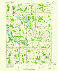
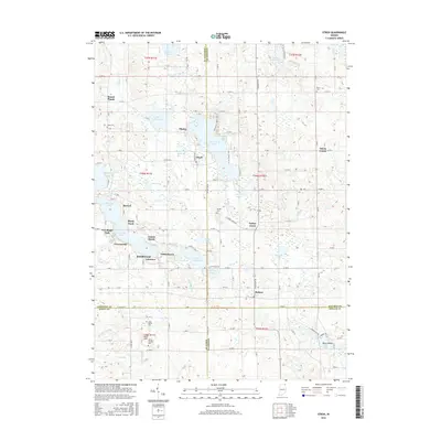
(11)- 1942 Map of Stroh
 1942 Stroh1942 Print · USGSNortheast Indiana’s lake country is captured here in the early 1940s, showing a landscape of small farming hamlets and lakeside landings. Researchers can trace family roots at Reed Cem or locate old community hubs like Salem Center and Helmer.2 unique versions available
 - 1953 Map of Fort Wayne, 1963 Print
 1953 Fort Wayne1963 Print · USGSNortheast Indiana and its neighboring borderlands in Michigan and Ohio appear here during a peak era of rail and road expansion. Researchers can trace the massive rail networks of the Nickel Plate Road and Wabash or locate lakeside landmarks like Lake Wawasee and Clear Lake.4 unique versions available
 - 1956 Map of Fort Wayne
 1956 Fort Wayne1956 Print · USGSThe tri-state borderlands of Indiana, Michigan, and Ohio are captured here in the mid-fifties, centered on the growing industrial hub of Fort Wayne. Researchers can trace the heavy rail lines of the New York Central and Pennsylvania alongside prominent water features like Lake Wawasee and the Maumee River.2 unique versions available
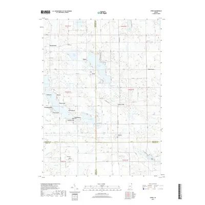
 - 1959 Map of Stroh, 1960 Print
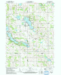
 1959 Stroh1960 Print · USGSNortheast Indiana at the end of the fifties reveals a landscape defined by glacial waters where four counties meet. Genealogists and local historians can locate lakeside communities like Shady Nook and family-centered landmarks such as Weston Chapel Cem and Salem Center Sch.2 unique versions available
 - 1985 Map of Elkhart
 1985 Elkhart1985 Print · USGSThe Indiana-Michigan borderlands come into focus in the mid-1980s, showcasing the industrial rail hubs and rural agricultural townships of the St. Joseph valley. Genealogists and historians can trace the growth of Elkhart, Goshen, and Three Rivers, or locate smaller communities like Middlebury and White Pigeon.2 unique versions available
 - 1993 Map of Stroh
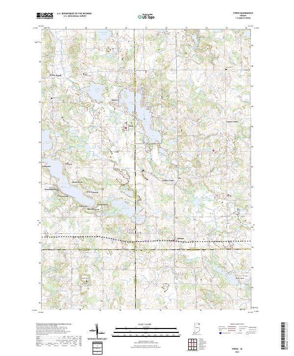
 1993 Stroh1993 Print · USGSNortheastern Indiana’s glaciated lake country is captured here in the early nineties, centered on the four-county junction. Trace family roots and local history at sites like Stroh, Salem Center, and the rural Weston Chapel Cem.
 - 2010 Map of Stroh, 2010 Print
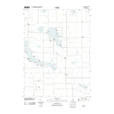 2010 Stroh2010 Print · USGSCovers Shady Nook, including Oak Lodge, Helmer, and other nearby areas
 - 2013 Map of Stroh, 2013 Print
 2013 Stroh2013 Print · USGSCovers Shady Nook, including Oak Lodge, Helmer, and other nearby areas
 - 2016 Map of Stroh, 2016 Print
 2016 Stroh2016 Print · USGSCovers Shady Nook, including Oak Lodge, Helmer, and other nearby areas
 - 2019 Map of Stroh, 2019 Print
 2019 Stroh2019 Print · USGSCovers Shady Nook, including Oak Lodge, Helmer, and other nearby areas
 - 2022 Map of Stroh, 2022 Print
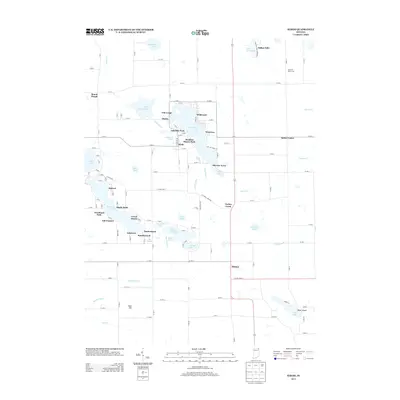
 2022 Stroh2022 Print · USGSGlacial lakes and rural crossroads define this northern Indiana landscape at the borders of four counties. Genealogists and local historians can trace family roots at Bethel Cem or Wright Cem and explore lakefront developments like Gravel Beach and Shady Nook.
End of results
Showing maps 1-11 of 11
Top cities near Shady Nook
- Auburn historical maps
- Sturgis historical maps
- Kendallville historical maps
- Angola historical maps
- Garrett historical maps
- Jamestown historical maps
See more
Frequently asked questions
- What are the different types of historical maps available for Shady Nook?
- What is the oldest map of Shady Nook?
- Where can I purchase historical maps of Shady Nook for my home or office?
- Where can I download high-res historical maps of Shady Nook?
- Are there historical topographic maps available for Shady Nook?
- Is there historical aerial imagery available for Shady Nook?
- Where are historical maps of Shady Nook sourced from?