Old Maps of LaPorte County, Indiana
Explore 148 old maps of LaPorte County, spanning from 1930 to today. These high-resolution historic maps reveal how streets, neighborhoods, landmarks, and natural features evolved over time — perfect for genealogy, metal detecting, research, and local history exploration.
What you can do with these maps:
- See how LaPorte County changed over time: Compare historical maps to modern-day views to trace roads, homesites, rail lines & more.
- View detailed metadata: Each map includes creators, publishers, year, scale, and archive source.
- Overlay maps with satellite & LiDAR: Visualize the past alongside modern tools to explore terrain & human change.
- Trusted historical sources: Maps sourced from the USGS, Library of Congress, and other archives.
- Access maps your way: View online, download high-res files, or order prints for personal or research use.
Start exploring old maps of LaPorte County to uncover forgotten places, hidden landmarks, and the deep history beneath your feet.
LaPorte County, IN maps
(148)- 1930 Map of Three Oaks
 1930 Three Oaks1930 Print · USGSSouthwest Michigan's lakeshore and interior townships are captured in detail during the late twenties. Genealogists and historians can trace family roots through numerous rural schoolhouses like California Sch or visit the settled blocks of Three Oaks and New Buffalo.3 unique versions available
 - 1944 Map of Three Oaks
 1944 Three Oaks1944 Print · USGSCoastal Berrien County at the height of the Second World War shows a vibrant mix of lakeside resorts and rural farming communities. Researchers can trace ancestral roots at Forest Lawn Cem or locate vintage schoolhouses like Riverside Sch and California Sch along the Pere Marquette rail line.
 - 1953 Map of Wanatah, 1955 Print
 1953 Wanatah1955 Print · USGSIn the early 1950s, this area of Indiana was a bustling rail corridor where several major lines converged at Wanatah. Trace the path of the Lincoln Highway and find rural landmarks like Luther Cem and Haskells.
 - 1953 Map of Westville, 1955 Print
 1953 Westville1955 Print · USGSLaPorte and Porter counties in the early fifties show a landscape defined by industrial rail corridors and institutional development. Researchers can trace the sprawling grounds of Beatty Memorial Hospital and old pioneer sites like Quakerdom Cem or Eight Square Cem.
 - 1953 Map of Michigan City West, 1955 Print
 1953 Michigan City West1955 Print · USGSMichigan City and the Indiana shoreline appear in the early fifties as a bustling hub of rail and industry. Trace the footprints of civic life at State Prison, Greenwood Cemetery, and the Bayles Sch (Abandoned) while exploring the dunes.
 - 1953 Map of Chicago, 1964 Print
 1953 Chicago1964 Print · USGSThe southern Lake Michigan shoreline was rapidly modernizing in the mid-fifties, balancing heavy industry with its famous academic centers. Researchers can trace the footprints of Notre Dame University or locate vanished sites like the Kingsbury Ordnance Plant and Meigs Field.5 unique versions available
 - 1957 Map of Chicago
 1957 Chicago1957 Print · USGSThe industrial heartland and southern Great Lakes shoreline are captured here during the peak of mid-century growth. Researchers can trace the massive Gary Steel Works, the grounds of the University of Notre Dame, and the early paths of the Tri-State Tollway.
 - 1957 Map of Knox West, 1959 Print
 1957 Knox West1959 Print · USGSStarke County in the late fifties shows a landscape shaped by reclaimed marshlands and heavy rail traffic. Genealogists and historians can trace family locations near Knox, Toto, and Hepner Cem, or follow the routes of the New York Central Railroad.
 - 1958 Map of La Crosse, 1959 Print
 1958 La Crosse1959 Print · USGSLa Crosse was a bustling rail hub in the late fifties, where four major lines intersected amidst the reclaimed marshlands. Genealogists and rail historians can trace the paths of the Monon Railroad and Erie Railroad through early settlements like Clanricarde and Wilders.2 unique versions available
 - 1958 Map of Lydick, 1960 Print
 1958 Lydick1960 Print · USGSSt. Joseph County's industrial and rural character is caught here in the late fifties as transport networks expanded across the Indiana-Michigan line. Researchers can trace historic family landmarks like Hamilton Cem, the Gordon Airport, and the localized STUDEBAKER PROVING GROUNDS.
 - 1958 Map of Hanna, 1960 Print
 1958 Hanna1960 Print · USGSLaPorte County's agricultural heartland was a complex nexus of rail and road at the end of the fifties. Genealogists and historians can trace family-named markers and rural community centers like Morgan Cem, Township Sch, and the Zion Ch.2 unique versions available
 - 1958 Map of Kingsford Heights, 1960 Print
 1958 Kingsford Heights1960 Print · USGSThe military-industrial landscape of Northern Indiana is on full display here in the late fifties. Researchers can trace the sprawling Kingsbury Ordnance Plant and local landmarks like Tracy Cem and the Township High Sch.
 - 1958 Map of Hamlet, 1960 Print
 1958 Hamlet1960 Print · USGSRailroad hubs and reclaimed marshlands define this part of Starke County in the late fifties. Genealogists and local historians can trace the intricate network of family-named drainage lines like Amy Kelley Ditch and rail stops at Hamlet and Grovertown.
 - 1958 Map of Stillwell, 1961 Print
 1958 Stillwell1961 Print · USGSLaPorte County in the late fifties shows a landscape of strategic industrial sites and critical rail junctions during the height of the Cold War. Genealogists and historians can trace the footprint of the Kingsbury Ordnance Plant and the rail corridors of the Wabash and New York Chicago and St Louis.
 - 1958 Map of North Liberty, 1961 Print
 1958 North Liberty1961 Print · USGSSt. Joseph County's agricultural heartland is documented here in the late fifties as the rail and river economy transitioned. Genealogists and local historians can trace property near North Liberty, find the Liberty Ch, or locate the Purdue Research Farm.2 unique versions available
 - 1958 Map of Michigan City East, 1963 Print
 1958 Michigan City East1963 Print · USGSThe Indiana shoreline and the rail corridors of LaPorte County are captured here at a peak of mid-century industrial and suburban expansion. Researchers can trace historic family locations near Swan Lake Cem or follow the paths of the Monon Railroad and New York Central Railroad.
 - 1958 Map of La Porte East, 1964 Print
 1958 La Porte East1964 Print · USGSLaPorte County's industrial and residential expansion is evident in the late fifties, featuring the massive Kingsbury Ordnance Plant. Genealogists can trace family sites at Patton Cemetery or locate old schoolhouses like Riley Sch and St Johns Sch.
 - 1958 Map of Springville, 1964 Print
 1958 Springville1964 Print · USGSLa Porte County is shown just as modern highways began to reshape the northern Indiana countryside in the late fifties. Researchers can trace historic family landmarks like Potter Chapel and Rossburg Cem alongside early rail routes like the Chicago South Shore and South Bend Railroad.2 unique versions available
 - 1958 Map of New Carlisle, 1964 Print
 1958 New Carlisle1964 Print · USGSThe Indiana-Michigan state line comes alive in the late fifties, showing a landscape of glacial lakes and growing rail corridors. Genealogists can locate family sites like Sauktown Cem, St Johns Ch, and the St Joseph Novitiate near New Carlisle.2 unique versions available
 - 1959 Map of English Lake, 1961 Print
 1959 English Lake1961 Print · USGSLa Porte and Starke Counties are seen here during the late 1950s, where a complex network of ditches and arms drains the marshy prairie for agriculture. Researchers can trace the tracks of the Chesapeake and Ohio Railroad and locate St Martins Cem near English Lake.2 unique versions available
 - 1959 Map of San Pierre, 1961 Print
 1959 San Pierre1961 Print · USGSNorthwest Indiana in the late fifties is defined by managed wetlands and the intersection of major rail lines. Genealogists and historians can trace the rural communities of San Pierre and Tefft, locating the All Saints Cem & Cem and the Township Sch.2 unique versions available
 - 1961 Map of La Porte West, 1964 Print
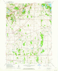 1961 La Porte West1964 Print · USGSLa Porte County at the start of the sixties shows a landscape shaped by early treaty lines and a dense network of major railroads. Genealogists and local historians can trace rural school districts and old settlements such as Door Village, Pinhook, and Pinola.
 - 1962 Map of Westville, 1964 Print
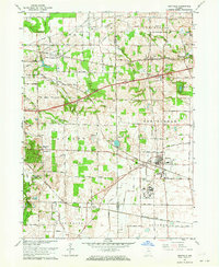 1962 Westville1964 Print · USGSWestville and the surrounding townships are shown at a peak of rail and institutional development during the early sixties. Genealogists and local historians can trace family roots through the Quakerdom Cem, the Eight-Square Ch, and old stops at Burdick and Coburg.
 - 1962 Map of Michigan City West, 1964 Print
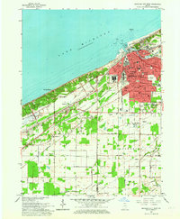 1962 Michigan City West1964 Print · USGSCoastal life and heavy industry meet along the Indiana dunes in the early sixties. Genealogists and rail historians can trace the paths of the South Shore Line, local schools like Barker Jr High, and the grounds of the State Prison.
 - 1969 Map of Lydick, 1971 Print
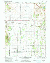 1969 Lydick1971 Print · USGSSt. Joseph County's industrial and rail corridor is captured here in the late sixties, showing the development between South Bend and the county line. Researchers can trace historic settlements like New Carlisle and Crumstown or locate the St Stanislaus Ch and Bendix Woods Park.2 unique versions available
Showing maps 1-25 of 148
Top cities of LaPorte County
- Michigan City historical maps
- La Porte historical maps
- Westville historical maps
- Springfield historical maps
- Kankakee historical maps
- Trail Creek historical maps
See more
Frequently asked questions
- What are the different types of historical maps available for LaPorte County?
- What is the oldest map of LaPorte County?
- Where can I purchase historical maps of LaPorte County for my home or office?
- Where can I download high-res historical maps of LaPorte County?
- Are there historical topographic maps available for LaPorte County?
- Is there historical aerial imagery available for LaPorte County?
- Where are historical maps of LaPorte County sourced from?