2020s Maps of LaPorte County, Indiana
Explore 21 historic maps of LaPorte County from the 2020s. These maps offer a rare glimpse into what life looked like during the 2020s — showing old roads, neighborhoods, homes, and landmarks that have changed or disappeared over time.
Whether you're researching your family's past, planning a metal detecting trip, or studying how LaPorte County's landscape evolved across the 2020s, these high-resolution maps are a powerful tool for exploring the history of this region.
- Focus on a specific era: All maps on this page are from the 2020s, giving you a focused view of this time period.
- See what’s changed: Compare century-old streets, trails, and buildings to today's modern landscape using overlays and satellite layers.
- Research with precision: Use these maps for genealogy, historical research, land use analysis, or educational projects.
- View, download, or print: Maps are fully viewable online in high resolution, and can be downloaded or printed for your own records.
Start exploring LaPorte County's history through authentic maps from the 2020s. This is your window into the past.
LaPorte County, IN maps
(21)- 2022 Map of Hamlet, 2022 Print
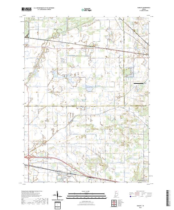 2022 Hamlet2022 Print · USGSThe rail-and-canal landscape of Starke County comes into focus as it appeared in the early twenty-first century. Genealogists and researchers can trace the drainage of the Kankakee marsh through Robbins Ditch and locate family landmarks near Hamlet and Grovertown.
 - 2022 Map of San Pierre, 2022 Print
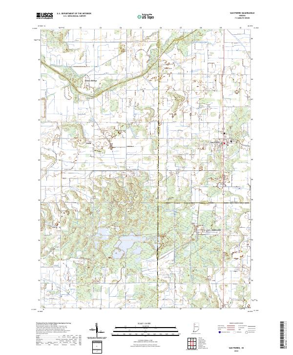 2022 San Pierre2022 Print · USGSNorthwest Indiana at the start of the 2020s shows a landscape deeply shaped by the drainage of the Kankakee Basin. Researchers can trace the heritage of local settlements like San Pierre and Tefft or locate family sites at the San Pierre Public Cem and All Saints Cem.
 - 2022 Map of Stillwell, 2022 Print
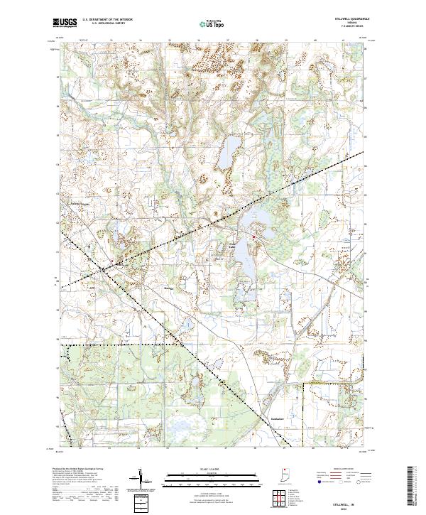 2022 Stillwell2022 Print · USGSLaPorte County, Indiana, is captured here in the early 2020s, showcasing a landscape of drained lowlands and rural townships. Genealogists and local researchers can trace family lands near the settlements of Stillwell and Hamlet or along the banks of Mill Creek.
 - 2022 Map of Knox West, 2022 Print
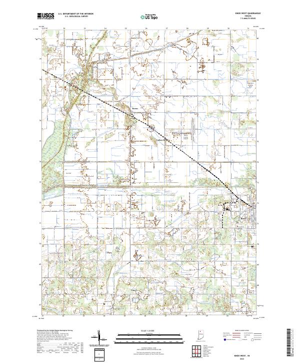 2022 Knox West2022 Print · USGSStarke County's engineered agricultural landscape is on full display here in the early 2020s, showing a complex web of drainage and irrigation. Researchers can locate family sites near Toto, Brems, and Indian Hill, or trace the paths of the Yellow River and Oak Park Cem.
 - 2022 Map of La Crosse, 2022 Print
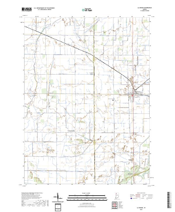 2022 La Crosse2022 Print · USGSLa Crosse and the Kankakee River valley are captured in this modern survey of the LaPorte and Porter county lines. Trace family roots at Oak Grove Cem or locate old rail-stop settlements like Clanricarde, Wilders, and Riverside.
 - 2022 Map of Wanatah, 2022 Print
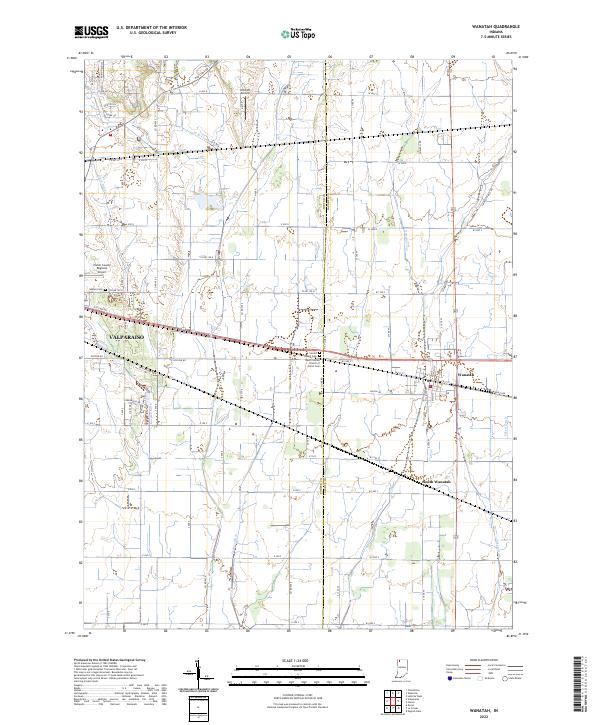 2022 Wanatah2022 Print · USGSThe rural borderlands between Porter and LaPorte counties are captured here in the early 2020s, revealing an intricate grid of agricultural drainage and aviation history. Genealogists and local historians can locate Sacred Heart Cem and South Wanatah or trace the path of Greiger Ditch.
 - 2022 Map of Kingsford Heights, 2022 Print
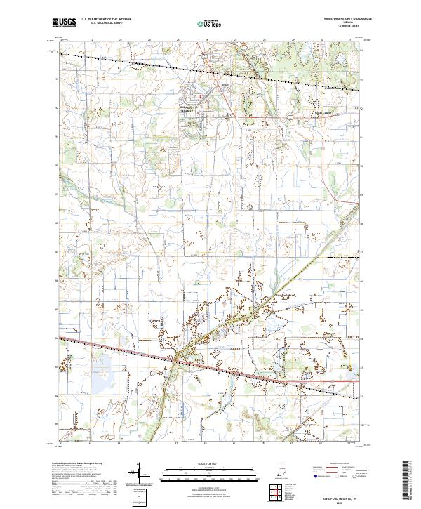 2022 Kingsford Heights2022 Print · USGSKingsford Heights and the Kankakee River valley appear here in the early twenty-first century, showcasing a landscape of precision drainage and rural crossroads. Genealogists and historians can trace the residential blocks of Kingsford Heights or locate local landmarks like Union Center and Salisbury Ditch.
 - 2022 Map of English Lake, 2022 Print
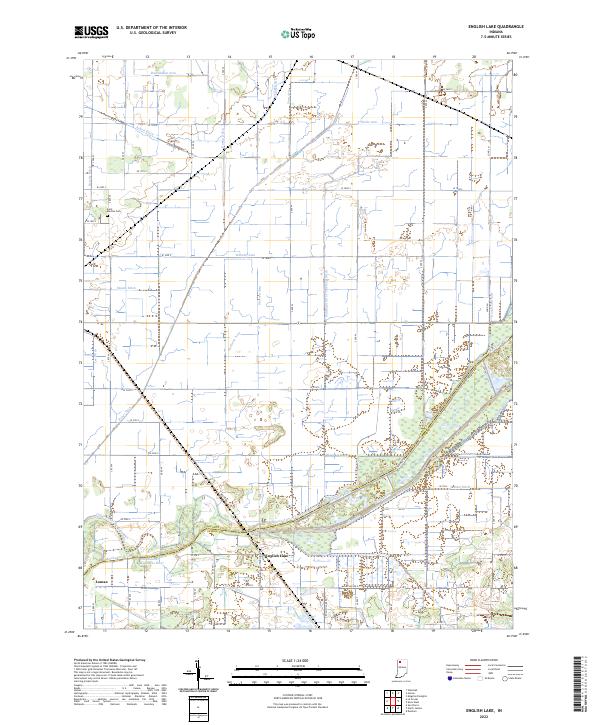 2022 English Lake2022 Print · USGSLaPorte and Starke counties appear here at the confluence of the Kankakee River and Yellow River in the modern era. Researchers can trace land management through an extensive network of drainage features like the William Arm of Tuesburg Ditch and find local history at English Lake or Saint Martins Cem.
 - 2022 Map of Westville, 2022 Print
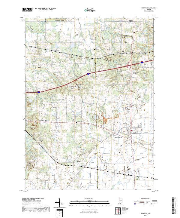 2022 Westville2022 Print · USGSLaPorte County's crossroads settlements and rural cemeteries are captured in this recent survey of the Indiana landscape. Researchers can trace family history at Quakerdom Cem and Carter Cem or locate the historic centers of Alida and Otis.
 - 2022 Map of Hanna, 2022 Print
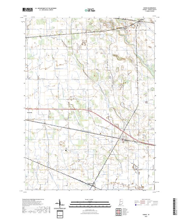 2022 Hanna2022 Print · USGSLaPorte County's agricultural heartland is captured here in recent years, showing the structured drainage and rail-side settlements of the Indiana plains. Researchers can trace family roots through Morgan Cemetery and explore the historic layouts of Hanna, Union Mills, and Thomaston.
 - 2022 Map of New Carlisle, 2022 Print
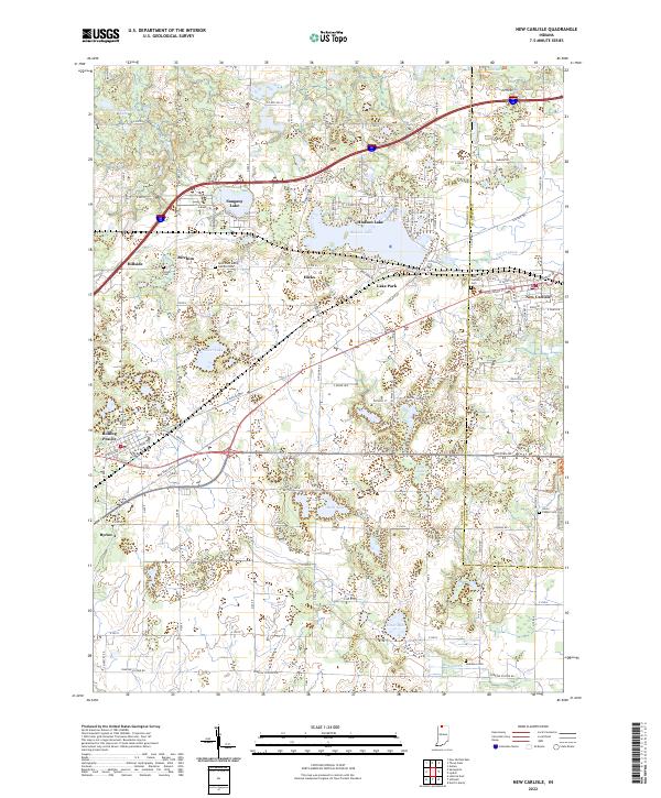 2022 New Carlisle2022 Print · USGSCrossing the line between La Porte and St. Joseph counties in the early twenty-first century, this map documents a landscape of glacial lakes and small prairie settlements. Researchers can locate several burial sites including Olive Chapel Cem and Teeter Cem, while tracing the shores of Hudson Lake and Pottawattomie Lake.
 - 2022 Map of LaPorte West, 2022 Print
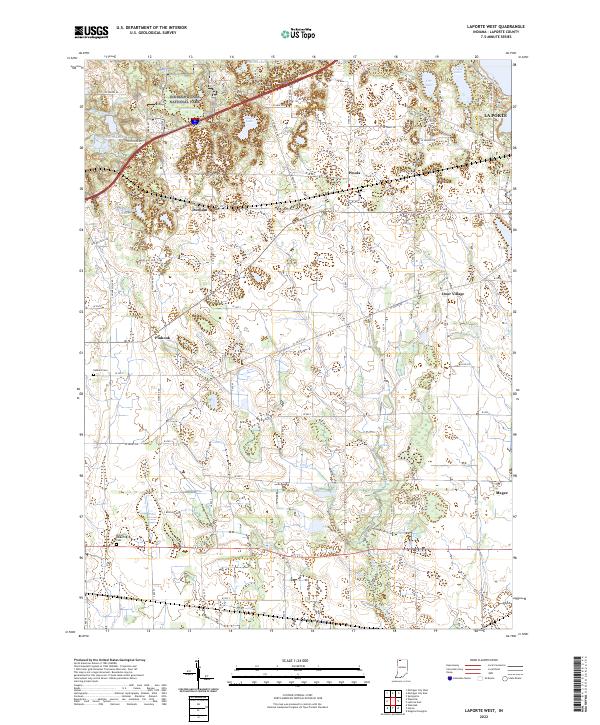 2022 LaPorte West2022 Print · USGSLaPorte County and the southern edge of the dunes are captured here in the early 2020s, showing a landscape of glacial lakes and historic crossroads. Researchers can trace rural lineages through sites like Miriam Benedict Cem or explore the small communities of Pinhook and Door Village.
 - 2022 Map of Lydick, 2022 Print
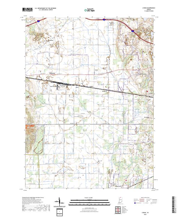 2022 Lydick2022 Print · USGSSt. Joseph County near the Indiana-Michigan border shows a landscape of historic townships and modern recreation in this recent survey. Genealogists and local historians can trace small communities like Lydick, Crumstown, and Terre Coupee alongside the Twin Lakes shoreline.
 - 2022 Map of Michigan City East, 2022 Print
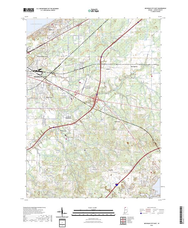 2022 Michigan City East2022 Print · USGSThe Lake Michigan coast meets the rural Indiana interior in the early 2020s, revealing a landscape of suburban growth and persistent agricultural drainage. Genealogists and local historians can locate several burial grounds like Sharp Cem and Lows Cem, or trace the development around Long Beach and Waterford.
 - 2022 Map of Springville, 2022 Print
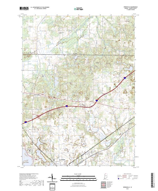 2022 Springville2022 Print · USGSLaPorte County's agricultural and lake-country landscape is documented here in the early twenty-first century. Genealogists can trace several local burial sites including Shippeeburg and Rossburg Cemetery near the village of Springville.
 - 2022 Map of North Liberty, 2022 Print
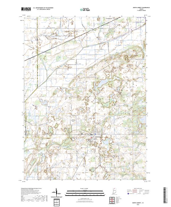 2022 North Liberty2022 Print · USGSThe northern Indiana borderlands near North Liberty are shown here in the early twenty-first century, defined by the Kankakee River and its managed drainage. Researchers can trace local heritage through Westlawn Cem or explore the vast recreation grounds of Potato Creek State Park.
 - 2022 Map of Michigan City West, 2022 Print
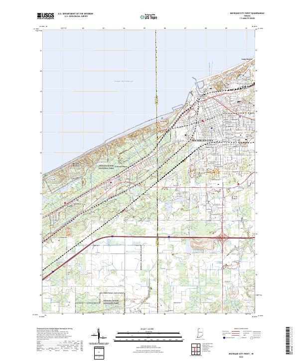 2022 Michigan City West2022 Print · USGSThe Indiana shoreline comes into focus during the early 2020s, showing the intersection of industrial Michigan City and preserved dunes. Genealogists and researchers can locate Greenwood Cem, Saint Stanislaus Cem, and the La Porte County Superior Courthouse.
 - 2022 Map of LaPorte East, 2022 Print
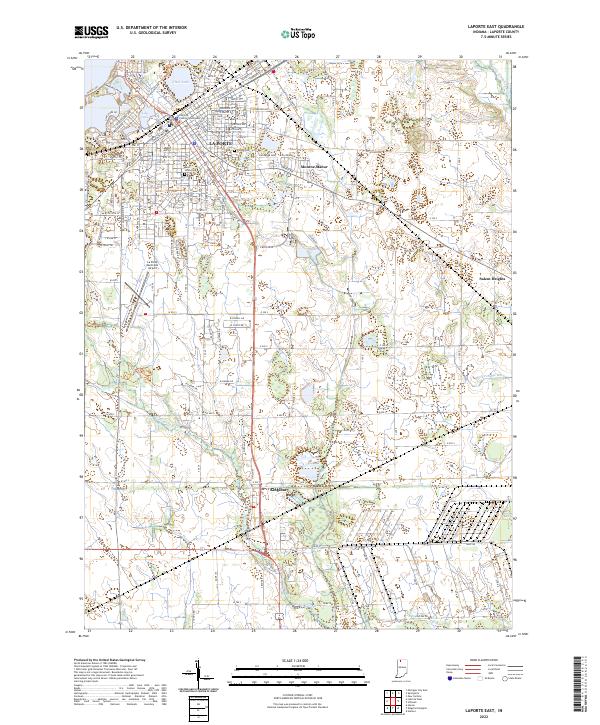 2022 LaPorte East2022 Print · USGSLa Porte and its southern reaches in Kingsbury are captured here during a period of modern expansion. Researchers can locate family sites near Patton Cem, trace the drainage of Breckenridge Ditch, or see the layout of Monroe Manor.
 - 2023 Map of Three Oaks, 2023 Print
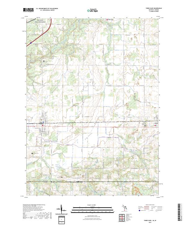 2023 Three Oaks2023 Print · USGSBerrien County and the Michigan-Indiana borderlands are captured here in the contemporary era, showing the enduring layout of rural townships and villages. Genealogists can locate family sites at Smith Germinder Ward Cem or Shedd Cem, and trace the path of CSX TRANSPORTATION rail through Three Oaks.
 - 2023 Map of New Buffalo East, 2023 Print
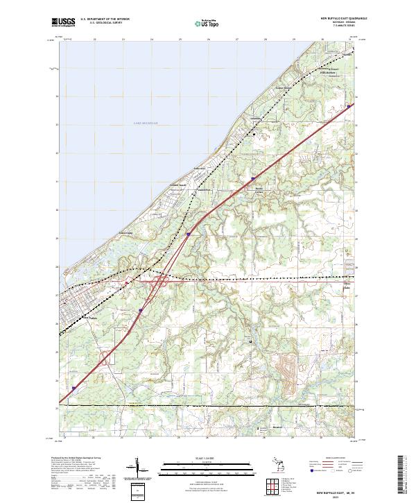 2023 New Buffalo East2023 Print · USGSThe Lake Michigan shoreline and the Michigan-Indiana border meet in this coastal study during the early 2020s. Researchers can trace the development of historic lakefront communities like Union Pier and Lakeside or locate family sites at Maudlin Cem.
 - 2023 Map of New Buffalo West, 2023 Print
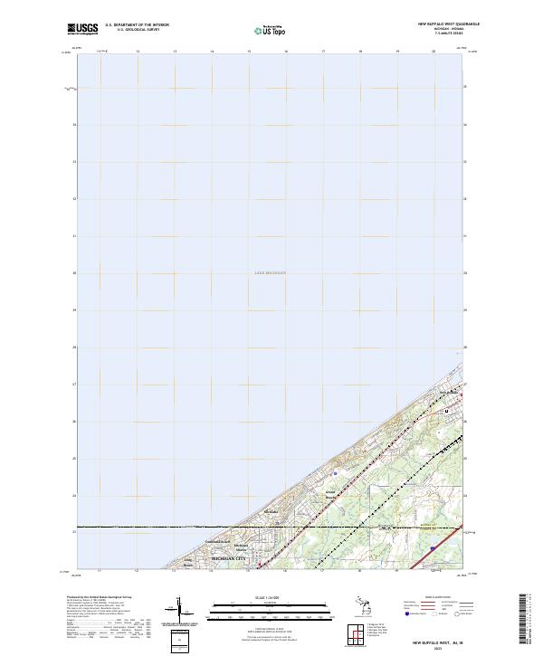 2023 New Buffalo West2023 Print · USGSThe Michigan-Indiana state line meets the coast in this modern survey of the lakeside communities between New Buffalo and Michigan City. Researchers can trace residential development and landmarks like Pine Grove Cem and Grand Beach.
End of results
Showing maps 1-21 of 21
Top cities of LaPorte County
- Michigan City historical maps
- La Porte historical maps
- Westville historical maps
- Springfield historical maps
- Kankakee historical maps
- Trail Creek historical maps
See more
Frequently asked questions
- What are the different types of historical maps available for LaPorte County?
- What is the oldest map of LaPorte County?
- Where can I purchase historical maps of LaPorte County for my home or office?
- Where can I download high-res historical maps of LaPorte County?
- Are there historical topographic maps available for LaPorte County?
- Is there historical aerial imagery available for LaPorte County?
- Where are historical maps of LaPorte County sourced from?