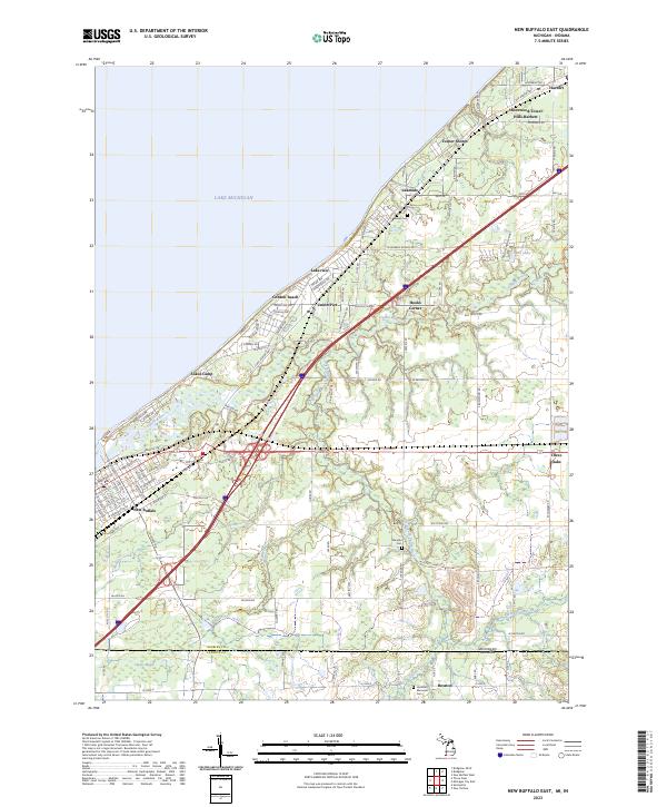
2023 Map of New Buffalo East
USGS Topo · Published 2023About this map
Lake Michigan forms the western boundary of this coastal landscape, where the Galien River and its tributaries carve paths toward the shoreline. The map reveals a dense network of resort communities and residential enclaves along the lakefront, including Union Pier, Lakeside, and the combined settlement of Shorewood-Tower Hills-Harbert. Inland, the terrain shifts toward the wetlands of Crosby Marsh and the agricultural lands surrounding Three Oaks.
Find a feature on this map
75 named features on this map. Tap any name to fly to it.
Don’t see what you’re looking for? This feature index may not catch every label — zoom into the map to look around manually.
Map Details
Editions of this 2023 New Buffalo East Map
This is the sole edition of this map. No revisions or reprints were ever made.
Other maps of this area

1930 · Three Oaks
USGS Topo · 1:62,500

1944 · Three Oaks
USGS Topo · 1:62,500

1953 · Chicago
USGS Topo · 1:250,000

1957 · Chicago
USGS Topo · 1:250,000

1958 · Michigan City East
USGS Topo · 1:24,000

1958 · Springville
USGS Topo · 1:24,000

1958 · New Carlisle
USGS Topo · 1:24,000
1969 · Michigan City East
USGS Topo · 1:24,000
1970 · New Buffalo West
USGS Topo · 1:24,000
1970 · New Buffalo East
USGS Topo · 1:24,000