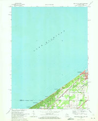
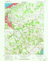
1970 Map of New Buffalo West
USGS Topo · Published 1973About this map
Lake Michigan dominates the western half of this 1970s survey, meeting a shoreline defined by a string of coastal communities and resort developments. The state line bisecting the map separates New Buffalo in Michigan from the lakeside enclaves of Michiana Shores and Duneland Beach in Indiana. Transportation and infrastructure are concentrated along the coast, where the Penn Central railroad tracks run parallel to Lake Shore Drive. Local history is captured through the presence of the St Mary of the Lake Sch and Pine Grove Cem, alongside civic markers like the Waterworks and a highway Weigh Station. The transition from the sandy shore to the interior of Springfield township reveals a shift toward smaller local roads like Stromer Road and White Drive, reflecting the area's development patterns during the early 1970s.
Find a feature on this map
25 named features on this map. Tap any name to fly to it.
Don’t see what you’re looking for? This feature index may not catch every label — zoom into the map to look around manually.
Map Details
Editions of this 1970 New Buffalo West Map
2 editions found
Other maps of this area

1930 · Three Oaks
USGS Topo · 1:62,500

1944 · Three Oaks
USGS Topo · 1:62,500

1953 · Michigan City West
USGS Topo · 1:24,000

1953 · Chicago
USGS Topo · 1:250,000

1957 · Chicago
USGS Topo · 1:250,000

1958 · Michigan City East
USGS Topo · 1:24,000

1958 · Springville
USGS Topo · 1:24,000
1962 · Michigan City West
USGS Topo · 1:24,000
1969 · Michigan City West
USGS Topo · 1:24,000
1969 · Michigan City East
USGS Topo · 1:24,000