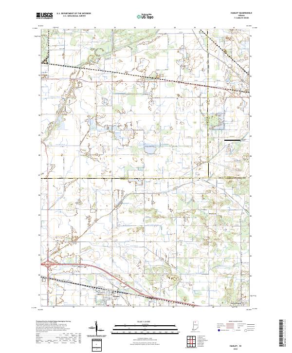
2022 Map of Hamlet
USGS Topo · Published 2022About this map
Hamlet and Grovertown anchor the southern portion of this landscape at the intersection of Northern Indiana rail and road corridors. The Chicago and North Western Transportation Company tracks cut diagonally across the terrain, paralleled by historically significant routes like the E Yellowstone Trl. This area is defined by an extensive network of water management, where the Kankakee River is supported by a dense grid of engineered waterways including Breckenridge Ditch, Robbins Ditch, and Johanni Ditch. The conversion of the wetlands into productive farmland is evident in the straight-line drainage patterns and family-named features like Dreessen Field. The map also captures the tri-county boundary where Starke Co, LaPorte Co, and St Joseph Co meet, reflecting the complex local jurisdictions of the region.
Find a feature on this map
94 named features on this map. Tap any name to fly to it.
Don’t see what you’re looking for? This feature index may not catch every label — zoom into the map to look around manually.
Map Details
Editions of this 2022 Hamlet Map
This is the sole edition of this map. No revisions or reprints were ever made.
Other maps of this area

1953 · Chicago
USGS Topo · 1:250,000

1957 · Chicago
USGS Topo · 1:250,000

1957 · Knox East
USGS Topo · 1:24,000

1957 · Knox West
USGS Topo · 1:24,000

1958 · Donaldson
USGS Topo · 1:24,000

1958 · Kingsford Heights
USGS Topo · 1:24,000

1958 · Hamlet
USGS Topo · 1:24,000

1958 · Walkerton
USGS Topo · 1:24,000

1958 · Stillwell
USGS Topo · 1:24,000

1958 · North Liberty
USGS Topo · 1:24,000