Old Maps of Bedford, Indiana for Metal Detecting
Plan your next treasure hunt with 38 historic maps of Bedford. Find old homesites, ghost towns, trails, and gathering spots that may be lost to time — perfect for identifying promising metal detecting locations.
- Locate forgotten sites: Uncover places like long-lost settlements, abandoned rail lines, or gathering spots.
- Plan better hunts: Use map overlays combined with LiDAR or satellite views to narrow in on historically rich areas.
- Made for detectorists: Thousands of hobbyists use these maps to discover relics, coins, and hidden history.
Use these historic maps to boost your research and find new opportunities beneath the surface of Bedford.
Bedford, IN maps
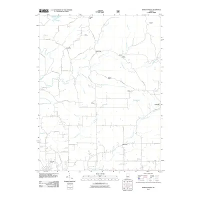
(38)- 1934 Map of Bedford
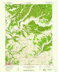
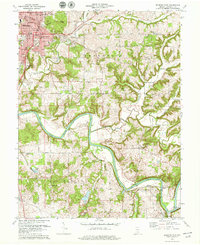
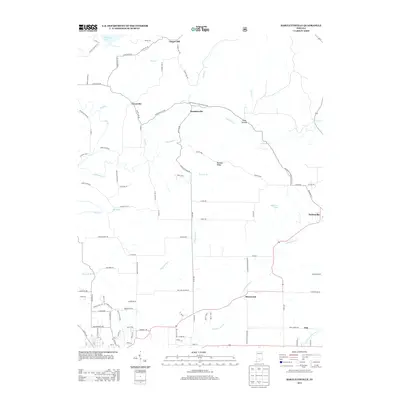
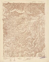 1934 Bedford1934 Print · USGSLawrence County's limestone district and the winding White River valley are detailed here during the mid-1930s. Genealogists and researchers can trace local families through many rural landmarks, including Sherril Cem, Leesville, and the Peerless Quarry.2 unique versions available
 - 1935 Map of Oolitic
 1935 Oolitic1935 Print · USGSLawrence and Greene Counties are captured in the mid-1930s during a period of heavy limestone production and rural transition. Local historians can trace family roots through numerous country landmarks like Popcorn Church, Williams Bridge, and the Dark Hollow stone works.6 unique versions available
 - 1937 Map of Bedford
 1937 Bedford1937 Print · USGSLawrence County limestone country is seen here in the late 1930s, defined by its massive quarries and river-valley railroads. Genealogists can trace family landmarks and rural life at the County Farm, Leesville, and the United Brethren Ch.2 unique versions available
 - 1942 Map of Oolitic
 1942 Oolitic1942 Print · USGSLawrence County limestone country is seen here in the mid-1930s, documenting the early stone industry and rail networks. Genealogists can trace family landmarks like Popcorn Cem, Bethel Ch, and industrial sites such as Patton Hill Quarry.2 unique versions available
 - 1956 Map of Vincennes, 1967 Print
 1956 Vincennes1967 Print · USGSSouthern Indiana and the Illinois borderlands are captured here in the mid-fifties, showing the region's dense network of river towns and rail lines. Researchers can trace historic river crossings along the Wabash River or locate landmarks like Wyandotte Cave and Lincoln State Park.4 unique versions available
 - 1957 Map of Vincennes
 1957 Vincennes1957 Print · USGSSouthwest Indiana and the Illinois borderlands come alive in the late 1950s, a period of heavy rail traffic and expanding state forests. Genealogists and historians can trace the riverfronts and rail lines of Vincennes, New Harmony, and the vast Crane Naval Ammunition Depot.
 - 1957 Map of Oolitic, 1958 Print
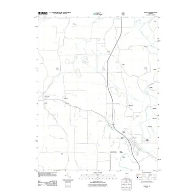
 1957 Oolitic1958 Print · USGSLawrence County limestone country is captured here in the late fifties, showing the industrial pulse of the quarries and rail lines. Researchers can trace the MONON railroad through Oolitic and find local landmarks like Beard Sch and the State Fish Hatchery.2 unique versions available
 - 1957 Map of Bedford West, 1958 Print
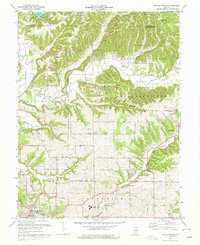
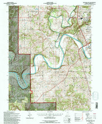
 1957 Bedford West1958 Print · USGSLawrence County's river-carved hills and limestone country are captured here during the late fifties as rural life and industry converged. Genealogists can trace family roots through numerous sites like Bryantsville, Eureka, and the Thomson Cem along the East Fork White River.2 unique versions available
 - 1958 Map of Vincennes
 1958 Vincennes1958 Print · USGSSouthern Indiana and the Illinois borderlands are captured during a mid-century period of heavy rail traffic and military activity. Researchers can trace the sprawling bounds of the Crane Naval Ammunition Depot or locate historic settlements like New Harmony and French Lick.2 unique versions available
 - 1958 Map of Bartlettsville, 1959 Print
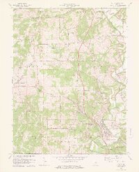
 1958 Bartlettsville1959 Print · USGSLawrence and Monroe counties are shown in the late fifties as timbered ridges and creek valleys define the rural landscape. Researchers can locate family landmarks like Hillenburg Cem, the rail siding at Erie, and several country churches like Ramsey Ridge Ch.2 unique versions available
 - 1958 Map of Bedford East, 1960 Print
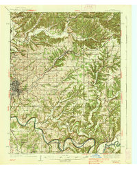
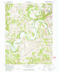
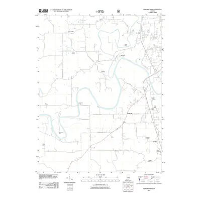
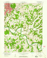 1958 Bedford East1960 Print · USGSLawrence County at the end of the 1950s shows the bustling hub of Bedford surrounded by the winding waters of the White River. Genealogists and local historians can trace rural family roots through numerous landmarks like Beech Grove Cem, Rabbitville, and Leatherwood Ch.2 unique versions available
 - 1978 Map of Oolitic
 1978 Oolitic1978 Print · USGSLawrence County limestone country is seen here in the late seventies, centered on the bustling quarrying hubs of Oolitic and East Oolitic. Genealogists and historians can trace numerous family-named burial sites like Anderson Cem and Perkins Cem alongside the heavy rail lines of the Louisville and Nashville.3 unique versions available
 - 1978 Map of Bartlettsville, 1979 Print
 1978 Bartlettsville1979 Print · USGSIn the late 1970s, the rural landscapes of Lawrence County remained centered around small settlements and the timbered hills of the Hoosier National Forest. Genealogists and historians can trace family locations through numerous sites like Covey Cem, Ramsey Ridge Ch, and the old rail corridor of the Chicago Milwaukee St Paul and Pacific.3 unique versions available
 - 1978 Map of Bedford East, 1979 Print
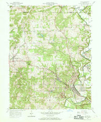
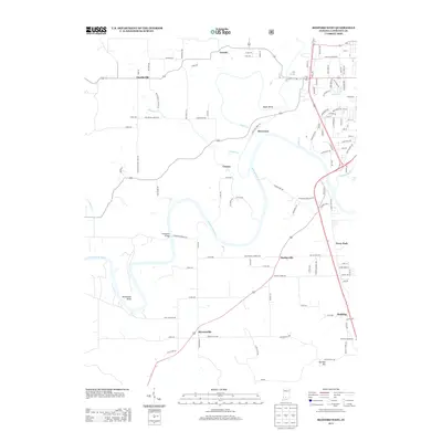
 1978 Bedford East1979 Print · USGSLawrence County enters the late seventies with the city of Bedford surrounded by active rail lines and river bends. Genealogists and local historians can trace family plots at Beach Grove Cemetery and explore old rail routes like the Baltimore and Ohio Railroad.2 unique versions available
 - 1979 Map of Bedford West
 1979 Bedford West1979 Print · USGSLawrence County enters the late seventies with its limestone quarries and river bends clearly defined. Researchers can trace rural lineages through the Wesley Chapel, Crest Haven Cem, and the winding Milwaukee Road railroad.
 - 1986 Map of Bedford
 1986 Bedford1986 Print · USGSSouthern Indiana in the mid-eighties remains a landscape of deep forests, limestone quarries, and vital rail junctions. Genealogists and historians can trace the rural networks connecting French Lick, the Crane Naval Weapons Support Center, and the historic Becks Mill.
 - 1990 Map of Bedford, 1991 Print
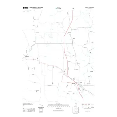
 1990 Bedford1991 Print · USGSSouthern Indiana in the early nineties reveals a complex landscape of military reservations, resort towns, and heavy industry. Genealogists and historians can trace family sites like Old Union Cem and Trinity Springs or locate the limestone quarries surrounding Oolitic.
 - 1993 Map of Bedford West, 1996 Print
 1993 Bedford West1996 Print · USGSLawrence County's river valleys and forested uplands are mapped here in the 1990s as the East Fork White River winds through the Hoosier National Forest. Genealogists can trace family names at Eureka Cem, Bass Cem, and Old Union Ch.
 - 2010 Map of Bedford East, 2010 Print
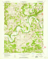
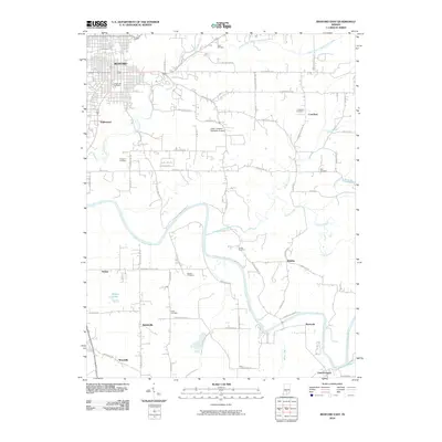 2010 Bedford East2010 Print · USGSCovers Bedford, including Mitchell, Crawford, and other nearby areas
 - 2010 Map of Bartlettsville, 2010 Print
 2010 Bartlettsville2010 Print · USGSCovers Bedford, including Heltonville, Bartlettsville, and other nearby areas
 - 2011 Map of Bedford West, 2011 Print
 2011 Bedford West2011 Print · USGSCovers Bedford, including Bryantsville, Coxton, and other nearby areas
 - 2011 Map of Oolitic, 2011 Print
 2011 Oolitic2011 Print · USGSCovers Bedford, including Guthrie, Oolitic, and other nearby areas
 - 2013 Map of Bedford West, 2013 Print
 2013 Bedford West2013 Print · USGSCovers Bedford, including Bryantsville, Coxton, and other nearby areas
 - 2013 Map of Bartlettsville, 2013 Print
 2013 Bartlettsville2013 Print · USGSCovers Bedford, including Heltonville, Bartlettsville, and other nearby areas
 - 2013 Map of Oolitic, 2013 Print
 2013 Oolitic2013 Print · USGSCovers Bedford, including Guthrie, Oolitic, and other nearby areas
Showing maps 1-25 of 38
Top cities near Bedford
- Mitchell historical maps
- Orleans historical maps
- Guthrie historical maps
- Oolitic historical maps
- Bono historical maps
- Orangeville historical maps
See more
Top neighborhoods of Bedford
Frequently asked questions
- What are the different types of historical maps available for Bedford?
- What is the oldest map of Bedford?
- Where can I purchase historical maps of Bedford for my home or office?
- Where can I download high-res historical maps of Bedford?
- Are there historical topographic maps available for Bedford?
- Is there historical aerial imagery available for Bedford?
- Where are historical maps of Bedford sourced from?