Old Maps of Old Southside, Indianapolis for Metal Detecting
Plan your next treasure hunt with 23 historic maps of Old Southside. Find old homesites, ghost towns, trails, and gathering spots that may be lost to time — perfect for identifying promising metal detecting locations.
- Locate forgotten sites: Uncover places like long-lost settlements, abandoned rail lines, or gathering spots.
- Plan better hunts: Use map overlays combined with LiDAR or satellite views to narrow in on historically rich areas.
- Made for detectorists: Thousands of hobbyists use these maps to discover relics, coins, and hidden history.
Use these historic maps to boost your research and find new opportunities beneath the surface of Old Southside.
Old Southside, Indianapolis maps
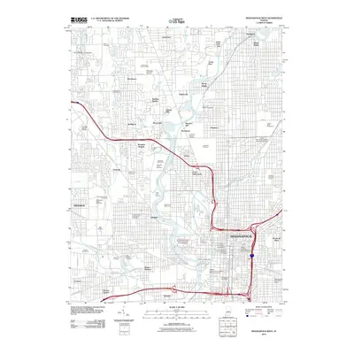
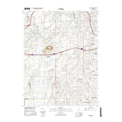
(23)- 1948 Map of Maywood
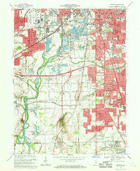
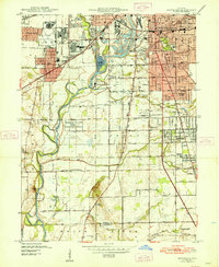 1948 Maywood1948 Print · USGSThe southern suburbs of Indianapolis are captured here in the post-war era as industrial centers and new neighborhoods expand toward the county line. Genealogists and historians can trace the foundations of Mars Hill, explore the campus of Indiana Central College, or locate family sites at Holy Cross Cem.2 unique versions available
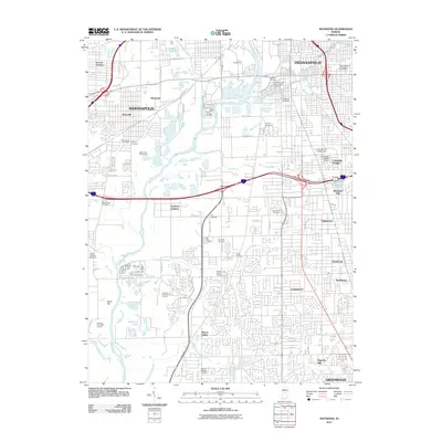
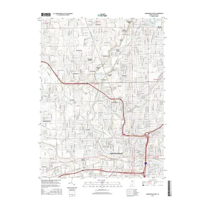
 - 1948 Map of Indianapolis West
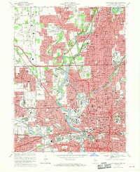
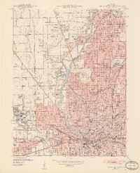 1948 Indianapolis West1948 Print · USGSIndianapolis and its western suburbs thrive in the late 1940s, revealing a landscape of bustling industry, grand civic centers, and emerging neighborhoods. Trace the early footprints of the Indianapolis Motor Speedway, the historic Crown Hill Cemetery, and the busy Hoosier Airport.2 unique versions available
 - 1953 Map of Indianapolis, 1965 Print
 1953 Indianapolis1965 Print · USGSCentral Indiana and the Illinois borderlands are captured in the mid-sixties, showing the growth of Indianapolis and its industrial rail corridors. Genealogists and historians can trace the development of outlying towns like Zionsville or Beech Grove and find landmarks such as Atterbury AAF and Turkey Run State Park.4 unique versions available
 - 1956 Map of Indianapolis
 1956 Indianapolis1956 Print · USGSCentral Indiana in the mid-fifties is captured during a period of industrial growth and military presence. Genealogists and historians can trace the rail networks of the New York Central or locate regional landmarks like Fort Benjamin Harrison and Camp Atterbury.
 - 1957 Map of Indianapolis
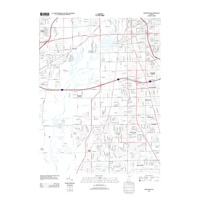
 1957 Indianapolis1957 Print · USGSCentral Indiana in the mid-fifties is captured here as a crossroads of major rail lines and nascent federal highways. Genealogists and historians can trace family-named ridges like Poplar Ridge or locate strategic sites like Camp Atterbury and Speedway.2 unique versions available
 - 1959 Map of Indianapolis West, 1961 Print
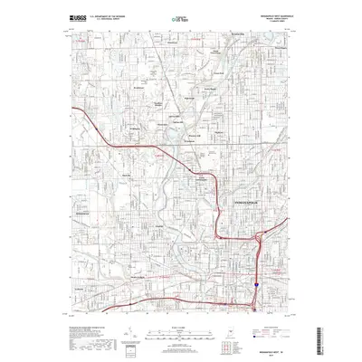
 1959 Indianapolis West1961 Print · USGSMid-century Indianapolis is captured here as suburban growth begins to surround the legendary Indianapolis Motor Speedway. Researchers can trace established neighborhoods like Broad Ripple, locate family plots in Crown Hill Cemetery, or find long-standing institutions such as Butler University.
 - 1959 Map of Maywood, 1961 Print
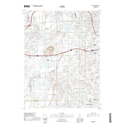
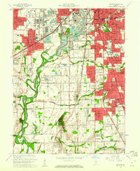 1959 Maywood1961 Print · USGSThe southern suburbs of Indianapolis and northern Johnson County are captured here during a period of rapid post-war growth. Researchers can trace family history through numerous landmarks like Indiana Central College, Union Stockyards, and Southport High Sch.
 - 1962 Map of Indianapolis
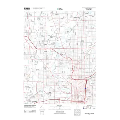
 1962 Indianapolis1962 Print · USGSCentral Indiana and the Illinois borderlands are captured here in the early sixties, showing the region's dense rail networks and growing urban centers. Genealogists and historians can locate family-named landmarks and institutions like Crown Hill Cem, Indiana University, and the Indianapolis Motor Speedway.
 - 1967 Map of Maywood, 1969 Print
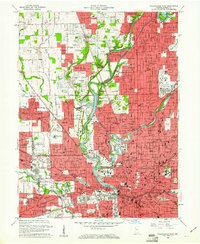
 1967 Maywood1969 Print · USGSMarion County's southern industrial and residential sprawl is captured here in the late sixties as the city pushed toward the Johnson County line. Researchers can trace family roots at Indiana Central College, locate the old Union Stockyards, or find records at Calvary Cemetery.3 unique versions available
 - 1967 Map of Indianapolis West, 1969 Print
 1967 Indianapolis West1969 Print · USGSMid-century Indianapolis comes alive in this survey of the city's west side and the growing western townships. Researchers can trace historic institutions and neighborhoods like Rocky Ripple and Broadmoor, or locate family sites at CROWN HILL CEMETERY and Floral Park Cem.5 unique versions available
 - 1986 Map of Indianapolis
 1986 Indianapolis1986 Print · USGSThe Indiana capital and its surrounding counties are captured here in the mid-1980s, showcasing the height of its orbital highway development and suburban growth. Researchers can trace the legacy of the Fort Benjamin Harrison Military Reservation, follow the Conrail lines, or locate family roots in Beech Grove, Greencastle, and Zionsville.2 unique versions available
 - 1998 Map of Maywood, 2002 Print
 1998 Maywood2002 Print · USGSThe southern suburbs of Indianapolis and the White River valley are captured here in the late 1990s as residential growth meets legacy industry. Researchers can locate family roots at Hebrew Cemetery or trace the early footprint of Indiana Central College and Stout Field.
 - 1998 Map of Indianapolis West, 2002 Print
 1998 Indianapolis West2002 Print · USGSIndianapolis and the town of Speedway are shown at a peak of late-century development, where the river meets the rail lines of CONRAIL. Trace historic school sites like Attucks High Sch and the expansive grounds of Crown Hill Cemetery.
 - 2010 Map of Indianapolis West, 2010 Print
 2010 Indianapolis West2010 Print · USGSCovers Old Southside, including Indianapolis, Speedway, and other nearby areas
 - 2011 Map of Maywood, 2011 Print
 2011 Maywood2011 Print · USGSCovers Old Southside, including Indianapolis, Greenwood, and other nearby areas
 - 2013 Map of Maywood, 2013 Print
 2013 Maywood2013 Print · USGSCovers Old Southside, including Indianapolis, Greenwood, and other nearby areas
 - 2013 Map of Indianapolis West, 2013 Print
 2013 Indianapolis West2013 Print · USGSCovers Old Southside, including Indianapolis, Speedway, and other nearby areas
 - 2016 Map of Indianapolis West, 2016 Print
 2016 Indianapolis West2016 Print · USGSCovers Old Southside, including Indianapolis, Speedway, and other nearby areas
 - 2016 Map of Maywood, 2016 Print
 2016 Maywood2016 Print · USGSCovers Old Southside, including Indianapolis, Greenwood, and other nearby areas
 - 2019 Map of Maywood, 2019 Print
 2019 Maywood2019 Print · USGSCovers Old Southside, including Indianapolis, Greenwood, and other nearby areas
 - 2019 Map of Indianapolis West, 2019 Print
 2019 Indianapolis West2019 Print · USGSCovers Old Southside, including Indianapolis, Speedway, and other nearby areas
 - 2022 Map of Indianapolis West, 2022 Print
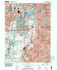
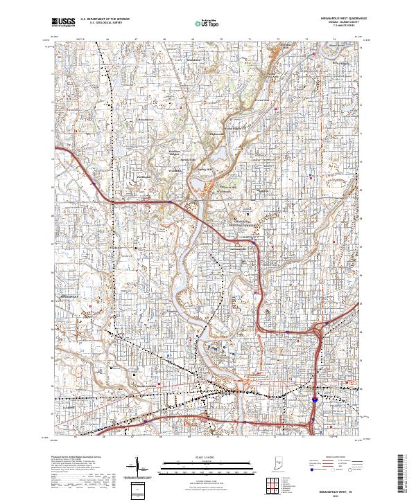 2022 Indianapolis West2022 Print · USGSWestern Indianapolis at the start of the 2020s shows a landscape where historic canal infrastructure and riverbanks meet modern academic and civic centers. Genealogists and historians can trace the borders of Crown Hill National Cem or locate the Grave of President Harrison and Floral Park Cem.
 - 2022 Map of Maywood, 2022 Print
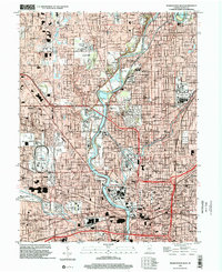
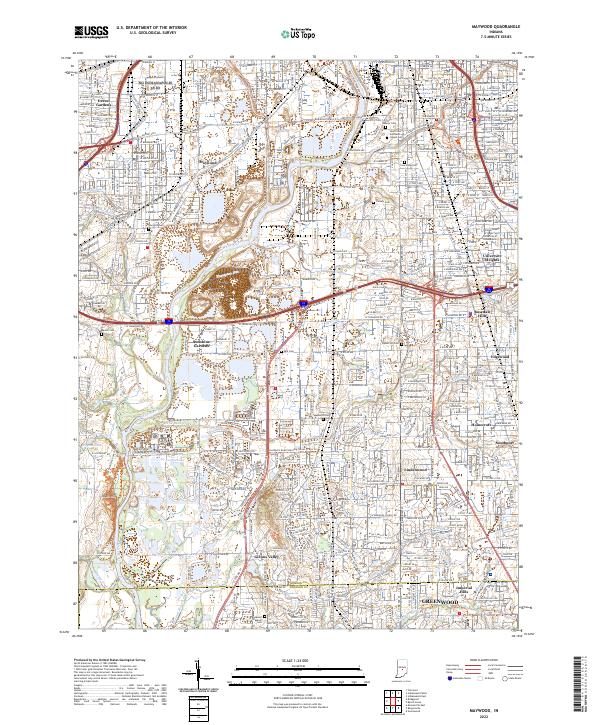 2022 Maywood2022 Print · USGSSouth of Indianapolis in the early 2020s, the river and rail corridors weave through long-established neighborhoods and expansive cemeteries. Genealogists and local historians can trace the grounds of Calvary Cemetery or locate the historic campus of the University of Indianapolis.
End of results
Showing maps 1-23 of 23
Frequently asked questions
- What are the different types of historical maps available for Old Southside?
- What is the oldest map of Old Southside?
- Where can I purchase historical maps of Old Southside for my home or office?
- Where can I download high-res historical maps of Old Southside?
- Are there historical topographic maps available for Old Southside?
- Is there historical aerial imagery available for Old Southside?
- Where are historical maps of Old Southside sourced from?