
1948 Map of Maywood
USGS Topo · Published 1948About this map
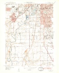
Industrial expansion and residential growth define the southern fringes of Indianapolis in the late 1940s. The landscape is heavily influenced by the presence of Stout Field and the sprawling Union Stockyards, reflecting a period when the city's western edge served as a critical hub for aviation and agriculture. Along the White River, the terrain shifts from the dense grids of Mars Hill and Drexel Gardens to the open land of Sunshine Gardens. The map documents a transition from urban center to the more agrarian landscapes of Perry and Wayne townships.
Find a feature on this map
56 named features on this map. Tap any name to fly to it.
Don’t see what you’re looking for? This feature index may not catch every label — zoom into the map to look around manually.
Map Details
Editions of this 1948 Maywood Map
2 editions found
Other maps of this area

1948 · Indianapolis East
USGS Topo · 1:24,000

1948 · Beech Grove
USGS Topo · 1:24,000

1948 · Indianapolis West
USGS Topo · 1:24,000

1952 · Bargersville
USGS Topo · 1:24,000

1953 · Greenwood
USGS Topo · 1:24,000

1953 · Bridgeport
USGS Topo · 1:24,000

1953 · Clermont
USGS Topo · 1:24,000

1953 · Indianapolis
USGS Topo · 1:250,000

1955 · Mooresville East
USGS Topo · 1:24,000

1956 · Indianapolis
USGS Topo · 1:250,000
Featured Places
- Indianapolis, IN
- Greenwood, IN
- Southport, Indianapolis
- Homecroft, Indianapolis
- Drexel Gardens, Indianapolis