Old Maps of Modesto, Indiana for Hiking & Exploration
Hike through history with 13 historic maps of Modesto. Explore old trails, ghost towns, and forgotten backroads — perfect for outdoor adventurers and local explorers.
- Rediscover forgotten places: Map out old mining camps, roads, and footpaths that no longer exist on modern maps.
- Layer with modern tools: Combine with LiDAR or satellite views to plan hikes through historical terrain.
- Made for exploration: Popular among hikers, overlanders, and local history lovers.
Use these maps to find adventure and explore the hidden past of Modesto.
Modesto, IN maps
(13)- 1953 Map of Indianapolis, 1965 Print
 1953 Indianapolis1965 Print · USGSCentral Indiana and the Illinois borderlands are captured in the mid-sixties, showing the growth of Indianapolis and its industrial rail corridors. Genealogists and historians can trace the development of outlying towns like Zionsville or Beech Grove and find landmarks such as Atterbury AAF and Turkey Run State Park.4 unique versions available
 - 1956 Map of Indianapolis
 1956 Indianapolis1956 Print · USGSCentral Indiana in the mid-fifties is captured during a period of industrial growth and military presence. Genealogists and historians can trace the rail networks of the New York Central or locate regional landmarks like Fort Benjamin Harrison and Camp Atterbury.
 - 1957 Map of Indianapolis
 1957 Indianapolis1957 Print · USGSCentral Indiana in the mid-fifties is captured here as a crossroads of major rail lines and nascent federal highways. Genealogists and historians can trace family-named ridges like Poplar Ridge or locate strategic sites like Camp Atterbury and Speedway.2 unique versions available
 - 1957 Map of Modesto, 1958 Print
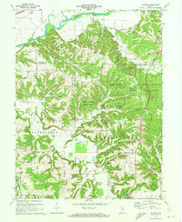
 1957 Modesto1958 Print · USGSThe rural borders of Monroe and Morgan County are documented here in the late fifties, featuring the deep woods of the Morgan Monroe State Forest. Researchers can locate several family cemeteries and old churches, such as Sodom Cem, Zion Hill Ch, and the Old Indian Treaty Boundary.2 unique versions available
 - 1962 Map of Indianapolis
 1962 Indianapolis1962 Print · USGSCentral Indiana and the Illinois borderlands are captured here in the early sixties, showing the region's dense rail networks and growing urban centers. Genealogists and historians can locate family-named landmarks and institutions like Crown Hill Cem, Indiana University, and the Indianapolis Motor Speedway.
 - 1970 Map of Modesto, 1972 Print
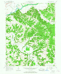
 1970 Modesto1972 Print · USGSThe hills of central Indiana remained a mix of dense timber and rural homesteads during the early seventies. Genealogists and local researchers can trace family landmarks like Sodom Cem, Liberty Ch, and the small settlement of Modesto.3 unique versions available
 - 1986 Map of Bloomington
 1986 Bloomington1986 Print · USGSMid-century development and vast conservation areas define south-central Indiana during the eighties. Genealogists and historians can trace family roots through numerous landmarks like Beanblossom Cem, New Unionville Church, and the historic corridors of the Indiana RR.3 unique versions available
 - 1998 Map of Modesto, 2002 Print
 1998 Modesto2002 Print · USGSThe rural borderlands of Morgan and Monroe counties are captured here in the late twentieth century, showing the balance between agriculture and conservation. Researchers can trace family history through numerous landmarks like New Salem Cem, Union Ch, and the small settlement of Modesto.
 - 2010 Map of Modesto, 2010 Print
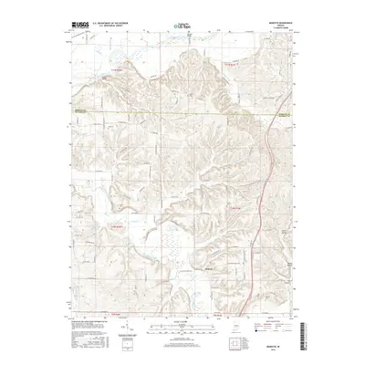
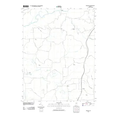 2010 Modesto2010 Print · USGSCovers Modesto, including Wayport, Monroe County, and other nearby areas
 - 2013 Map of Modesto, 2013 Print
 2013 Modesto2013 Print · USGSCovers Modesto, including Wayport, Monroe County, and other nearby areas
 - 2016 Map of Modesto, 2016 Print
 2016 Modesto2016 Print · USGSCovers Modesto, including Wayport, Monroe County, and other nearby areas
 - 2019 Map of Modesto, 2019 Print
 2019 Modesto2019 Print · USGSCovers Modesto, including Wayport, Monroe County, and other nearby areas
 - 2022 Map of Modesto, 2022 Print
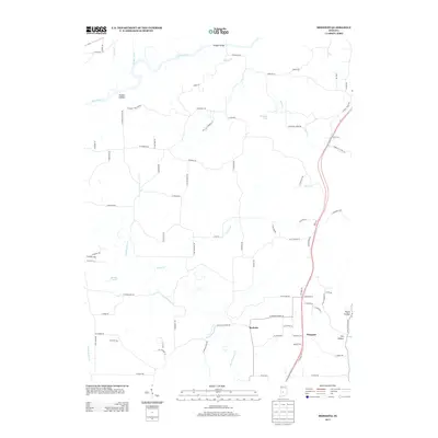
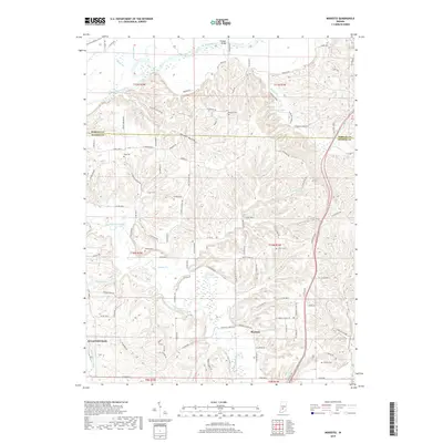
 2022 Modesto2022 Print · USGSMonroe and Morgan Counties are captured here in the early twenty-first century, showing the rural character of the land north of Bloomington. Genealogists and historians can trace family land near Sodom Cem, Modesto, and the banks of Beanblossom Creek.
End of results
Showing maps 1-13 of 13
Top cities near Modesto
- Bloomington historical maps
- Martinsville historical maps
- Ellettsville historical maps
- Clear Creek historical maps
- Spencer historical maps
- Adams historical maps
See more
Frequently asked questions
- What are the different types of historical maps available for Modesto?
- What is the oldest map of Modesto?
- Where can I purchase historical maps of Modesto for my home or office?
- Where can I download high-res historical maps of Modesto?
- Are there historical topographic maps available for Modesto?
- Is there historical aerial imagery available for Modesto?
- Where are historical maps of Modesto sourced from?