Old Maps of Montgomery County, Indiana
Explore 110 old maps of Montgomery County, spanning from 1949 to today. These high-resolution historic maps reveal how streets, neighborhoods, landmarks, and natural features evolved over time — perfect for genealogy, metal detecting, research, and local history exploration.
What you can do with these maps:
- See how Montgomery County changed over time: Compare historical maps to modern-day views to trace roads, homesites, rail lines & more.
- View detailed metadata: Each map includes creators, publishers, year, scale, and archive source.
- Overlay maps with satellite & LiDAR: Visualize the past alongside modern tools to explore terrain & human change.
- Trusted historical sources: Maps sourced from the USGS, Library of Congress, and other archives.
- Access maps your way: View online, download high-res files, or order prints for personal or research use.
Start exploring old maps of Montgomery County to uncover forgotten places, hidden landmarks, and the deep history beneath your feet.
Montgomery County, IN maps
(110)- 1949 Map of Alamo
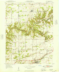 1949 Alamo1949 Print · USGSThe rugged valleys of Montgomery and Parke counties are documented here in the late 1940s, just as the area's natural landmarks gained prominence. Researchers can locate long-standing rural institutions like Liberty Sch, Freedom Ch, and the old grounds of Deer Mill.
 - 1953 Map of Danville, 1965 Print
 1953 Danville1965 Print · USGSIndiana and Illinois crossroads come to life in this mid-century survey as the interstate era begins to reshape the river-and-rail landscape. Genealogists and collectors can trace the historic paths of the Nickel Plate railroad or locate smaller communities like Veedersburg, Goodland, and Bismarck.3 unique versions available
 - 1953 Map of Indianapolis, 1965 Print
 1953 Indianapolis1965 Print · USGSCentral Indiana and the Illinois borderlands are captured in the mid-sixties, showing the growth of Indianapolis and its industrial rail corridors. Genealogists and historians can trace the development of outlying towns like Zionsville or Beech Grove and find landmarks such as Atterbury AAF and Turkey Run State Park.4 unique versions available
 - 1955 Map of Danville
 1955 Danville1955 Print · USGSThe Indiana-Illinois borderlands during the mid-fifties reveal a landscape of thriving rail hubs and university towns. Researchers can trace the legacy of Purdue University, the Tippecanoe Battlefield, and the path of the Pennsylvania RR.
 - 1955 Map of Russellville, 1957 Print
 1955 Russellville1957 Print · USGSNorthwestern Putnam County in the mid-1950s is defined by the winding Raccoon Creek and the busy Baltimore and Ohio rail line. Genealogists and local historians can locate numerous family burial sites like Golder Cem and trace the original footprints of Russellville and Fincastle.
 - 1956 Map of Danville
 1956 Danville1956 Print · USGSMid-century Indiana and Illinois are captured here as the river-and-rail economy evolved into the modern highway era. Researchers can trace ancestral roots and old transport lines through Logansport, Battle Ground, and the dams at Lake Shafer.
 - 1956 Map of Indianapolis
 1956 Indianapolis1956 Print · USGSCentral Indiana in the mid-fifties is captured during a period of industrial growth and military presence. Genealogists and historians can trace the rail networks of the New York Central or locate regional landmarks like Fort Benjamin Harrison and Camp Atterbury.
 - 1956 Map of Crawfordsville, 1957 Print
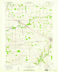
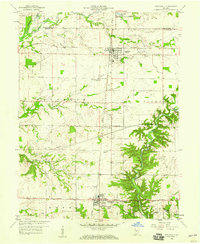
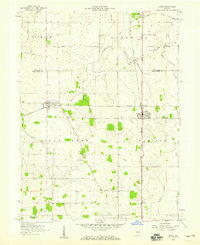
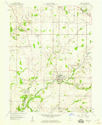
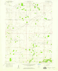
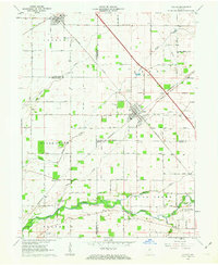
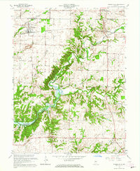
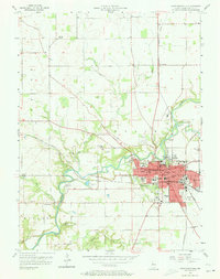 1956 Crawfordsville1957 Print · USGSCrawfordsville and the surrounding Montgomery County countryside are captured here in the mid-1950s at a peak of rail and river industry. Researchers can trace family sites at Oak Hill Cemetery, visit the old Mt Zion Sch, or locate the bygone depots at Fiskyville and Ames.4 unique versions available
 - 1956 Map of New Market, 1957 Print
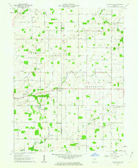
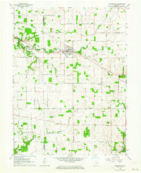
 1956 New Market1957 Print · USGSMontgomery County in the mid-fifties is a landscape of established rail towns and quiet rural parishes. Genealogists can trace family names through dozens of sites like Old Hickory Cem, Union Chapel, and the community at Browns Valley.3 unique versions available
 - 1957 Map of Indianapolis
 1957 Indianapolis1957 Print · USGSCentral Indiana in the mid-fifties is captured here as a crossroads of major rail lines and nascent federal highways. Genealogists and historians can trace family-named ridges like Poplar Ridge or locate strategic sites like Camp Atterbury and Speedway.2 unique versions available
 - 1957 Map of New Ross, 1959 Print
 1957 New Ross1959 Print · USGSThe rail-and-river corridor of central Indiana comes to life in the late fifties, showing the agricultural networks between New Ross and Jamestown. Trace family history through landmarks like Mt Zion Ch and rural burial grounds including New Ross Cem.3 unique versions available
 - 1958 Map of Darlington, 1959 Print
 1958 Darlington1959 Print · USGSCentral Indiana's farming townships are captured here in the late fifties, centered on the village of Darlington. Researchers can trace the rail corridors of the Pennsylvania and Monon lines or locate rural landmarks like Youngs Chapel and Township Sch.2 unique versions available
 - 1958 Map of Roachdale, 1959 Print
 1958 Roachdale1959 Print · USGSPutnam County in the late fifties was a hub of transit where the Monon and Baltimore and Ohio railroads met. Genealogists and local historians can trace the rural landscape through the Roachdale Cem, Haw Creek Ch, and the Ernie Pyle Memorial Highway.
 - 1958 Map of Linden, 1959 Print
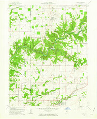
 1958 Linden1959 Print · USGSThe Montgomery County prairie was defined by a cross-hatch of rail lines and rural roads during the mid-fifties. Genealogists and local historians can trace the foundations of New Richmond, Linden, and the old Wilson-Killen Cem.2 unique versions available
 - 1958 Map of Ladoga, 1959 Print
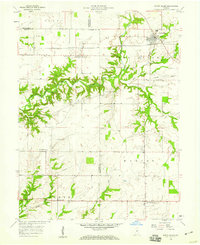
 1958 Ladoga1959 Print · USGSMontgomery County was a landscape of fertile creek valleys and intersecting rail lines in the late 1950s. Researchers can locate the early layout of Ladoga and trace family heritage at Harshbarger Cem, Snow Cem, or along the Monon railroad.2 unique versions available
 - 1958 Map of Kirkpatrick, 1959 Print
 1958 Kirkpatrick1959 Print · USGSThe rural borderlands of Tippecanoe and Montgomery counties are captured here in the late fifties, showing a landscape of rail-fed hamlets and productive farmland. Genealogists can locate family landmarks like Peterson Cem and the rural Potato Creek Ch.
 - 1958 Map of North Salem, 1959 Print
 1958 North Salem1959 Print · USGSCentral Indiana's farming heartland comes to life in the late fifties, centered on the village of North Salem. Genealogists and local historians can trace the paths of the Baltimore and Ohio railroad and find rural landmarks like Mt Olivet Ch and New Maysville.3 unique versions available
 - 1961 Map of Alamo, 1962 Print
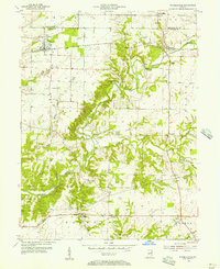
 1961 Alamo1962 Print · USGSThe rural landscape of Montgomery County during the early sixties is dominated by the winding path of Sugar Creek and the southern edge of Shades State Park. Researchers can find fascinating relics of local history, from the Deer Mill and its Covered Bridge to the Pennsylvania rail line serving Waveland.3 unique versions available
 - 1961 Map of Shannondale, 1963 Print
 1961 Shannondale1963 Print · USGSCentral Indiana farm country comes into focus in the early sixties, showing the rural landscape before modern expansion. Genealogists can trace family roots through sites like Shannondale, Log Cabin Crossroads, and the Pisgah Cem.2 unique versions available
 - 1962 Map of Indianapolis
 1962 Indianapolis1962 Print · USGSCentral Indiana and the Illinois borderlands are captured here in the early sixties, showing the region's dense rail networks and growing urban centers. Genealogists and historians can locate family-named landmarks and institutions like Crown Hill Cem, Indiana University, and the Indianapolis Motor Speedway.
 - 1962 Map of Colfax, 1963 Print
 1962 Colfax1963 Print · USGSColfax and the surrounding rural townships are shown here in the early sixties at a peak of mid-century rail activity. Genealogists can trace family connections through numerous local burial sites including Union Cem, Shilo Cem, and Plainview Cem near the banks of Sugar Creek.2 unique versions available
 - 1962 Map of Waynetown, 1964 Print
 1962 Waynetown1964 Print · USGSThe Montgomery County countryside comes into focus in the early sixties as a network of rail and river commerce. Genealogists can trace family footprints through Masonic Cem, Fruits Cem, and the rural crossroads at Taylor Corner.2 unique versions available
 - 1962 Map of Wingate, 1964 Print
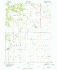
 1962 Wingate1964 Print · USGSIndiana farmland in the early sixties centers on the rail junction at Wingate. Local historians can trace numerous family-named landmarks and rural burial grounds, from Oak Ridge Cem to the Coal Creek Central Sch.2 unique versions available
 - 1963 Map of Bellmore, 1964 Print
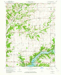 1963 Bellmore1964 Print · USGSEastern Parke County is captured here just as the landscape was transforming with the completion of the Mansfield Reservoir. Researchers can trace old family burial grounds like Lough Cem or follow the rail lines through Guion and Milligan.3 unique versions available
 - 1963 Map of Russellville, 1964 Print
 1963 Russellville1964 Print · USGSMid-century Putnam County and Montgomery County meet here in the early 1960s, showing a landscape defined by the Raccoon Creek valley. Genealogists can locate family names at Sutherlin Cem or James Cem and trace the original path of the Baltimore and Ohio railroad through Russellville.2 unique versions available
Showing maps 1-25 of 110
Top cities of Montgomery County
- Crawfordsville historical maps
- Ladoga historical maps
- Waynetown historical maps
- Darlington historical maps
- Linden historical maps
- New Market historical maps
See more
Frequently asked questions
- What are the different types of historical maps available for Montgomery County?
- What is the oldest map of Montgomery County?
- Where can I purchase historical maps of Montgomery County for my home or office?
- Where can I download high-res historical maps of Montgomery County?
- Are there historical topographic maps available for Montgomery County?
- Is there historical aerial imagery available for Montgomery County?
- Where are historical maps of Montgomery County sourced from?