Old Maps of Hartford, Indiana for Academic Research
Study the evolution of Hartford with 11 high-resolution historic maps. Whether you're teaching, researching, or modeling changes in land use, these maps provide essential visual documentation of urban, environmental, and geographic change.
- Analyze long-term change: Track patterns in development, transportation, and natural features.
- Ideal for environmental or urban studies: Support academic projects with primary historical map data.
- Use in the classroom or lab: Educators and researchers rely on these maps to bring historical context to life.
These maps are a powerful tool for teaching, research, and visualizing how Hartford has changed over the decades.
Hartford, IN maps
(11)- 1943 Map of Aberdeen
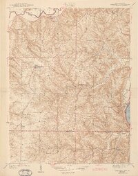 1943 Aberdeen1943 Print · USGSSoutheastern Indiana's river hills are captured here just before mid-century, showing a landscape of ridge-top farms and creek-side settlements. Researchers can locate family landmarks like Gillespie Cem, Bascom Corner, and several schools including Fisher Sch.2 unique versions available
 - 1953 Map of Aberdeen, 1955 Print
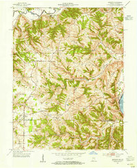 1953 Aberdeen1955 Print · USGSSoutheastern Indiana's rural character is preserved here in the early fifties, showing the upland ridges above the OHIO RIVER. Genealogists and historians can trace family locations near Aberdeen, Bovard Cem, and the Cass-Union Sch along the county lines.2 unique versions available
 - 1956 Map of Louisville, 1971 Print
 1956 Louisville1971 Print · USGSThe Ohio River valley and the Kentucky Bluegrass are captured here during a period of rapid mid-century growth and industrial activity. Genealogists and historians can trace rail-centered towns and military land use at Fort Knox and the Jefferson Proving Ground.2 unique versions available
 - 1964 Map of Louisville
 1964 Louisville1964 Print · USGSThe Ohio River valley and Kentucky Bluegrass are captured in the mid-1960s, showing a region balanced between industrial growth and its agrarian roots. Genealogists and historians can trace the development of county seats like Shelbyville and Paris, or locate established institutions such as Georgetown College and Bernheim Forest.
 - 1965 Map of Aberdeen, 1967 Print
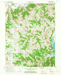 1965 Aberdeen1967 Print · USGSThe hills of Ohio and Switzerland counties are captured here in the mid-1960s, showing a landscape of high ridges and narrow creek bottoms. Genealogists can trace family landmarks and local centers like Aberdeen, Salem Ch, and the Grant Brothers Cem.3 unique versions available
 - 1986 Map of Falmouth
 1986 Falmouth1986 Print · USGSNorthern Kentucky and the Ohio River valley are shown here in the mid-1980s, highlighting the region's complex river-and-rail geography. Genealogists and researchers can trace the roads connecting Big Bone Lick, Zion Church, and river towns like Falmouth and Augusta.2 unique versions available
 - 2011 Map of Aberdeen, 2011 Print
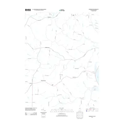
 2011 Aberdeen2011 Print · USGSCovers Hartford, including Cofield Corner, Washington Township, and other nearby areas
 - 2013 Map of Aberdeen, 2013 Print
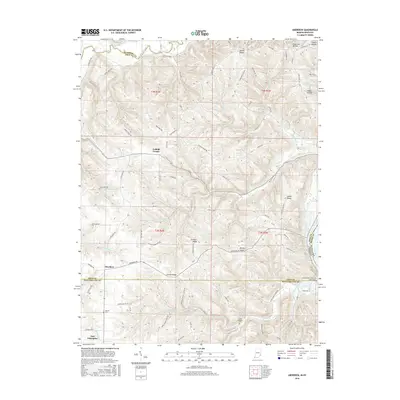
 2013 Aberdeen2013 Print · USGSCovers Hartford, including Cofield Corner, Washington Township, and other nearby areas
 - 2016 Map of Aberdeen, 2016 Print
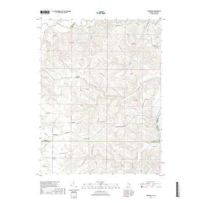
 2016 Aberdeen2016 Print · USGSCovers Hartford, including Cofield Corner, Washington Township, and other nearby areas
 - 2019 Map of Aberdeen, 2019 Print
 2019 Aberdeen2019 Print · USGSCovers Hartford, including Cofield Corner, Washington Township, and other nearby areas
 - 2022 Map of Aberdeen, 2022 Print
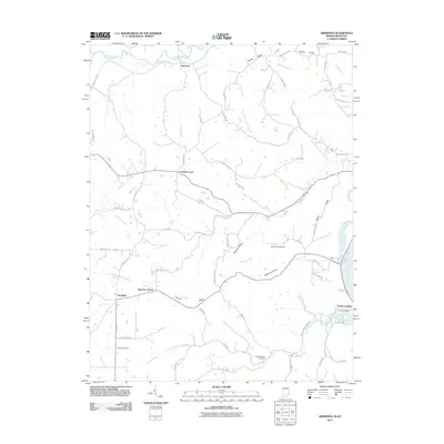
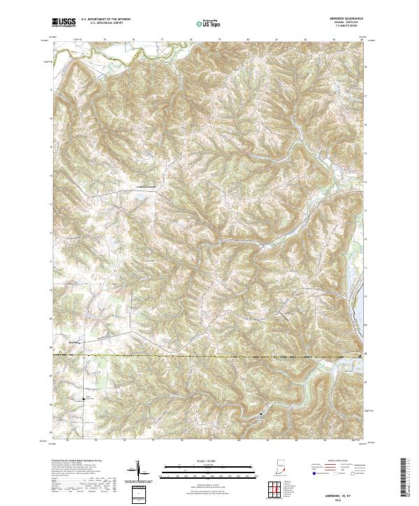 2022 Aberdeen2022 Print · USGSThe tri-county border of Indiana meets the Kentucky shoreline in the early 2020s, showing a landscape of high ridges and deep creek valleys. Researchers can locate family sites at Bovard Cem or Grant Brothers Cem near the settlements of Aberdeen and Cofield Corner.
End of results
Showing maps 1-11 of 11
Top cities near Hartford
- Burlington historical maps
- Lawrenceburg historical maps
- Greendale historical maps
- Aurora historical maps
- Cleves historical maps
- Sparta historical maps
See more
Frequently asked questions
- What are the different types of historical maps available for Hartford?
- What is the oldest map of Hartford?
- Where can I purchase historical maps of Hartford for my home or office?
- Where can I download high-res historical maps of Hartford?
- Are there historical topographic maps available for Hartford?
- Is there historical aerial imagery available for Hartford?
- Where are historical maps of Hartford sourced from?