1960s Maps of Ripley County, Indiana
Explore 7 historic maps of Ripley County from the 1960s. These maps offer a rare glimpse into what life looked like during the 1960s — showing old roads, neighborhoods, homes, and landmarks that have changed or disappeared over time.
Whether you're researching your family's past, planning a metal detecting trip, or studying how Ripley County's landscape evolved across the 1960s, these high-resolution maps are a powerful tool for exploring the history of this region.
- Focus on a specific era: All maps on this page are from the 1960s, giving you a focused view of this time period.
- See what’s changed: Compare century-old streets, trails, and buildings to today's modern landscape using overlays and satellite layers.
- Research with precision: Use these maps for genealogy, historical research, land use analysis, or educational projects.
- View, download, or print: Maps are fully viewable online in high resolution, and can be downloaded or printed for your own records.
Start exploring Ripley County's history through authentic maps from the 1960s. This is your window into the past.
Ripley County, IN maps
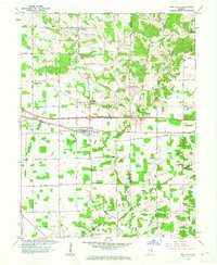
(7)- 1961 Map of Milan, 1963 Print
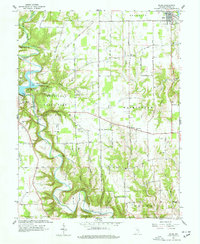 1961 Milan1963 Print · USGSRipley County in the early 1960s is defined by the deep meanders of Laughery Creek and the growing VERSAILLES STATE PARK. Genealogists can trace family names through several rural burying grounds, including Marble Corner Cem and Wilson Cem, alongside old landmarks like the Covered Bridge.5 unique versions available
 - 1961 Map of Batesville, 1963 Print
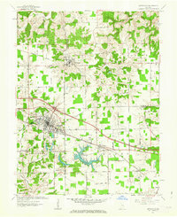 1961 Batesville1963 Print · USGSBatesville and the surrounding Ripley County countryside are captured here in the early sixties, showing a landscape defined by its German Catholic heritage and rail connections. Researchers can locate family landmarks like Holy Family Ch, St Marys Cem, and the rural junction of Cross Roads.5 unique versions available
 - 1961 Map of Versailles, 1963 Print
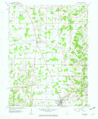
 1961 Versailles1963 Print · USGSRipley County is captured in the early sixties, showing the juxtaposition of the growing Versailles State Park and the high-security Jefferson Proving Ground. Genealogists can trace family footprints through numerous rural landmarks like Tanglewood Ch, New Marion, and Holman Cem.2 unique versions available
 - 1961 Map of Pierceville, 1963 Print
 1961 Pierceville1963 Print · USGSRipley County in the early sixties maintains a landscape of tight-knit farming hamlets and river-valley roads. Genealogists can locate family sites near Little Memory Cem, St Pauls Ch, and the small crossroads at Stumpke Corner.3 unique versions available
 - 1961 Map of New Point, 1963 Print
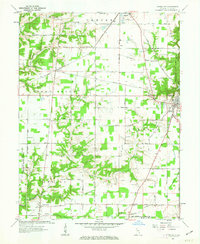
 1961 New Point1963 Print · USGSSoutheastern Indiana's agricultural heartland is documented here in the early sixties, centered on the railroad town of New Point. Researchers can trace the New York Central line through Rossburg and locate rural landmarks like Zion Ch and Enochsburg.4 unique versions available
 - 1961 Map of Osgood, 1963 Print
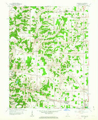
 1961 Osgood1963 Print · USGSRipley County life is captured here in the early sixties, centered on the rail-and-road hub of Osgood. Genealogists and local historians can trace family roots through sites like St Maurice Cem, Finke Church, and the historic Michigan Road.3 unique versions available
 - 1964 Map of Louisville
 1964 Louisville1964 Print · USGSThe Ohio River valley and Kentucky Bluegrass are captured in the mid-1960s, showing a region balanced between industrial growth and its agrarian roots. Genealogists and historians can trace the development of county seats like Shelbyville and Paris, or locate established institutions such as Georgetown College and Bernheim Forest.
End of results
Showing maps 1-7 of 7
Top cities of Ripley County
- Versailles historical maps
- Milan historical maps
- Osgood historical maps
- Delaware historical maps
- Jackson historical maps
- Sunman historical maps
See more
Frequently asked questions
- What are the different types of historical maps available for Ripley County?
- What is the oldest map of Ripley County?
- Where can I purchase historical maps of Ripley County for my home or office?
- Where can I download high-res historical maps of Ripley County?
- Are there historical topographic maps available for Ripley County?
- Is there historical aerial imagery available for Ripley County?
- Where are historical maps of Ripley County sourced from?