2020s Maps of Ripley County, Indiana
Explore 15 historic maps of Ripley County from the 2020s. These maps offer a rare glimpse into what life looked like during the 2020s — showing old roads, neighborhoods, homes, and landmarks that have changed or disappeared over time.
Whether you're researching your family's past, planning a metal detecting trip, or studying how Ripley County's landscape evolved across the 2020s, these high-resolution maps are a powerful tool for exploring the history of this region.
- Focus on a specific era: All maps on this page are from the 2020s, giving you a focused view of this time period.
- See what’s changed: Compare century-old streets, trails, and buildings to today's modern landscape using overlays and satellite layers.
- Research with precision: Use these maps for genealogy, historical research, land use analysis, or educational projects.
- View, download, or print: Maps are fully viewable online in high resolution, and can be downloaded or printed for your own records.
Start exploring Ripley County's history through authentic maps from the 2020s. This is your window into the past.
Ripley County, IN maps
(15)- 2022 Map of Osgood, 2022 Print
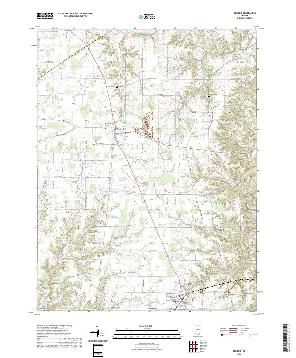 2022 Osgood2022 Print · USGSIndiana's rural Ripley County interior comes into focus here during the early twenty-first century, showing the established town centers and deep-rooted farmsteads. Family historians can pinpoint several local burial sites like Old Salem Cem and Booher Cem situated along the winding banks of Laughery Creek.
 - 2022 Map of Milan, 2022 Print
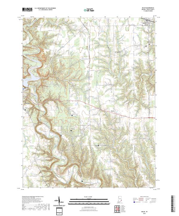 2022 Milan2022 Print · USGSRipley County's rural landscape is captured here in the early twenty-first century, showing the enduring patterns of rail and river life. Researchers can trace family roots through several local burial sites, including Saint Charles Cem, Bethel Cem, and the Wilson Family Cem.
 - 2022 Map of Pierceville, 2022 Print
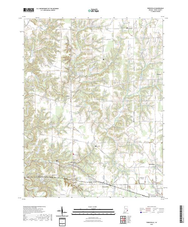 2022 Pierceville2022 Print · USGSRipley County, Indiana, is captured here in the early twenty-first century, showing the enduring rural network of townships and creek valleys. Genealogists can trace family roots at Little Memory Church Cem and through settlements like Old Milan and Delaware.
 - 2022 Map of Sunman, 2022 Print
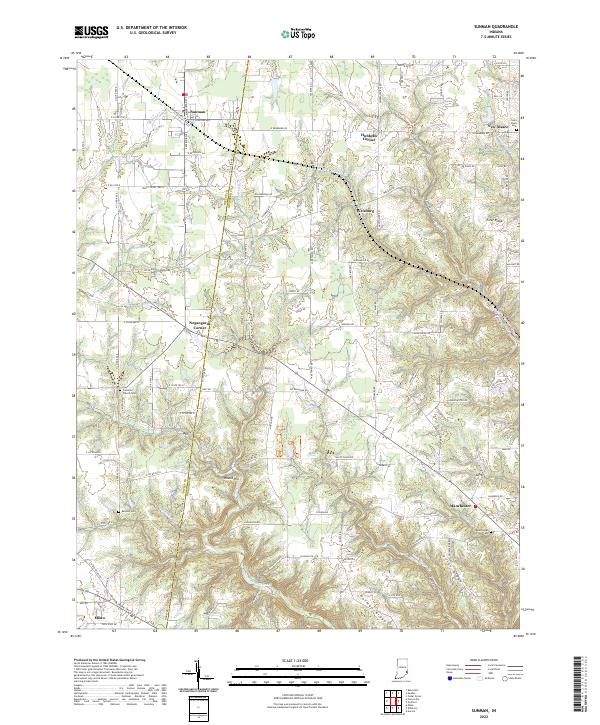 2022 Sunman2022 Print · USGSSoutheast Indiana's borderlands between Ripley and Dearborn counties are shown here as they appeared in the early 2020s. Researchers can trace rural cemeteries and local history across Ester Ridge, from the Manchester Cem to the railroad stop at Sunman.
 - 2022 Map of Holton, 2022 Print
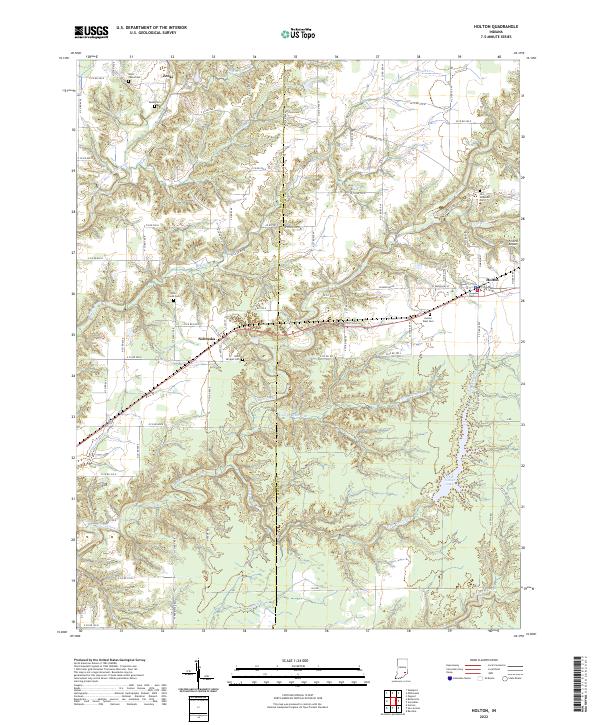 2022 Holton2022 Print · USGSThe rural borderlands of Ripley and Jennings counties are documented here in recent years, centered on the settlement of Holton. Genealogists and local researchers can trace family sites at West Zenas Cem, Otter Creek Cem, and the small crossroads of Nebraska.
 - 2022 Map of Versailles, 2022 Print
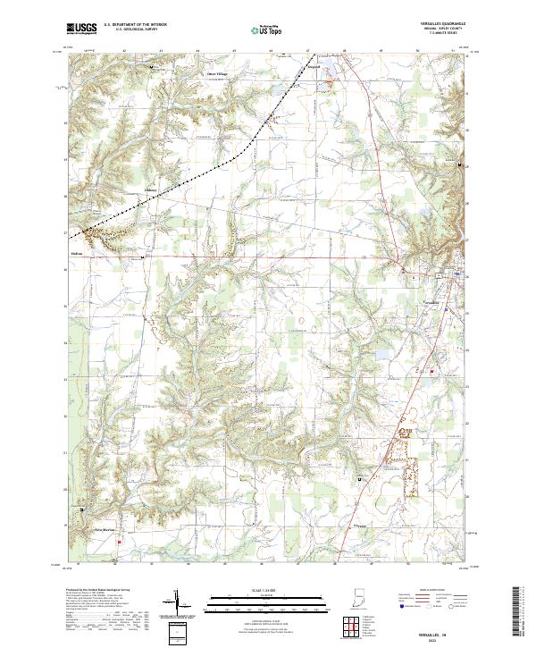 2022 Versailles2022 Print · USGSRipley County at the start of the 2020s shows a landscape of established towns and winding creek valleys. Researchers can trace ancestral roots at Holman Cem or locate historic landmarks like the Ripley County Courthouse and Francis Airport.
 - 2022 Map of Millhousen, 2022 Print
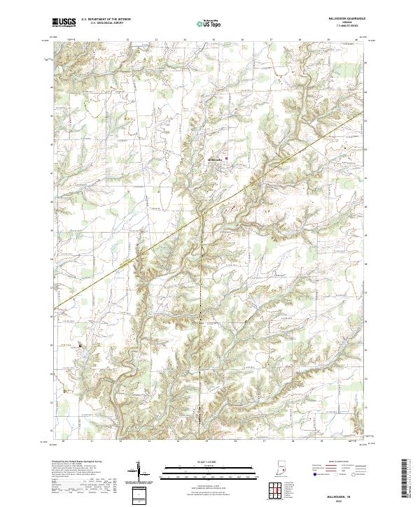 2022 Millhousen2022 Print · USGSThe tri-county border area of Decatur, Jennings, and Ripley Counties is mapped here in the early 2020s. Researchers can trace the rugged creek valleys of the Vernon Fork Muscatatuck River and locate the Cornell Cem near Millhousen.
 - 2022 Map of Spades, 2022 Print
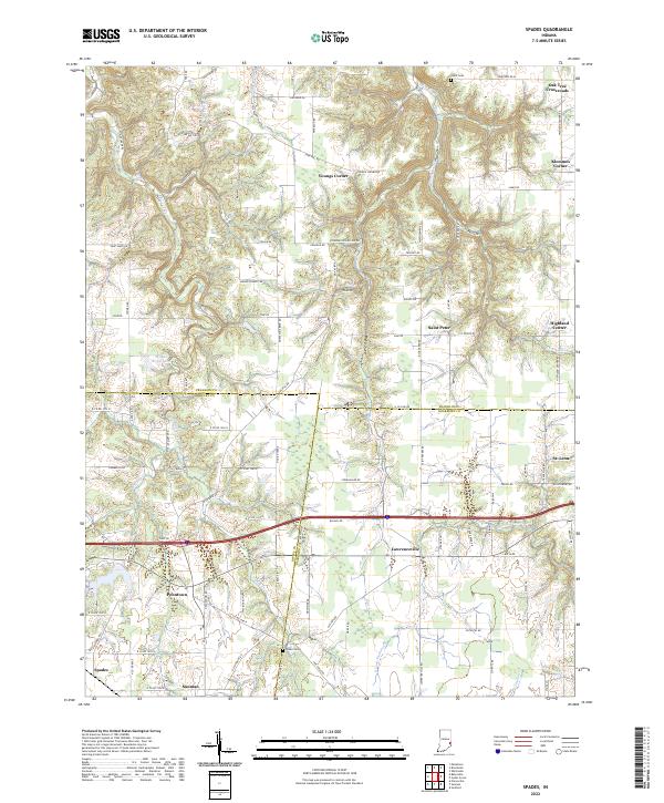 2022 Spades2022 Print · USGSSoutheastern Indiana's rural character is on full display here, where the borders of Franklin, Ripley, and Dearborn counties converge. Researchers can trace family roots through small junctions like Klemmes Corner and Penntown, or locate burials at Usher Cem and Alden Cem.
 - 2022 Map of New Point, 2022 Print
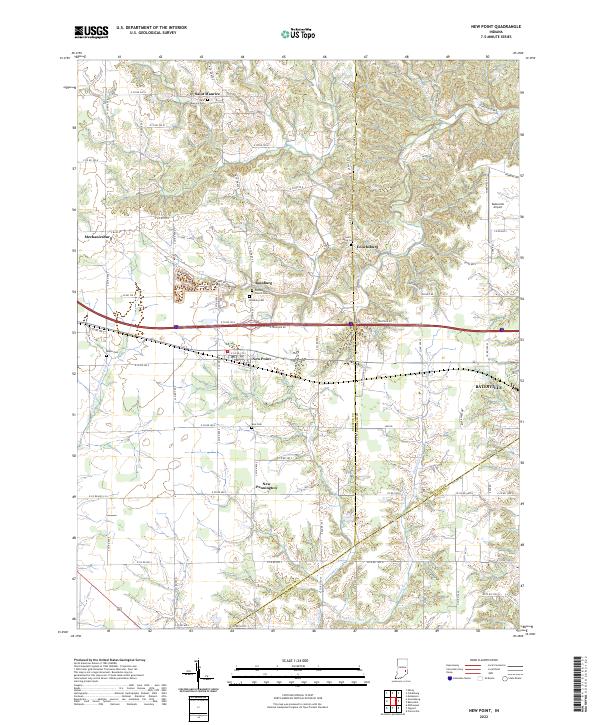 2022 New Point2022 Print · USGSDecatur County's rural townships and crossroads settlements are documented here in the early twenty-first century. Genealogists can trace family connections through numerous local sites like Old Rossburg Church Cem, Saint Maurice, and Enochsburg.
 - 2022 Map of Dillsboro, 2022 Print
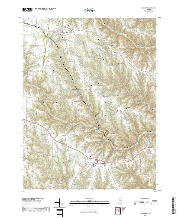 2022 Dillsboro2022 Print · USGSIndiana's Dearborn County ridge country is captured here in the early twenty-first century, showing the enduring rural layout of the region. Genealogists can locate numerous burial sites such as Oakdale Cem and Concord Cem, alongside the CSX Transportation corridor.
 - 2022 Map of Batesville, 2022 Print
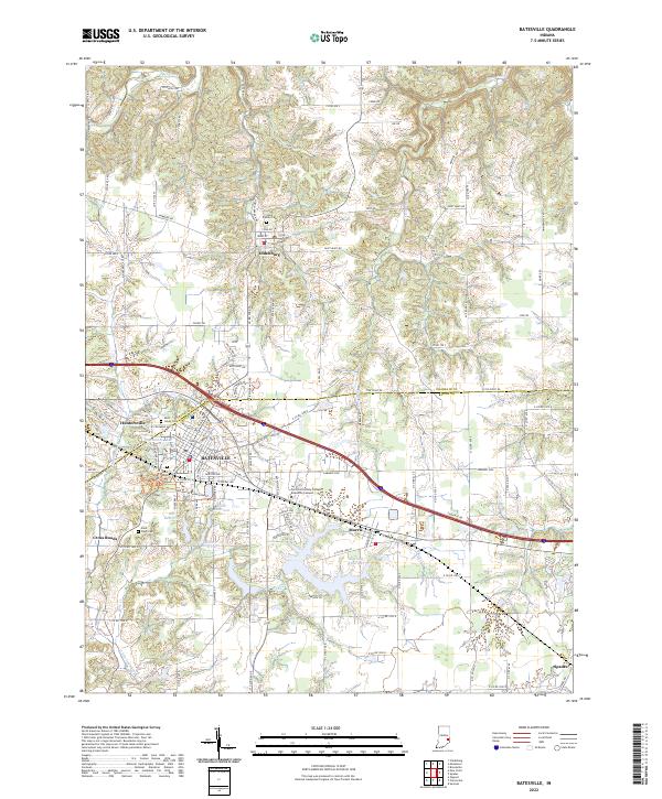 2022 Batesville2022 Print · USGSSoutheastern Indiana's industrial and educational landscape is detailed here in the early twenty-first century. Researchers can trace family history at Saint Louis Cem or locate community landmarks in Oldenburg and Batesville.
 - 2022 Map of San Jacinto, 2022 Print
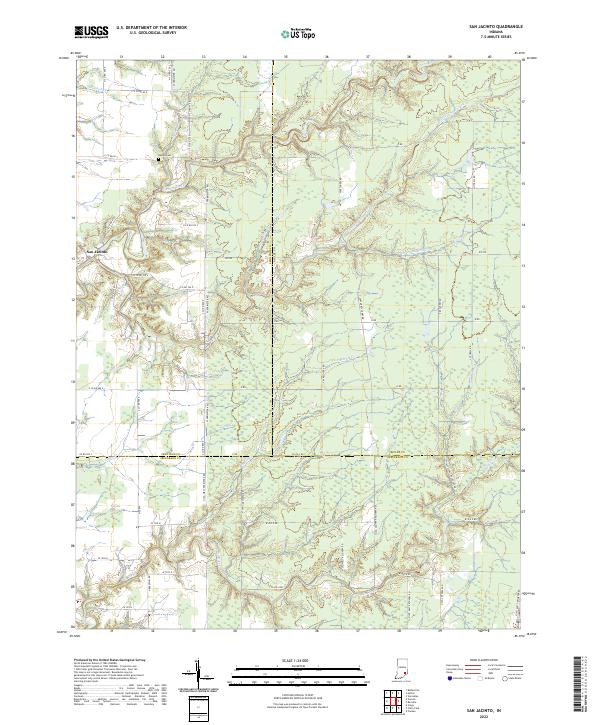 2022 San Jacinto2022 Print · USGSIndiana's tri-county borderlands come alive in this recent survey of the rural landscape near San Jacinto. Genealogists and local historians can trace family land and landmarks like Bethel Cem or follow the winding paths of Big Creek and Marble Cr.
 - 2022 Map of Bear Branch, 2022 Print
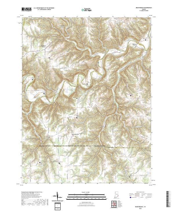 2022 Bear Branch2022 Print · USGSSoutheast Indiana's rural landscape at the start of the 2020s shows a resilient pattern of ridge-top settlements and creek-side hollows. Genealogists and local historians can trace legacy sites like Saint Johns Lutheran Cem, Milton, and the aptly named Farmers Retreat.
 - 2022 Map of Rexville, 2022 Print
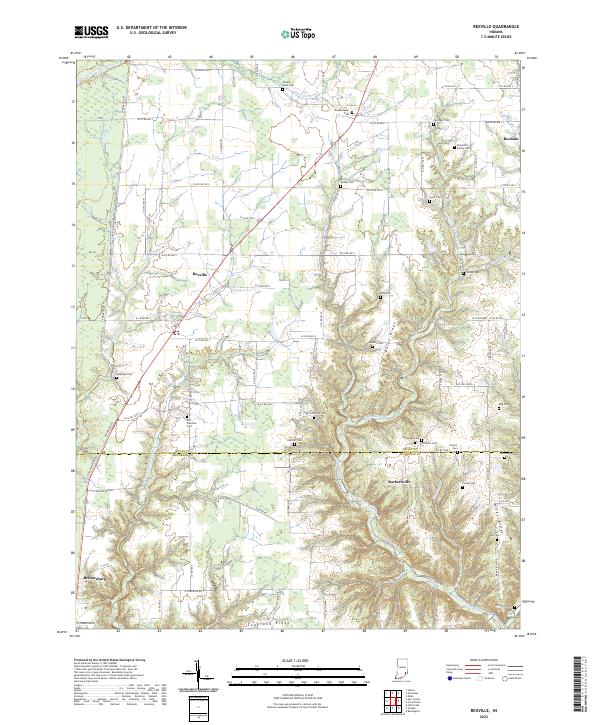 2022 Rexville2022 Print · USGSRipley and Jefferson counties come together at the edge of the Indiana hills in the early twenty-first century. Local historians can trace old family plots and rural communities including Rexville, Barbersville, and cemeteries like Klotzsche Family Cem.
 - 2022 Map of Cross Plains, 2022 Print
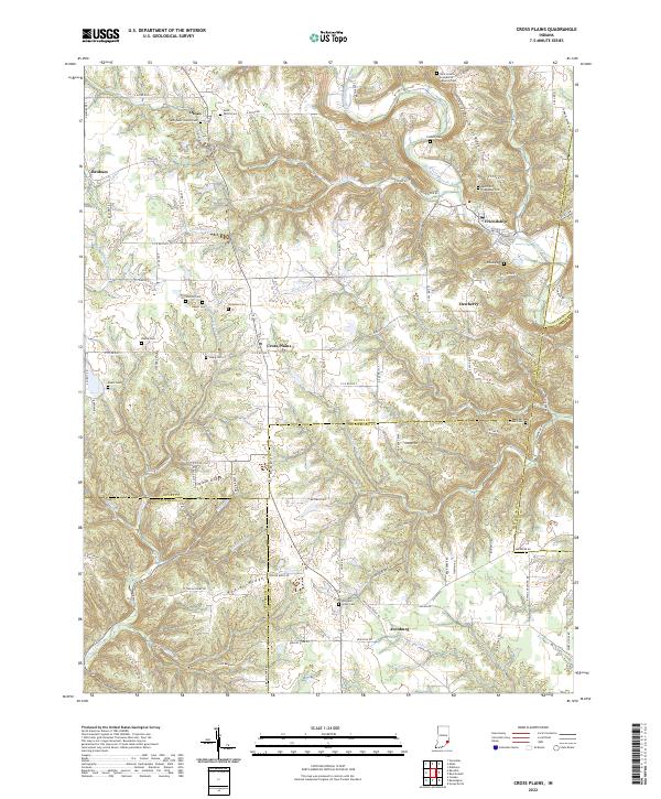 2022 Cross Plains2022 Print · USGSSoutheast Indiana's ridge-and-hollow country is captured here in the early twenty-first century, centered on the historic crossroads of Cross Plains. Genealogists can trace local roots through numerous family burial sites like Winkler Cem and Akers and Friendship Cem.
End of results
Showing maps 1-15 of 15
Top cities of Ripley County
- Versailles historical maps
- Milan historical maps
- Osgood historical maps
- Delaware historical maps
- Jackson historical maps
- Sunman historical maps
See more
Frequently asked questions
- What are the different types of historical maps available for Ripley County?
- What is the oldest map of Ripley County?
- Where can I purchase historical maps of Ripley County for my home or office?
- Where can I download high-res historical maps of Ripley County?
- Are there historical topographic maps available for Ripley County?
- Is there historical aerial imagery available for Ripley County?
- Where are historical maps of Ripley County sourced from?