2020s Maps of Shelby County, Indiana
Explore 12 historic maps of Shelby County from the 2020s. These maps offer a rare glimpse into what life looked like during the 2020s — showing old roads, neighborhoods, homes, and landmarks that have changed or disappeared over time.
Whether you're researching your family's past, planning a metal detecting trip, or studying how Shelby County's landscape evolved across the 2020s, these high-resolution maps are a powerful tool for exploring the history of this region.
- Focus on a specific era: All maps on this page are from the 2020s, giving you a focused view of this time period.
- See what’s changed: Compare century-old streets, trails, and buildings to today's modern landscape using overlays and satellite layers.
- Research with precision: Use these maps for genealogy, historical research, land use analysis, or educational projects.
- View, download, or print: Maps are fully viewable online in high resolution, and can be downloaded or printed for your own records.
Start exploring Shelby County's history through authentic maps from the 2020s. This is your window into the past.
Shelby County, IN maps
(12)- 2022 Map of Edinburgh, 2022 Print
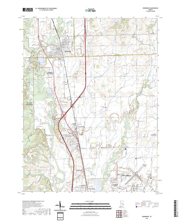 2022 Edinburgh2022 Print · USGSThe confluence of the Big Blue and Driftwood rivers south of Edinburgh is captured in this contemporary survey of the Indiana heartland. Genealogists can trace family sites at Rest Haven Cem and Tannehill Cem or explore the rail corridor of the L & I RR.
 - 2022 Map of Boggstown, 2022 Print
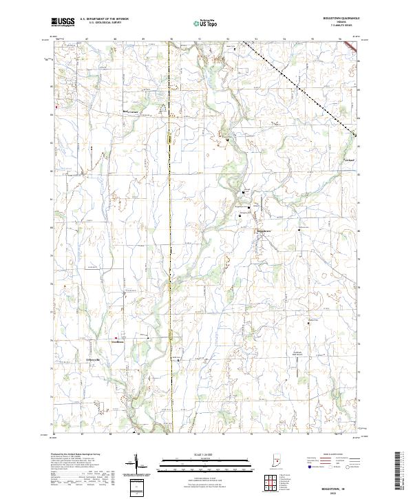 2022 Boggstown2022 Print · USGSShelby and Johnson counties come alive in this contemporary record of Indiana's rural agricultural heartland. Genealogists and local historians can trace family ties through numerous small burial sites like Sandhill Cem or Francis Cem and explore long-standing communities such as Boggstown and Fairland.
 - 2022 Map of Lewis Creek, 2022 Print
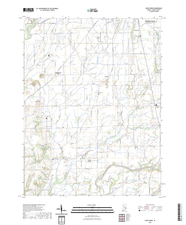 2022 Lewis Creek2022 Print · USGSShelby County in the early 2020s remains a landscape of deep-rooted farmsteads and rural crossroads south of SHELBYVILLE. Local researchers can trace family lands near Smithland or locate generational resting places at Patterson Cem and the Lewis Creek Baptist Cem.
 - 2022 Map of Fountaintown, 2022 Print
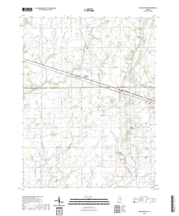 2022 Fountaintown2022 Print · USGSThe rural boundary of Hancock and Shelby counties is documented here as a high-functioning agricultural landscape in the twenty-first century. Genealogists and local historians can locate several family burial sites like Fairview Cem and Concord Cem among the many drainage works like Snodgrass Ditch.
 - 2022 Map of Morristown, 2022 Print
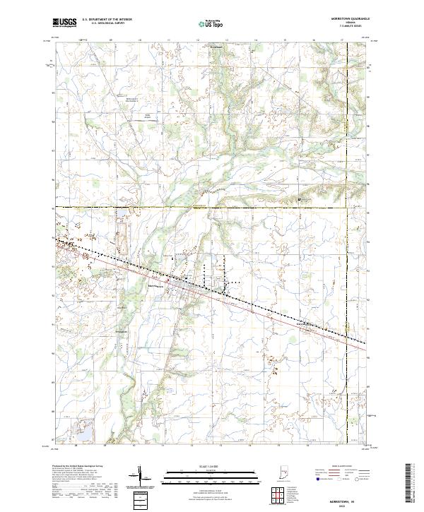 2022 Morristown2022 Print · USGSMorristown and its surrounding Shelby County farmland are documented in the early 2020s as a landscape of river-fed agriculture and small-town hubs. Researchers can trace local history through sites like Haskett Cem, the settlement at Gwynneville, and the natural rise of Hog Back.
 - 2022 Map of Hartsville, 2022 Print
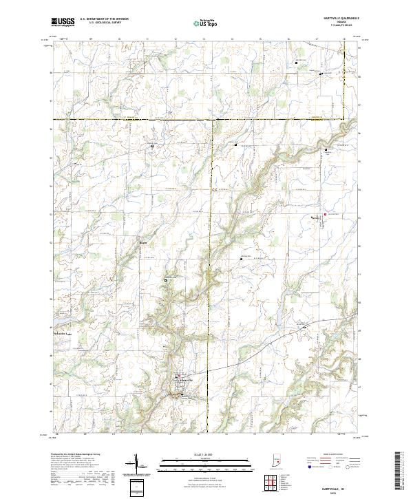 2022 Hartsville2022 Print · USGSBartholomew and Decatur counties come together in this modern survey of south-central Indiana’s rural heartland. Researchers can trace family history through several small burial grounds like Galbraith Cem and explore the historic layout of Hartsville and Rugby.
 - 2022 Map of Shelbyville, 2022 Print
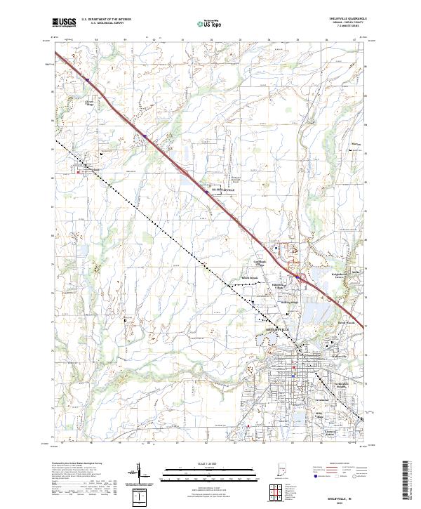 2022 Shelbyville2022 Print · USGSShelbyville and its neighboring townships appear here in the early 2020s, showing a landscape of river-valley agriculture and suburban expansion. Genealogists and historians can locate numerous family-named landmarks and burial sites, from Forest Hill Cem to Center Cem and the Shelbyville Municipal Airport.
 - 2022 Map of Rays Crossing, 2022 Print
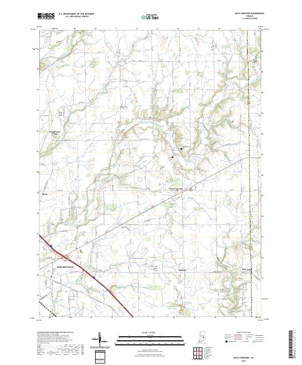 2022 Rays Crossing2022 Print · USGSShelby County farmland and the river valleys east of the county seat are captured in this recent survey. Researchers can trace rural lineages through Dewitt Cem or explore the smaller crossroads of Rays Crossing, Meltzer, and Blue Ridge.
 - 2022 Map of Marietta, 2022 Print
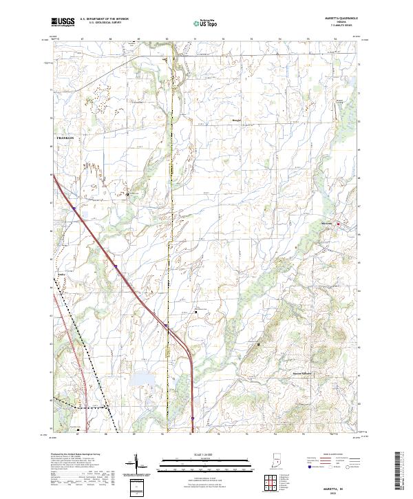 2022 Marietta2022 Print · USGSThe rural border of Johnson and Shelby Counties is documented here in the early 2020s, showing a landscape defined by its waterways and small settlements. Researchers can locate numerous local burial sites like Needham and Brockman Cemeteries or trace the routes through Marietta and Bengal.
 - 2022 Map of Acton, 2022 Print
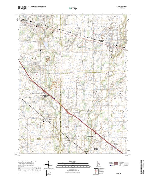 2022 Acton2022 Print · USGSThe rural communities southeast of Indianapolis are captured in this detailed study of the tri-county border area. Researchers can trace family roots through numerous burial grounds, including Mount Pleasant Methodist Church Cem and New Palestine Cem.
 - 2022 Map of Waldron, 2022 Print
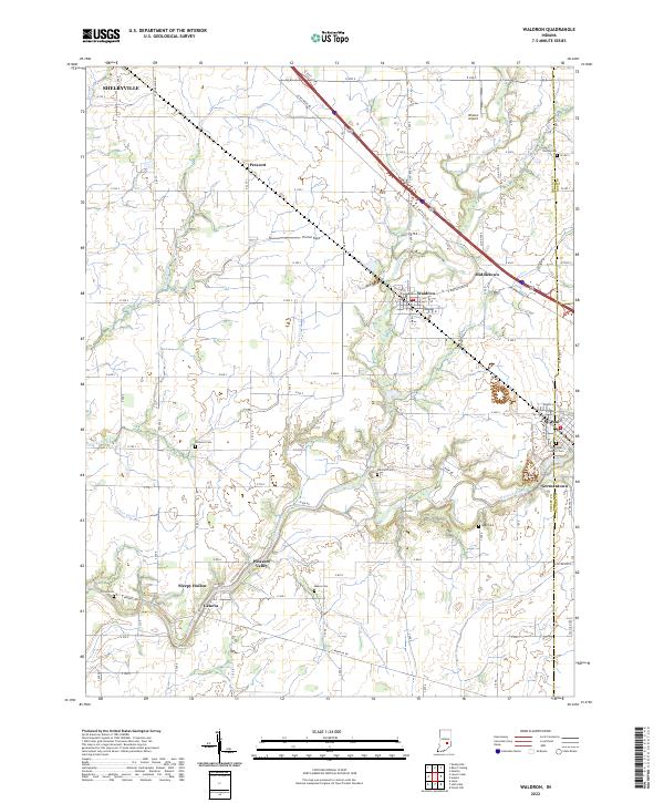 2022 Waldron2022 Print · USGSSoutheast Shelby County is documented here in the early 2020s, showing a landscape of fertile farmland between the Flatrock River and the outskirts of Shelbyville. Genealogists can locate several historic burial sites, including Saint Paul Catholic Cemetery, Van Pelt Cemetery, and Reed Cemetery.
 - 2022 Map of Hope, 2022 Print
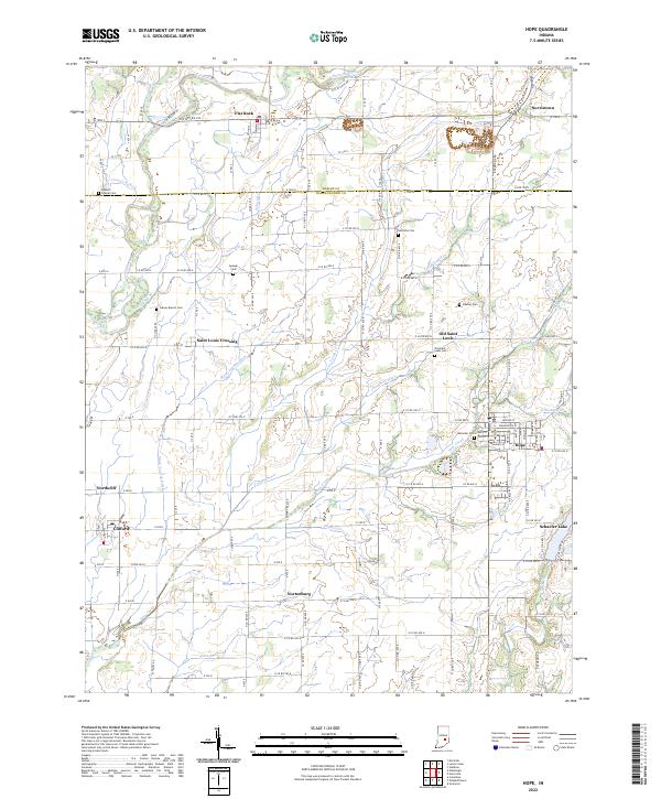 2022 Hope2022 Print · USGSBartholomew County farm country and the established town of Hope are captured in this modern survey. Genealogists can locate family burial sites like Moravian Cem and Simmons Cem or trace the early settlements of Old Saint Louis and Flat Rock.
End of results
Showing maps 1-12 of 12
Top cities of Shelby County
- Shelbyville historical maps
- Marion historical maps
- Morristown historical maps
- Sugar Creek historical maps
- Fairland historical maps
Frequently asked questions
- What are the different types of historical maps available for Shelby County?
- What is the oldest map of Shelby County?
- Where can I purchase historical maps of Shelby County for my home or office?
- Where can I download high-res historical maps of Shelby County?
- Are there historical topographic maps available for Shelby County?
- Is there historical aerial imagery available for Shelby County?
- Where are historical maps of Shelby County sourced from?