1900s (20th Century) Maps of Shelby County, Indiana
Explore 26 historic maps of Shelby County from the 1900s (20th Century). These maps offer a rare glimpse into what life looked like during the 1900s — showing old roads, neighborhoods, homes, and landmarks that have changed or disappeared over time.
Whether you're researching your family's past, planning a metal detecting trip, or studying how Shelby County's landscape evolved across the 1900s, these high-resolution maps are a powerful tool for exploring the history of this region.
- Focus on a specific era: All maps on this page are from the 1900s, giving you a focused view of this time period.
- See what’s changed: Compare century-old streets, trails, and buildings to today's modern landscape using overlays and satellite layers.
- Research with precision: Use these maps for genealogy, historical research, land use analysis, or educational projects.
- View, download, or print: Maps are fully viewable online in high resolution, and can be downloaded or printed for your own records.
Start exploring Shelby County's history through authentic maps from the 1900s. This is your window into the past.
Shelby County, IN maps
(26)- 1942 Map of Columbus
 1942 Columbus1942 Print · USGSBartholomew and Shelby counties are shown during the early years of the war, as military installations and rail lines reshaped the rural Indiana landscape. Genealogists can trace family-named sites and established communities like St Louis Crossing, Hope, and the sprawling Camp Atterbury.
 - 1947 Map of Hope, 1966 Print
 1947 Hope1966 Print · USGSBartholomew County and the surrounding townships are captured in the late 1940s as a thriving rail-and-river agricultural landscape. Researchers can trace family roots through the Moravian Cem in Hope or locate older communities like Old St Louis and Norristown.
 - 1948 Map of Edinburg
 1948 Edinburg1948 Print · USGSThe Driftwood River valley transitions from agricultural heartland to a significant military installation in the late 1940s. Genealogists can trace family names at Rest Haven Cem and Treadway Cem or locate the rural Old Union Ch near the banks of Big Slough.
 - 1948 Map of Hope
 1948 Hope1948 Print · USGSBartholomew County enters the late 1940s as a thriving agricultural region defined by its rail junctions and numerous small settlements. Genealogists and historians can trace family locations through Moravian Cem, Flat Rock, and the unique dual sites of Old St Louis and St Louis Crossing.2 unique versions available
 - 1948 Map of Lewis Creek
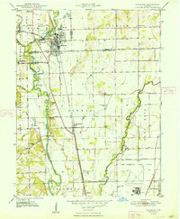
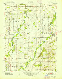
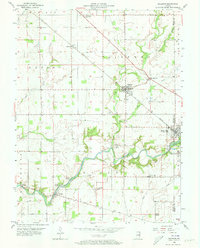
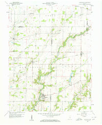
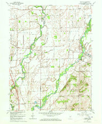
 1948 Lewis Creek1948 Print · USGSShelby County in the late 1940s reveals a productive rural landscape of small crossroads and family-named landmarks. Genealogists can trace property roots near Smithland or locate local burial sites like Eberhart Cem and Parrish Cem along the Pennsylvania rail line.2 unique versions available
 - 1948 Map of Marietta
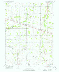
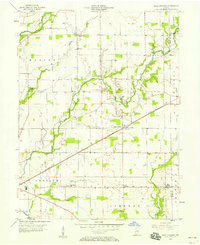
 1948 Marietta1948 Print · USGSShelby County farmland meets military history in the late 1940s as the Blue River winds through rural townships. Genealogists can trace family names at Smiley Cem or Conover Cem and locate rural landmarks like Jollity Ch and the Hendricks Township School.2 unique versions available
 - 1950 Map of Edinburg
 1950 Edinburg1950 Print · USGSMid-century Shelby and Bartholomew Counties are captured here as the military presence at Atterbury meets a deeply rooted farming landscape. Researchers can locate dozens of country landmarks like Jollity Church, Tennehill Bridge, and the Shelby Township School.2 unique versions available
 - 1952 Map of Fountaintown, 1953 Print
 1952 Fountaintown1953 Print · USGSThe crossroads of Shelby and Hancock counties come to life in this mid-century survey of the Indiana countryside. Genealogists can trace family roots through several rural burial grounds and churches, including Concord Cem, Lisher Cem, and Fairview Ch.3 unique versions available
 - 1953 Map of Shelbyville, 1954 Print
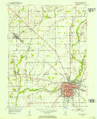 1953 Shelbyville1954 Print · USGSShelbyville and the surrounding townships thrive in the early fifties as the county seat grows along the Blue River. Genealogists can trace family names at St Joseph Cem and Brandywine Ch, or explore the rail-linked settlements of Fairland and Little Marion.2 unique versions available
 - 1953 Map of Acton, 1954 Print
 1953 Acton1954 Print · USGSSoutheastern Indiana farmland meets the rail lines of the early fifties in this detailed look at the rural landscape. Genealogists can locate family-named sites like Schildmeier Cem, Zion Sch, and the old rail stop at Acton.
 - 1953 Map of Boggstown, 1954 Print
 1953 Boggstown1954 Print · USGSShelby and Johnson Counties are captured here in the early 1950s as rural agriculture and small-town life centered on the river and rail. Researchers can trace family roots through numerous burial grounds like Hough Cem and Boggstown Cem or locate The Red Mills along Sugar Creek.2 unique versions available
 - 1953 Map of Cincinnati, 1965 Print
 1953 Cincinnati1965 Print · USGSThe Ohio River valley and the industrial heartland of Indiana and Ohio are captured here during the mid-century peak of rail and river commerce. Genealogists and historians can trace connections between Cincinnati and outlying military sites like Camp Atterbury and Bakalar AFB.3 unique versions available
 - 1956 Map of Morristown, 1957 Print
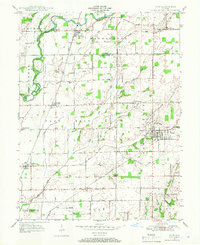
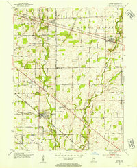
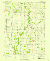
 1956 Morristown1957 Print · USGSMid-century Shelby County is captured here as the Baltimore and Ohio railroad links small agricultural hubs. Genealogists can trace local roots at Asbury Cem, Shiloh Ch, and the school at Morristown.2 unique versions available
 - 1956 Map of Waldron, 1957 Print
 1956 Waldron1957 Print · USGSSoutheastern Shelby County comes alive in this mid-century survey of rural Indiana as it appeared before modern suburban sprawl. Researchers can locate family landmarks like Wesley Chapel, find the old Stone Quarry at Saint Paul, and trace the path of the New York Central railroad.5 unique versions available
 - 1956 Map of Rays Crossing, 1958 Print
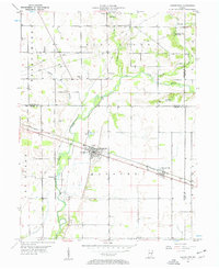
 1956 Rays Crossing1958 Print · USGSShelby County farm country comes to life in this mid-century survey, showing the rail-dependent hamlets and river valleys before the modernization of Indiana's rural landscape. Genealogists can trace family footprints near Rays Crossing, the Township Sch, and Mt Pisgah Ch.5 unique versions available
 - 1957 Map of Cincinnati
 1957 Cincinnati1957 Print · USGSThe Ohio River valley and its surrounding highlands thrived during the mid-fifties industrial peak, centered on the bustling Cincinnati and Dayton metropolitan hubs. Researchers can trace the extensive rail networks and military sites like Wright-Patterson AFB and Camp Atterbury.
 - 1958 Map of Hartsville, 1959 Print
 1958 Hartsville1959 Print · USGSBartholomew and Decatur counties are shown here in the late fifties, where rail lines and winding creeks shaped rural life. Genealogists can locate family-named sites like Galbraith Cem and Center Grove Cem, or trace the tracks of the New York Central through Rugby.4 unique versions available
 - 1961 Map of Edinburg, 1964 Print
 1961 Edinburg1964 Print · USGSThe river forks south of Indianapolis come alive in this early 1960s survey of the Driftwood and Flatrock valleys. Genealogists can locate family sites at Tannehill Cem and Old Bethel Ch, or trace the legacy of the Tannehill Covered Bridge.5 unique versions available
 - 1962 Map of Boggstown, 1963 Print
 1962 Boggstown1963 Print · USGSShelby and Johnson Counties are captured here in the early sixties, showing a landscape shaped by the winding Sugar Creek and the rail lines. You can trace the local heritage of small settlements and rural landmarks like The Red Mills, Urmeyville, and the Township Sch.4 unique versions available
 - 1962 Map of Marietta, 1964 Print
 1962 Marietta1964 Print · USGSThe rural border of Shelby and Johnson counties is captured in the early sixties as a landscape of productive farmland and military training grounds. Local historians can trace family roots at Smiley Cem or explore the rail-and-river geography near Marietta and the Pennsylvania railroad line.5 unique versions available
 - 1962 Map of Acton, 1964 Print
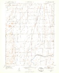
 1962 Acton1964 Print · USGSThe rural-to-suburban transition east of Indianapolis is captured here in the early sixties, where traditional farmland meets new housing estates. Researchers can trace ancestral roots at Freeman Cem or follow the historic tracks of the New York Central through Acton.4 unique versions available
 - 1962 Map of Shelbyville, 1964 Print
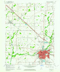 1962 Shelbyville1964 Print · USGSShelbyville and its surrounding townships are captured in the early sixties as mid-century suburbs began to expand alongside established rural centers. Genealogists and local historians can locate several country churches, including Old Union Ch and Brandywine Ch, or trace the tracks of the New York Central railroad.4 unique versions available
 - 1968 Map of Lewis Creek, 1970 Print
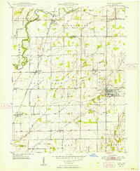
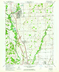
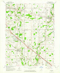
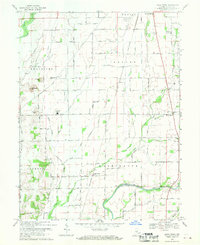 1968 Lewis Creek1970 Print · USGSShelby County farmland is captured here in the late sixties, showing a landscape defined by the Penn Central rail corridor and river valleys. Researchers can trace rural lineages through family landmarks like Patterson Cem, Eberhart Cem, and Winchester Ch.3 unique versions available
 - 1968 Map of Hope, 1970 Print
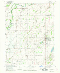 1968 Hope1970 Print · USGSBartholomew and Shelby counties meet here in the late sixties, where the Flatrock River valley supports a network of rail-side towns and rural townships. Trace family roots at Old St Louis Cemetery or explore the settlements of Flat Rock and Hope.3 unique versions available
 - 1986 Map of Greensburg
 1986 Greensburg1986 Print · USGSSoutheastern Indiana in the mid-eighties shows a balance of growing industrial centers and deeply rooted rural communities. Family historians can trace landmarks like the Highland Center School, South Park Cemetery, and the Bartholomew County Courthouse among the river forks.2 unique versions available
Showing maps 1-25 of 26
Top cities of Shelby County
- Shelbyville historical maps
- Marion historical maps
- Morristown historical maps
- Sugar Creek historical maps
- Fairland historical maps
Frequently asked questions
- What are the different types of historical maps available for Shelby County?
- What is the oldest map of Shelby County?
- Where can I purchase historical maps of Shelby County for my home or office?
- Where can I download high-res historical maps of Shelby County?
- Are there historical topographic maps available for Shelby County?
- Is there historical aerial imagery available for Shelby County?
- Where are historical maps of Shelby County sourced from?