
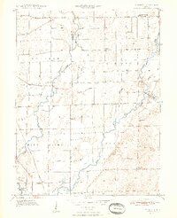
1948 Map of Marietta
USGS Topo · Published 1948About this map
Blue River and Sugar Creek converge across the fertile agricultural landscapes of southern Indiana in the years following World War II. The terrain is defined by an extensive network of drainage infrastructure, including the Medsker and McCue Ditch and Fisher Ditch, illustrating the intensive effort to manage the lowland topography for farming. Small community hubs like Marietta and Bengal anchor the rural townships of Needham, Hendricks, and Jackson.
Find a feature on this map
26 named features on this map. Tap any name to fly to it.
Don’t see what you’re looking for? This feature index may not catch every label — zoom into the map to look around manually.
Map Details
Editions of this 1948 Marietta Map
2 editions found
Other maps of this area

1942 · Franklin
USGS Topo · 1:125,000

1942 · Columbus
USGS Topo · 1:125,000

1947 · Franklin
USGS Topo · 1:62,500

1947 · Hope
USGS Topo · 1:24,000

1948 · Franklin
USGS Topo · 1:24,000

1948 · Edinburg
USGS Topo · 1:24,000

1948 · Hope
USGS Topo · 1:24,000

1948 · Nineveh
USGS Topo · 1:24,000

1948 · Lewis Creek
USGS Topo · 1:24,000

1950 · Franklin
USGS Topo · 1:62,500