Old Maps of Tipton County, Indiana for Genealogy
Trace your family roots with 80 historic maps of Tipton County. These high-res maps reveal old neighborhoods, homesites, landmarks, and streets — helping you uncover where your ancestors lived and how the area evolved over time.
- Explore historic neighborhoods: Identify where your relatives may have lived in the 1800s or 1900s.
- Compare maps over time: Trace the changes in streets, buildings, and landmarks for multi-generational research.
- Perfect for genealogy & ancestry research: Used by family historians and researchers to map out lineage and migration.
These maps are an incredible resource for exploring your personal connection to Tipton County's past.
Tipton County, IN maps
(80)- 1953 Map of Danville, 1965 Print
 1953 Danville1965 Print · USGSIndiana and Illinois crossroads come to life in this mid-century survey as the interstate era begins to reshape the river-and-rail landscape. Genealogists and collectors can trace the historic paths of the Nickel Plate railroad or locate smaller communities like Veedersburg, Goodland, and Bismarck.3 unique versions available
 - 1953 Map of Muncie, 1966 Print
 1953 Muncie1966 Print · USGSIndiana and Ohio borderlands thrive in the early fifties, showing a landscape defined by manufacturing cities and an intensive railroad network. Genealogists can trace family roots across the Indiana-Ohio line through Muncie, Celina, and Portland via the Pennsylvania railroad.5 unique versions available
 - 1955 Map of Danville
 1955 Danville1955 Print · USGSThe Indiana-Illinois borderlands during the mid-fifties reveal a landscape of thriving rail hubs and university towns. Researchers can trace the legacy of Purdue University, the Tippecanoe Battlefield, and the path of the Pennsylvania RR.
 - 1956 Map of Muncie
 1956 Muncie1956 Print · USGSEastern Indiana and western Ohio are shown at a peak of rail-driven industry in the mid-fifties. Genealogists and rail historians can trace the paths of the Pennsylvania RR through Muncie or locate landmarks like Lake Saint Marys (Grand Lake Reservoir) and Frances Slocum State Forest.
 - 1956 Map of Danville
 1956 Danville1956 Print · USGSMid-century Indiana and Illinois are captured here as the river-and-rail economy evolved into the modern highway era. Researchers can trace ancestral roots and old transport lines through Logansport, Battle Ground, and the dams at Lake Shafer.
 - 1960 Map of Elwood, 1961 Print
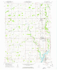
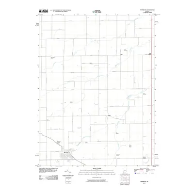
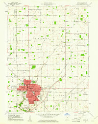 1960 Elwood1961 Print · USGSElwood and the Madison County borderlands are shown here in the early sixties as a thriving rail and agricultural hub. Local researchers can trace family plots at St Josephs Cemetery or locate vanished landmarks like the Drive-In Theater and Townships School.2 unique versions available
 - 1960 Map of Point Isabel, 1961 Print
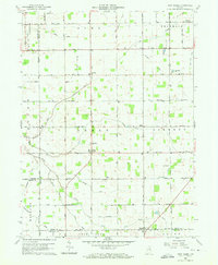 1960 Point Isabel1961 Print · USGSAgricultural life in central Indiana comes into focus during the early sixties, showing a landscape of small crossroads and family-named ditches. Genealogists can locate Antioch Ch, Knox Chapel, and the settlement of Point Isabel.4 unique versions available
 - 1960 Map of Kokomo West, 1961 Print
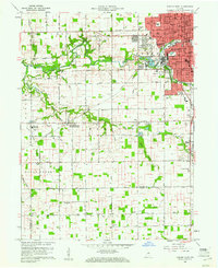 1960 Kokomo West1961 Print · USGSThe western edge of Kokomo was undergoing steady post-war growth when this survey was conducted. Local researchers can trace family roots through landmarks like West Middleton, the Shiloh Church, and the New York Chicago and St Louis Railroad corridor.3 unique versions available
 - 1960 Map of Kokomo East, 1961 Print
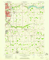 1960 Kokomo East1961 Print · USGSThe Howard County countryside meets the rising industrial sprawl of Kokomo during the early sixties. Genealogists can trace family names and local landmarks through sites like Crown Point Cemetery, Darrough Chapel, and the rural Township Sch.3 unique versions available
 - 1960 Map of Kempton, 1961 Print
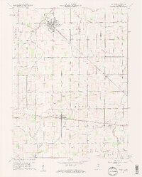
 1960 Kempton1961 Print · USGSCentral Indiana's agricultural heartland is documented here in the early sixties, showing the vital rail-and-canal network. Trace family roots at Kempton Cem or explore the rural clusters of Groomsville and Normanda along the New York Chicago and St Louis railroad.2 unique versions available
 - 1960 Map of Tipton, 1961 Print
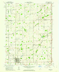
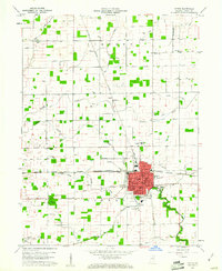 1960 Tipton1961 Print · USGSTipton and the surrounding Central Indiana farmland are captured here in the early sixties, showing a landscape shaped by rail and agriculture. Genealogists and local historians can trace family roots through numerous sites like Fairview Cemetery, St Joseph Academy, and Rock Prairie Ch.2 unique versions available
 - 1960 Map of Windfall, 1961 Print
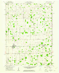
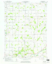
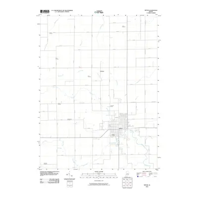
 1960 Windfall1961 Print · USGSTipton County’s agricultural heartland is documented here in the early sixties, showing the rail-dependent growth of small Indiana towns. Researchers can trace family history through sites like Brookside Cemetery, Hazeldell Ch, and the distinct street plan of Windfall.2 unique versions available
 - 1960 Map of Greentown, 1961 Print
 1960 Greentown1961 Print · USGSHoward County's agricultural heartland is documented here in the early sixties as the railroad era met a modernizing landscape. Trace the development of Greentown and smaller rural hamlets like Jerome and Phlox, alongside historic sites such as New Salem Ch and the Jerome Cem.4 unique versions available
 - 1961 Map of Sheridan, 1962 Print
 1961 Sheridan1962 Print · USGSSheridan and the surrounding Indiana farm country are captured here at the start of the 1960s, showing a landscape defined by rail and early aviation. Researchers can trace the MONON line through town or locate family sites at Crown Hill Cem, Wiles Cem, and Hills Ch.3 unique versions available
 - 1961 Map of Omega, 1962 Print
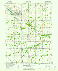
 1961 Omega1962 Print · USGSNorth of Noblesville in the early sixties, this rural landscape reveals the agricultural heart of Hamilton and Tipton counties. Researchers can trace family roots through sites like Harveys Chapel, Buscher Cem, and the small settlements of Omega and Aroma.3 unique versions available
 - 1961 Map of Arcadia, 1963 Print
 1961 Arcadia1963 Print · USGSNorth of the newly developed Morse Reservoir, the early 1960s landscape of Hamilton County centers on the busy rail towns of Arcadia and Atlanta. Genealogists and historians can trace family roots through several local landmarks like Taylor Cemetery, Roberts Chapel, and the Indiana Academy.4 unique versions available
 - 1962 Map of Frankton, 1963 Print
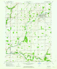 1962 Frankton1963 Print · USGSThe Madison County countryside comes into focus in the early sixties, centered on the rail-fed town of Frankton. Researchers can trace rural lineages through numerous local burial grounds like Howard Cem and Neese Cem or locate Ironwood Ch.2 unique versions available
 - 1984 Map of Lafayette, 1985 Print
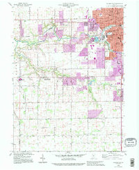
 1984 Lafayette1985 Print · USGSNorth-central Indiana thrives in the 1980s as a hub of higher education, industry, and agriculture centered on the Wabash River. Genealogists and historians can locate family sites near Darrough Chapel, Oak Hill Cem, or the small crossroads of Thorntown and Colfax.2 unique versions available
 - 1986 Map of Muncie
 1986 Muncie1986 Print · USGSEast Central Indiana was a hub of manufacturing and higher education in the mid-eighties. Genealogists and historians can trace the streets of Muncie, locate rural Cem sites, and explore landmarks like Mounds State Park and Taylor Univ.3 unique versions available
 - 1992 Map of Kokomo West, 1995 Print
 1992 Kokomo West1995 Print · USGSHoward County's western outskirts and the growing city of Kokomo are captured here in the early nineties as suburban expansion met rural farmland. Researchers can trace local community roots through landmarks like West Middleton, Shiloh Ch, and the Western High Sch.
 - 2010 Map of Windfall, 2010 Print
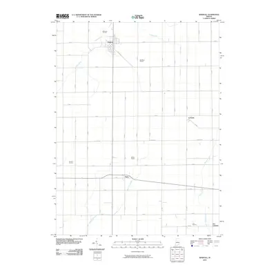 2010 Windfall2010 Print · USGSCovers Tipton County, including New Lancaster, Windfall City, and other nearby areas
 - 2010 Map of Elwood, 2010 Print
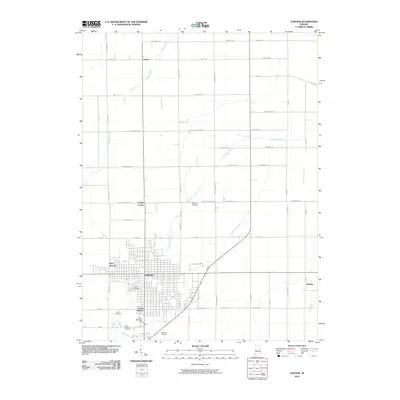 2010 Elwood2010 Print · USGSCovers Tipton County, including Elwood, College Corner, and other nearby areas
 - 2010 Map of Frankton, 2010 Print
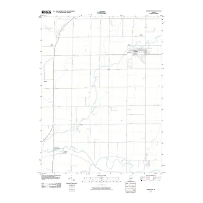 2010 Frankton2010 Print · USGSCovers Tipton County, including Frankton, Aroma, and other nearby areas
 - 2010 Map of Tipton, 2010 Print
 2010 Tipton2010 Print · USGSCovers Tipton County, including Tipton, Jacksons, and other nearby areas
 - 2010 Map of Sheridan, 2010 Print
 2010 Sheridan2010 Print · USGSCovers Tipton County, including Sheridan, Ekin, and other nearby areas
Showing maps 1-25 of 80
Top cities of Tipton County
Frequently asked questions
- What are the different types of historical maps available for Tipton County?
- What is the oldest map of Tipton County?
- Where can I purchase historical maps of Tipton County for my home or office?
- Where can I download high-res historical maps of Tipton County?
- Are there historical topographic maps available for Tipton County?
- Is there historical aerial imagery available for Tipton County?
- Where are historical maps of Tipton County sourced from?