2020s Maps of Union County, Indiana
Explore 6 historic maps of Union County from the 2020s. These maps offer a rare glimpse into what life looked like during the 2020s — showing old roads, neighborhoods, homes, and landmarks that have changed or disappeared over time.
Whether you're researching your family's past, planning a metal detecting trip, or studying how Union County's landscape evolved across the 2020s, these high-resolution maps are a powerful tool for exploring the history of this region.
- Focus on a specific era: All maps on this page are from the 2020s, giving you a focused view of this time period.
- See what’s changed: Compare century-old streets, trails, and buildings to today's modern landscape using overlays and satellite layers.
- Research with precision: Use these maps for genealogy, historical research, land use analysis, or educational projects.
- View, download, or print: Maps are fully viewable online in high resolution, and can be downloaded or printed for your own records.
Start exploring Union County's history through authentic maps from the 2020s. This is your window into the past.
Union County, IN maps
(6)- 2022 Map of Brownsville, 2022 Print
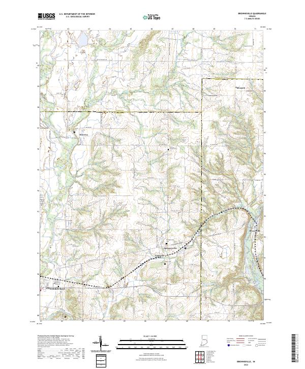 2022 Brownsville2022 Print · USGSTracing the borderlands of Fayette, Wayne, and Union counties, this modern survey illustrates a landscape shaped by the Whitewater River. Researchers will find numerous burial sites and small hamlets to explore, including Springersville, Lyonsville, and the historical Robinson Chapel Cem.
 - 2022 Map of Everton, 2022 Print
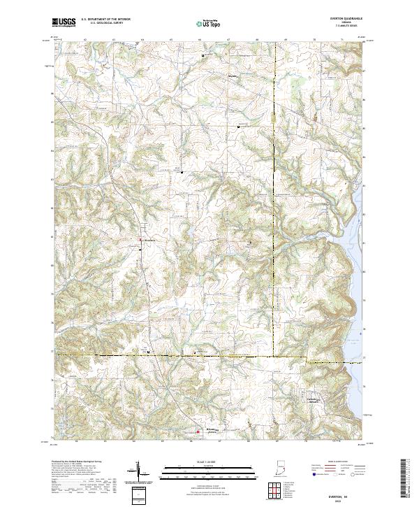 2022 Everton2022 Print · USGSThe Fayette County uplands meet the waters of Brookville Lake in this contemporary survey of southeastern Indiana. Researchers can trace rural lineages through numerous local sites like Everton Cem, Poplar Ridge Cem, and the settlement of Alquina.
 - 2022 Map of Liberty, 2022 Print
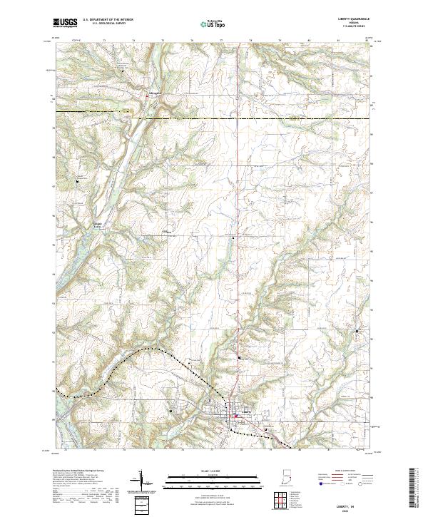 2022 Liberty2022 Print · USGSThe East Fork Whitewater River valley in Union County was well-established by the early 2020s. Genealogists can trace family lines across numerous burial sites like Richland Cem, Patterson Cem, and the Locust Grove Methodist Episcopal Cem.
 - 2022 Map of New Fairfield, 2022 Print
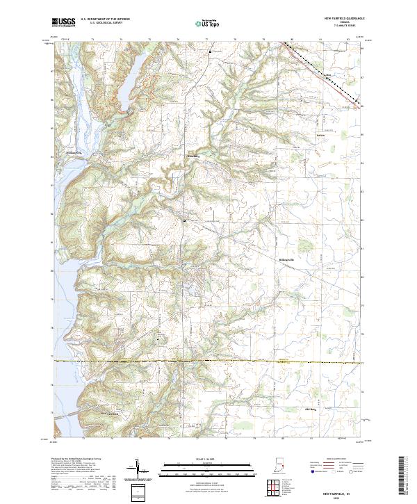 2022 New Fairfield2022 Print · USGSThe rural landscapes of eastern Indiana are captured here in the early 2020s, centered on the Brookville Lake area and the East Fork Whitewater River. Researchers can trace old family sites and local centers like Lotus, Billingsville, and the Bath Springs Cem.
 - 2023 Map of Fairhaven, 2023 Print
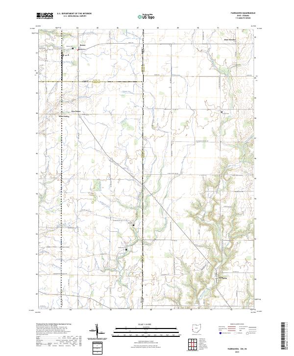 2023 Fairhaven2023 Print · USGSThe rural borderlands of Ohio and Indiana are captured here in a contemporary survey of the landscape around Fairhaven. Researchers can locate historic rural burial sites like Pentecost Cemetery and family-named landmarks including Norris Field.
 - 2023 Map of College Corner, 2023 Print
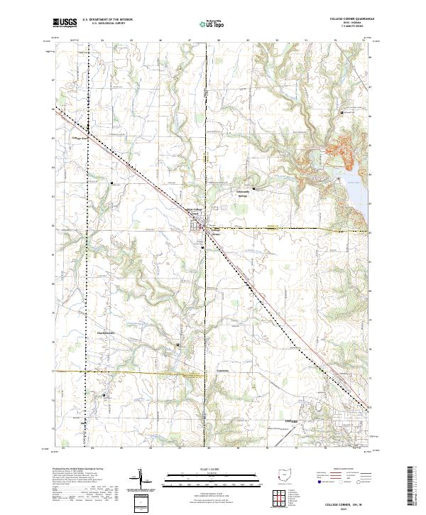 2023 College Corner2023 Print · USGSThe Indiana-Ohio borderlands come into focus in the early 2020s, centered on the unique tri-county junction at College Corner. Researchers can trace local lineages through College Corner Cemetery or explore the wooded trails surrounding Acton Lake.
End of results
Showing maps 1-6 of 6
Top cities of Union County
Frequently asked questions
- What are the different types of historical maps available for Union County?
- What is the oldest map of Union County?
- Where can I purchase historical maps of Union County for my home or office?
- Where can I download high-res historical maps of Union County?
- Are there historical topographic maps available for Union County?
- Is there historical aerial imagery available for Union County?
- Where are historical maps of Union County sourced from?