Old Maps of Blanford, Indiana for Academic Research
Study the evolution of Blanford with 14 high-resolution historic maps. Whether you're teaching, researching, or modeling changes in land use, these maps provide essential visual documentation of urban, environmental, and geographic change.
- Analyze long-term change: Track patterns in development, transportation, and natural features.
- Ideal for environmental or urban studies: Support academic projects with primary historical map data.
- Use in the classroom or lab: Educators and researchers rely on these maps to bring historical context to life.
These maps are a powerful tool for teaching, research, and visualizing how Blanford has changed over the decades.
Blanford, IN maps
(14)- 1947 Map of Paris, 1967 Print
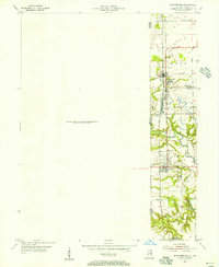
 1947 Paris1967 Print · USGSPost-war Edgar County and the Indiana borderlands are captured here at a time when rural schoolhouses and small family cemeteries still marked nearly every section. Genealogists can locate Edgar Cem, the Old Indian Boundary Line, and dozens of local schools like Plum Grove Sch.
 - 1949 Map of Paris
 1949 Paris1949 Print · USGSEastern Illinois and the Indiana borderlands are captured here in the late 1940s, centered on the rail hub of Paris. Researchers can trace dozens of rural schoolhouses and family cemeteries, including St Aloysius Ch, Edgar Cem, and the path of the Old Indian Boundary Line.2 unique versions available
 - 1951 Map of Saint Bernice, 1956 Print
 1951 Saint Bernice1956 Print · USGSThe Illinois-Indiana borderlands are captured here in the early 1950s, showcasing a landscape shaped by coal extraction and heavy rail. Researchers can trace the heritage of mining towns like Saint Bernice and Blanford alongside the Chicago Milwaukee St Paul and Pacific tracks.
 - 1953 Map of Indianapolis, 1965 Print
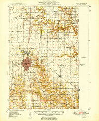
 1953 Indianapolis1965 Print · USGSCentral Indiana and the Illinois borderlands are captured in the mid-sixties, showing the growth of Indianapolis and its industrial rail corridors. Genealogists and historians can trace the development of outlying towns like Zionsville or Beech Grove and find landmarks such as Atterbury AAF and Turkey Run State Park.4 unique versions available
 - 1956 Map of Indianapolis
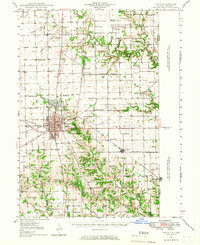
 1956 Indianapolis1956 Print · USGSCentral Indiana in the mid-fifties is captured during a period of industrial growth and military presence. Genealogists and historians can trace the rail networks of the New York Central or locate regional landmarks like Fort Benjamin Harrison and Camp Atterbury.
 - 1957 Map of Indianapolis
 1957 Indianapolis1957 Print · USGSCentral Indiana in the mid-fifties is captured here as a crossroads of major rail lines and nascent federal highways. Genealogists and historians can trace family-named ridges like Poplar Ridge or locate strategic sites like Camp Atterbury and Speedway.2 unique versions available
 - 1962 Map of Indianapolis
 1962 Indianapolis1962 Print · USGSCentral Indiana and the Illinois borderlands are captured here in the early sixties, showing the region's dense rail networks and growing urban centers. Genealogists and historians can locate family-named landmarks and institutions like Crown Hill Cem, Indiana University, and the Indianapolis Motor Speedway.
 - 1966 Map of Saint Bernice, 1967 Print
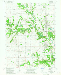 1966 Saint Bernice1967 Print · USGSThe Illinois-Indiana borderlands are captured here in the mid-1960s, showing a landscape defined by the Milwaukee Road rail line and fertile creek bottoms. Genealogists can trace family footprints through numerous rural landmarks like Old Scott Cem, St Aloysius Ch, and the settlement of Saint Bernice.3 unique versions available
 - 1986 Map of Paris
 1986 Paris1986 Print · USGSThe Illinois-Indiana borderlands thrive in the mid-1980s as a hub of river-side industry and fertile farmland. Genealogists and historians can trace rail-centered settlements like Chrisman and Metcalf, or locate family sites at the Quaker Cem and Bethel Ch.2 unique versions available
 - 2011 Map of Saint Bernice, 2011 Print
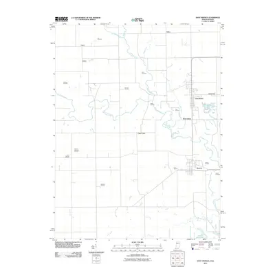 2011 Saint Bernice2011 Print · USGSCovers Blanford, including Clays Prairie, West Clinton, and other nearby areas
 - 2013 Map of Saint Bernice, 2013 Print
 2013 Saint Bernice2013 Print · USGSCovers Blanford, including Clays Prairie, West Clinton, and other nearby areas
 - 2016 Map of Saint Bernice, 2016 Print
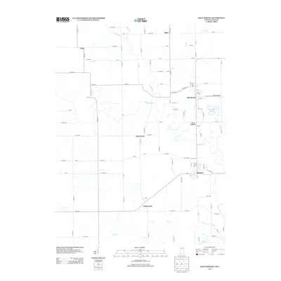
 2016 Saint Bernice2016 Print · USGSCovers Blanford, including Clays Prairie, West Clinton, and other nearby areas
 - 2019 Map of Saint Bernice, 2019 Print
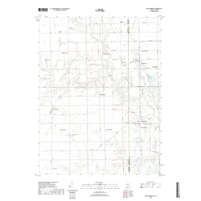 2019 Saint Bernice2019 Print · USGSCovers Blanford, including Clays Prairie, West Clinton, and other nearby areas
 - 2022 Map of Saint Bernice, 2022 Print
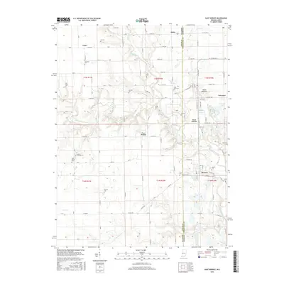
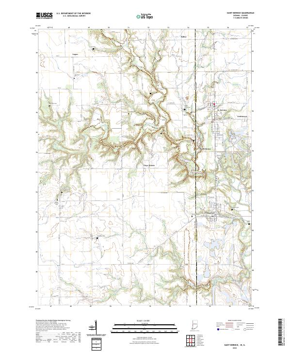 2022 Saint Bernice2022 Print · USGSThe Indiana-Illinois state line comes alive in this survey of Vermillion County, where small communities like St. Bernice and Blanford sit amidst the winding Brouilletts Creek. Genealogists can locate numerous burial sites including Sugar Grove Cem and Old Scott Cem.
End of results
Showing maps 1-14 of 14
Top cities near Blanford
- Terre Haute historical maps
- Paris historical maps
- Clinton historical maps
- West Terre Haute historical maps
- Highland historical maps
- Fairview Park historical maps
See more
Frequently asked questions
- What are the different types of historical maps available for Blanford?
- What is the oldest map of Blanford?
- Where can I purchase historical maps of Blanford for my home or office?
- Where can I download high-res historical maps of Blanford?
- Are there historical topographic maps available for Blanford?
- Is there historical aerial imagery available for Blanford?
- Where are historical maps of Blanford sourced from?