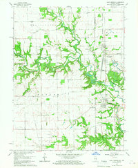
1966 Map of Saint Bernice
USGS Topo · Published 1967About this map
The Illinois-Indiana state line divides this landscape of fertile prairies and meandering creek bottoms during the mid-1960s. The Chicago Milwaukee St Paul and Pacific railroad forms a sharp north-south corridor through the eastern half, anchoring the development of Saint Bernice and West Clinton. Between the wooded banks of Brouilletts Creek and Crabapple Creek, the map reveals a deeply rooted rural community marked by numerous family and pioneer burial grounds like Old Scott Cem and Stafford-Simmons Cem.
Find a feature on this map
41 named features on this map. Tap any name to fly to it.
Don’t see what you’re looking for? This feature index may not catch every label — zoom into the map to look around manually.
Map Details
Editions of this 1966 Saint Bernice Map
Other maps of this area

1947 · Ridge Farm
USGS Topo · 1:62,500

1947 · Paris
USGS Topo · 1:62,500

1949 · Paris
USGS Topo · 1:62,500

1950 · New Goshen
USGS Topo · 1:24,000

1950 · Sandford
USGS Topo · 1:24,000

1951 · Clinton
USGS Topo · 1:24,000

1951 · Saint Bernice
USGS Topo · 1:24,000

1953 · Indianapolis
USGS Topo · 1:250,000

1955 · Scottland
USGS Topo · 1:24,000

1955 · Dana
USGS Topo · 1:24,000