
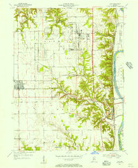
1955 Map of Dana
USGS Topo · Published 1957About this map
The U S Military Reservation Wabash River Ordnance Works dominates the northern landscape of this mid-century survey, revealing the sprawling infrastructure of a Cold War-era industrial and military installation. Complete with a Guard Tower, Aircraft Beacon, and numerous specialized buildings, this facility stands in stark contrast to the traditional agricultural patterns of Vermillion County. Along the western edge, the town of Dana serves as a local hub, featuring prominent Grain Bins and a connection to the Baltimore and Ohio railroad, while Ernie Pyle Rest Park honors the famous war correspondent near his birthplace.
Find a feature on this map
40 named features on this map. Tap any name to fly to it.
Don’t see what you’re looking for? This feature index may not catch every label — zoom into the map to look around manually.
Map Details
Editions of this 1955 Dana Map
2 editions found
Other maps of this area

1947 · Ridge Farm
USGS Topo · 1:62,500

1947 · Paris
USGS Topo · 1:62,500

1949 · Paris
USGS Topo · 1:62,500

1951 · Clinton
USGS Topo · 1:24,000

1951 · Mecca
USGS Topo · 1:24,000

1951 · Saint Bernice
USGS Topo · 1:24,000

1953 · Indianapolis
USGS Topo · 1:250,000

1955 · Kingman
USGS Topo · 1:24,000

1955 · Humrick
USGS Topo · 1:24,000

1955 · Scottland
USGS Topo · 1:24,000