Old Maps of Wyndham, Terre Haute for Hiking & Exploration
Hike through history with 13 historic maps of Wyndham. Explore old trails, ghost towns, and forgotten backroads — perfect for outdoor adventurers and local explorers.
- Rediscover forgotten places: Map out old mining camps, roads, and footpaths that no longer exist on modern maps.
- Layer with modern tools: Combine with LiDAR or satellite views to plan hikes through historical terrain.
- Made for exploration: Popular among hikers, overlanders, and local history lovers.
Use these maps to find adventure and explore the hidden past of Wyndham.
Wyndham, Terre Haute maps
(13)- 1941 Map of Seelyville
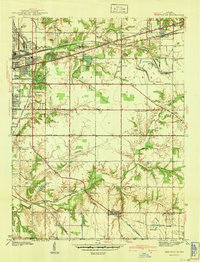 1941 Seelyville1941 Print · USGSVigo County at the start of the 1940s shows the industrial expansion of Terre Haute toward Seelyville. Trace family roots at Highland Lawn Cemetery or locate old industrial sites like the Binkley Mine and the Central Canal (Abandoned).2 unique versions available
 - 1952 Map of Seelyville, 1953 Print
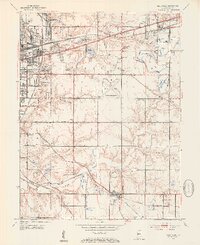 1952 Seelyville1953 Print · USGSVigo County enters a period of post-war industrial and civic expansion in the early fifties. Genealogists and local historians can trace the foundations of Rose Polytechnic Institute, locate family plots in Highland Lawn Cemetery, and explore the coal-mining heritage near Seelyville and Glen Ayr.2 unique versions available
 - 1953 Map of Indianapolis, 1965 Print
 1953 Indianapolis1965 Print · USGSCentral Indiana and the Illinois borderlands are captured in the mid-sixties, showing the growth of Indianapolis and its industrial rail corridors. Genealogists and historians can trace the development of outlying towns like Zionsville or Beech Grove and find landmarks such as Atterbury AAF and Turkey Run State Park.4 unique versions available
 - 1956 Map of Indianapolis
 1956 Indianapolis1956 Print · USGSCentral Indiana in the mid-fifties is captured during a period of industrial growth and military presence. Genealogists and historians can trace the rail networks of the New York Central or locate regional landmarks like Fort Benjamin Harrison and Camp Atterbury.
 - 1957 Map of Indianapolis
 1957 Indianapolis1957 Print · USGSCentral Indiana in the mid-fifties is captured here as a crossroads of major rail lines and nascent federal highways. Genealogists and historians can trace family-named ridges like Poplar Ridge or locate strategic sites like Camp Atterbury and Speedway.2 unique versions available
 - 1962 Map of Indianapolis
 1962 Indianapolis1962 Print · USGSCentral Indiana and the Illinois borderlands are captured here in the early sixties, showing the region's dense rail networks and growing urban centers. Genealogists and historians can locate family-named landmarks and institutions like Crown Hill Cem, Indiana University, and the Indianapolis Motor Speedway.
 - 1963 Map of Seelyville, 1965 Print
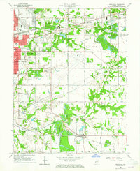 1963 Seelyville1965 Print · USGSThe eastern fringes of Terre Haute in the early sixties reveal a landscape transition from city parks to coal mines and historic canal beds. Genealogists and local historians can trace the paths of the Wabash and Erie Canal and locate landmarks like the Rose Polytechnic Institute and Mt Pleasant Mine.4 unique versions available
 - 1986 Map of Terre Haute
 1986 Terre Haute1986 Print · USGSThe Wabash River valley and the coal-rich hills of West-Central Indiana and East-Central Illinois are shown here in the mid-eighties. Genealogists and local historians can trace family-named corners like Barrick Corner, find rural churches like New Hope Ch, and locate industrial landmarks such as the Thunderbird Mine.2 unique versions available
 - 2010 Map of Seelyville, 2010 Print
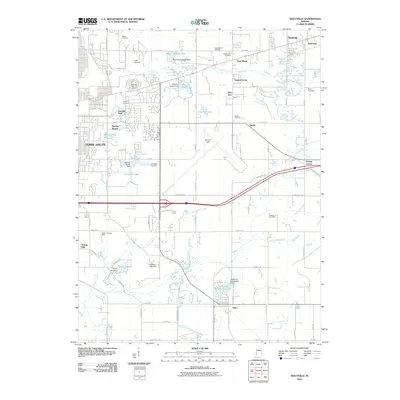 2010 Seelyville2010 Print · USGSCovers Wyndham, including Terre Haute, Seelyville, and other nearby areas
 - 2013 Map of Seelyville, 2013 Print
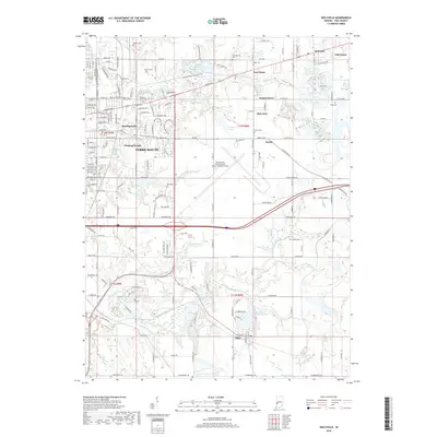
 2013 Seelyville2013 Print · USGSCovers Wyndham, including Terre Haute, Seelyville, and other nearby areas
 - 2016 Map of Seelyville, 2016 Print
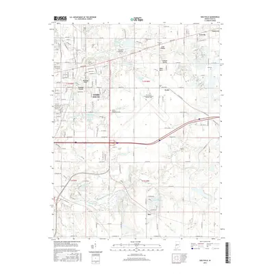 2016 Seelyville2016 Print · USGSCovers Wyndham, including Terre Haute, Seelyville, and other nearby areas
 - 2019 Map of Seelyville, 2019 Print
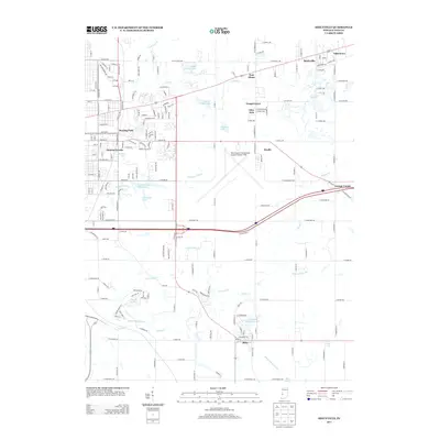
 2019 Seelyville2019 Print · USGSCovers Wyndham, including Terre Haute, Seelyville, and other nearby areas
 - 2022 Map of Seelyville, 2022 Print
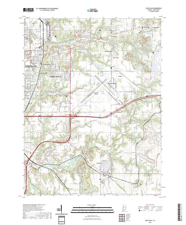 2022 Seelyville2022 Print · USGSEastern Vigo County in the early 2020s shows the continued growth of Terre Haute alongside historical remnants like the Wabash and Erie Canal. Researchers can trace local lineages through numerous burial sites such as Highland Lawn Cem, Coltrin Cem, and Baker Cem.
End of results
Showing maps 1-13 of 13
Frequently asked questions
- What are the different types of historical maps available for Wyndham?
- What is the oldest map of Wyndham?
- Where can I purchase historical maps of Wyndham for my home or office?
- Where can I download high-res historical maps of Wyndham?
- Are there historical topographic maps available for Wyndham?
- Is there historical aerial imagery available for Wyndham?
- Where are historical maps of Wyndham sourced from?