1960s Maps of South Whitley, Indiana
Explore 2 historic maps of South Whitley from the 1960s. These maps offer a rare glimpse into what life looked like during the 1960s — showing old roads, neighborhoods, homes, and landmarks that have changed or disappeared over time.
Whether you're researching your family's past, planning a metal detecting trip, or studying how South Whitley's landscape evolved across the 1960s, these high-resolution maps are a powerful tool for exploring the history of this region.
- Focus on a specific era: All maps on this page are from the 1960s, giving you a focused view of this time period.
- See what’s changed: Compare century-old streets, trails, and buildings to today's modern landscape using overlays and satellite layers.
- Research with precision: Use these maps for genealogy, historical research, land use analysis, or educational projects.
- View, download, or print: Maps are fully viewable online in high resolution, and can be downloaded or printed for your own records.
Start exploring South Whitley's history through authentic maps from the 1960s. This is your window into the past.
South Whitley, IN maps
(2)- 1962 Map of South Whitley West, 1963 Print
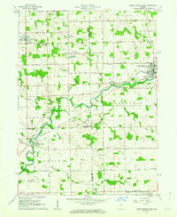 1962 South Whitley West1963 Print · USGSIndiana's Eel River valley comes into sharp focus during the early sixties as a thriving corridor of rail and river commerce. Genealogists and historians can trace the foundations of South Whitley, explore the grounds of Township Sch, or locate family plots in Glenwood Cem and Union Cem.2 unique versions available
 - 1962 Map of South Whitley East, 1963 Print
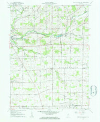 1962 South Whitley East1963 Print · USGSWhitley County agriculture and rail commerce thrived in the early sixties as the Eel River shaped the local economy. Genealogists can trace family roots through St Johns Ch, Eberhard Ch Cem, and the crossroads at Tunker.2 unique versions available
End of results
Showing maps 1-2 of 2
Top cities near South Whitley
- Huntington historical maps
- Warsaw historical maps
- Columbia City historical maps
- North Manchester historical maps
- Winona Lake historical maps
- Andrews historical maps
See more
Frequently asked questions
- What are the different types of historical maps available for South Whitley?
- What is the oldest map of South Whitley?
- Where can I purchase historical maps of South Whitley for my home or office?
- Where can I download high-res historical maps of South Whitley?
- Are there historical topographic maps available for South Whitley?
- Is there historical aerial imagery available for South Whitley?
- Where are historical maps of South Whitley sourced from?