2020s Maps of Cass County, Iowa
Explore 20 historic maps of Cass County from the 2020s. These maps offer a rare glimpse into what life looked like during the 2020s — showing old roads, neighborhoods, homes, and landmarks that have changed or disappeared over time.
Whether you're researching your family's past, planning a metal detecting trip, or studying how Cass County's landscape evolved across the 2020s, these high-resolution maps are a powerful tool for exploring the history of this region.
- Focus on a specific era: All maps on this page are from the 2020s, giving you a focused view of this time period.
- See what’s changed: Compare century-old streets, trails, and buildings to today's modern landscape using overlays and satellite layers.
- Research with precision: Use these maps for genealogy, historical research, land use analysis, or educational projects.
- View, download, or print: Maps are fully viewable online in high resolution, and can be downloaded or printed for your own records.
Start exploring Cass County's history through authentic maps from the 2020s. This is your window into the past.
Cass County, IA maps
(20)- 2022 Map of Adair North, 2022 Print
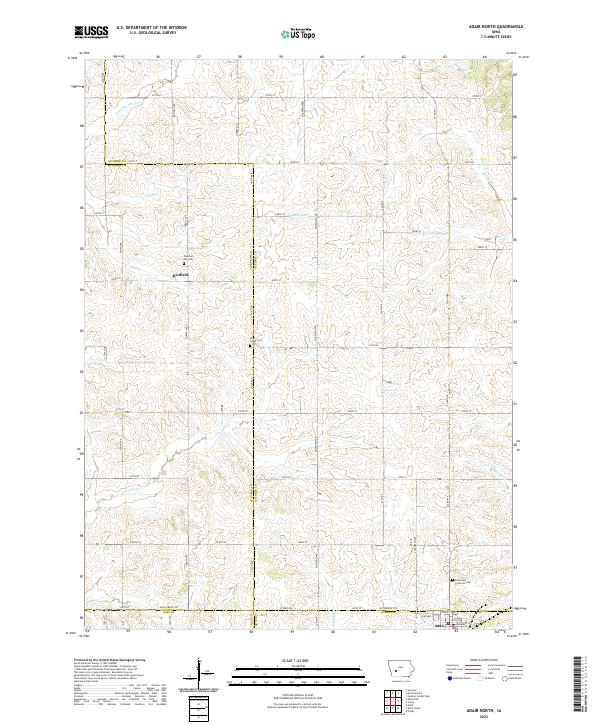 2022 Adair North2022 Print · USGSThe rural borders of Guthrie, Audubon, Adair, and Cass counties are captured here in the early twenty-first century. Researchers can locate family farm sites and historical burial grounds like Pleasant Hill Cem and Saint Johns Cem near Kenfield.
 - 2022 Map of Atlantic, 2022 Print
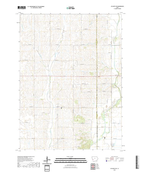
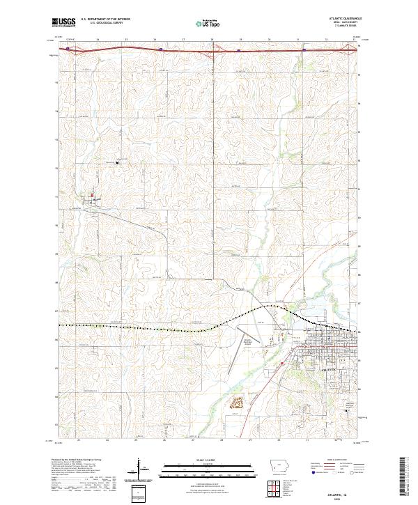 2022 Atlantic2022 Print · USGSAtlantic and its surrounding Cass County townships are shown here in the early twenty-first century, highlighting the region's enduring agricultural and civic structure. Researchers can trace family sites near Brighton Cem or follow the historic path of the East Nishnabotna River near the town of Marne.
 - 2022 Map of Lewis, 2022 Print
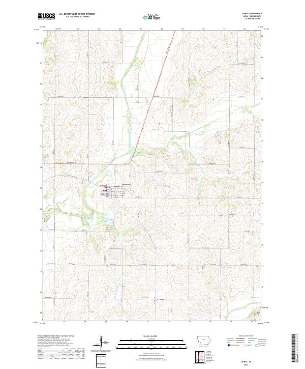 2022 Lewis2022 Print · USGSLewis and the surrounding Cass County countryside are documented here in the early twenty-first century as the local river-and-road network defines the landscape. Genealogists and local historians can trace the street-level geography of Lewis or follow the course of the East Nishnabotna River past Cold Springs and along White Pole Rd.
 - 2022 Map of Wiota, 2022 Print
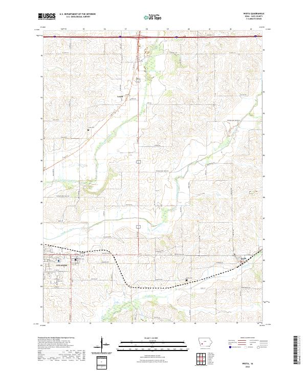 2022 Wiota2022 Print · USGSCass County agricultural lands and river valleys are captured here in the early 2020s. Researchers can trace family history at Lorah Cem and Wiota Cem or follow the path of the East Nishnabotna River through the heart of the county.
 - 2022 Map of Griswold NE, 2022 Print
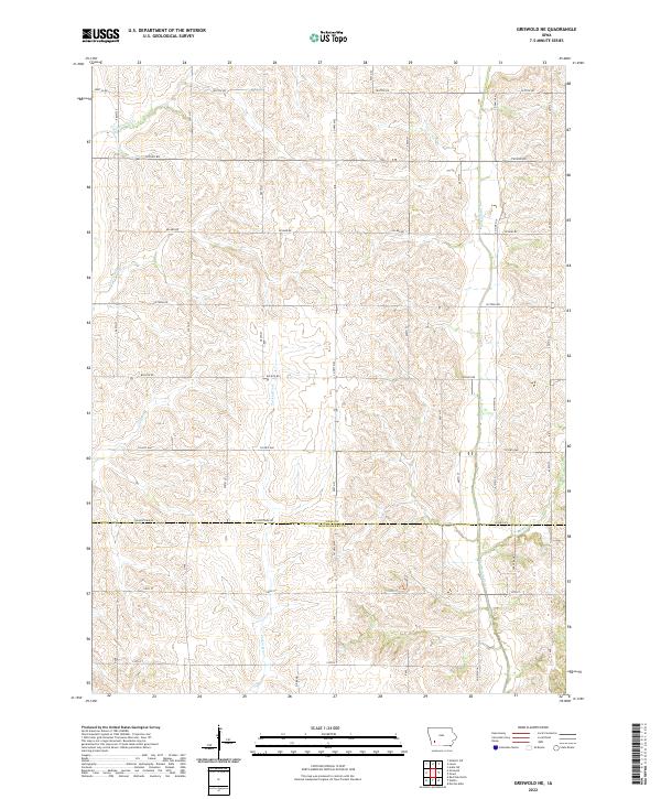 2022 Griswold NE2022 Print · USGSSouthwest Iowa farmlands are documented here in the early twenty-first century, showing the rural grid where CASS CO and MONTGOMERY CO meet. Trace the headwaters of the Tarkio River and the winding course of Sevenmile Creek.
 - 2022 Map of Exira East, 2022 Print
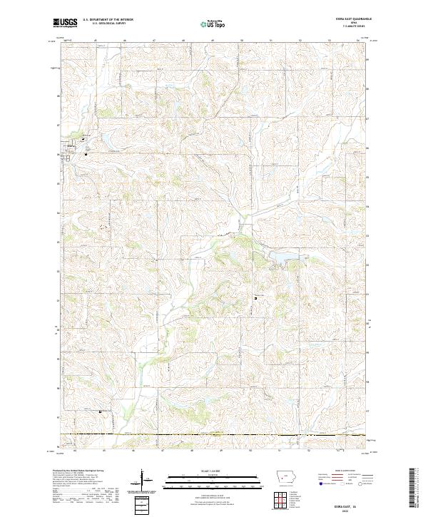 2022 Exira East2022 Print · USGSAudubon County agriculture and rural life are preserved here in the early twenty-first century. Genealogists can locate several local burial sites like Grove Cem and Bowen Cem or trace the winding paths of Troublesome Creek and Honey Creek.
 - 2022 Map of Walnut, 2022 Print
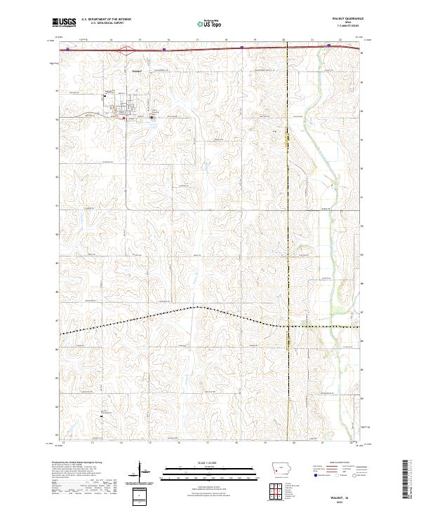 2022 Walnut2022 Print · USGSThe community of Walnut and its surrounding prairie townships are captured here in the early 2020s. Researchers can locate local landmarks like the Saint Patricks Catholic Cem and follow the paths of Walnut Cr and Indian Cr across the county line.
 - 2022 Map of Fontanelle SW, 2022 Print
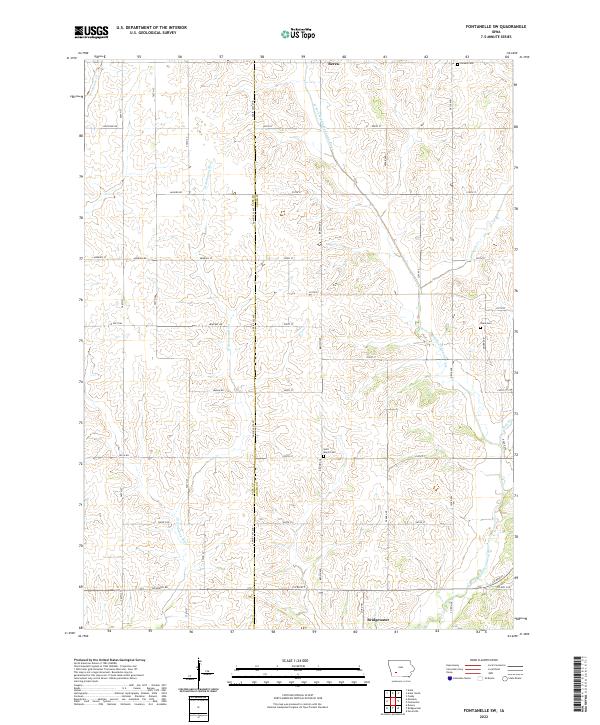 2022 Fontanelle SW2022 Print · USGSIn the early twenty-first century, this corner of Adair County remains a landscape of river-fed farmland and quiet rural crossroads. Researchers can trace family ties at Saint Marys Cem or Sears Cem near the banks of the W Fork Middle Nodaway River.
 - 2022 Map of Griswold, 2022 Print
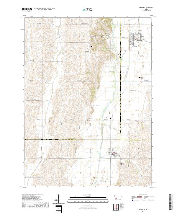 2022 Griswold2022 Print · USGSGriswold and Elliott are featured in this recent survey of the southwestern Iowa prairie at the intersection of three counties. Genealogists can trace family heritage across several local burial grounds, including Griswold Cem, Pleasant Township Cem, and Waveland Cem.
 - 2022 Map of Massena, 2022 Print
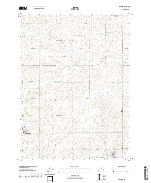 2022 Massena2022 Print · USGSCass County agriculture and small-town life are preserved here in the early twenty-first century. Researchers can trace family roots through numerous rural landmarks like Norway Center Cem, Franklin Lutheran Cem, and the streets of Cumberland.
 - 2022 Map of Grant, 2022 Print
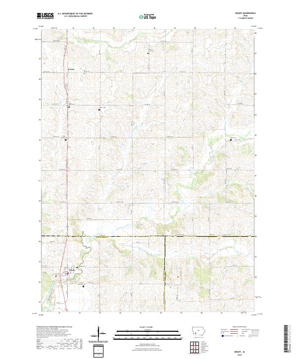 2022 Grant2022 Print · USGSSouthwestern Iowa farm country is mapped in detail during the early 2020s at the meeting point of three counties. Researchers can trace family history through a high density of rural burial sites, including Old East Cem, Grant Cem, and Newtons Grove Cem.
 - 2022 Map of Exira West, 2022 Print
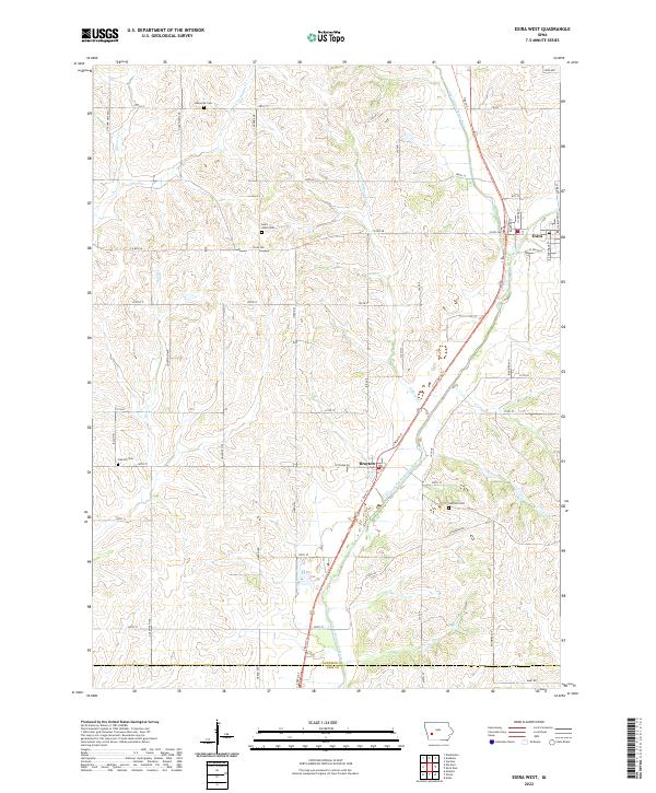 2022 Exira West2022 Print · USGSAudubon County's river-bottom farmland and traditional town centers are captured here in the early twenty-first century. Genealogists and local historians can locate the Saint Johns Cem and Oakfield Cem or trace the T-Bone Trl past Exira and Brayton.
 - 2022 Map of Anita, 2022 Print
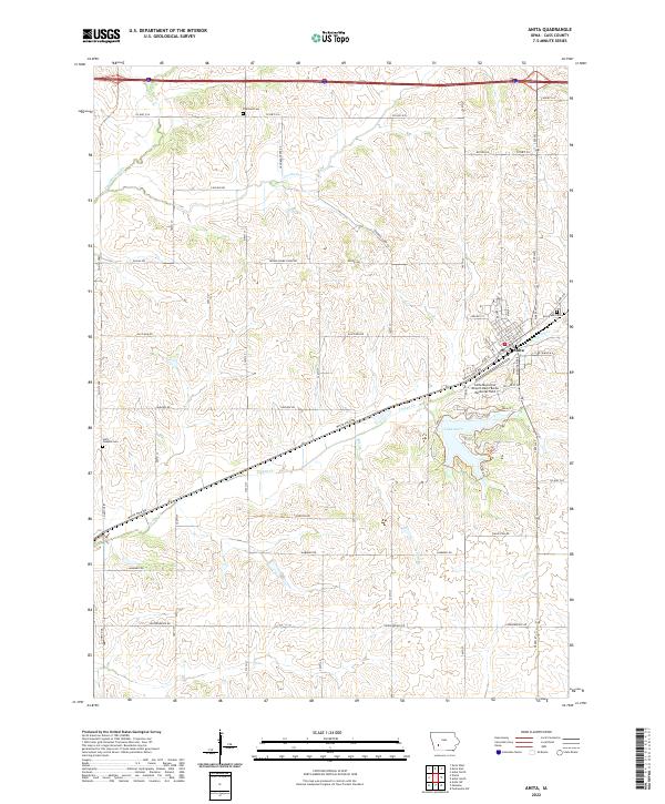 2022 Anita2022 Print · USGSAnita and its surrounding farmstead grid are captured here in the early twenty-first century, centered on the crossing of White Pole Rd and Turkey Creek. Researchers can locate several burial grounds including Highland Cem and Saint Josephs Cem, alongside the recreation area at Lake Anita.
 - 2022 Map of Anita SW, 2022 Print
 2022 Anita SW2022 Print · USGSSouthwestern Iowa farm country near Cumberland is captured here in the early twenty-first century, showing the enduring grid of section-line roads and creek valleys. Family historians can locate Greenwood Cem and trace the paths of Sevenmile Cr and Fourmile Cr.
 - 2022 Map of Bridgewater, 2022 Print
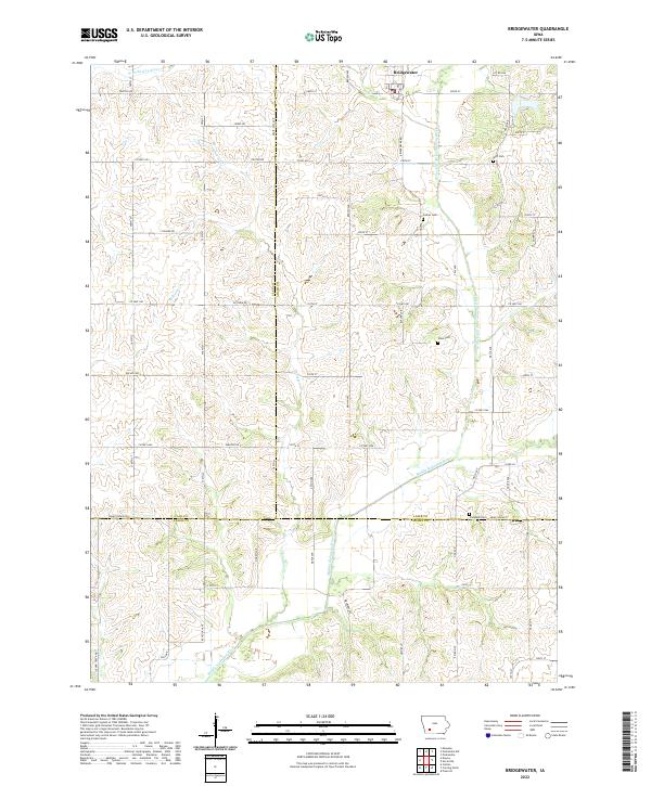 2022 Bridgewater2022 Print · USGSBridgewater and the surrounding farm country of Southwest Iowa are shown here at the start of the 2020s. Genealogists and local historians can trace family roots through rural landmarks like Witt Cem, Campbell Cem, and the banks of the Middle Nodaway River.
 - 2022 Map of Dewey, 2022 Print
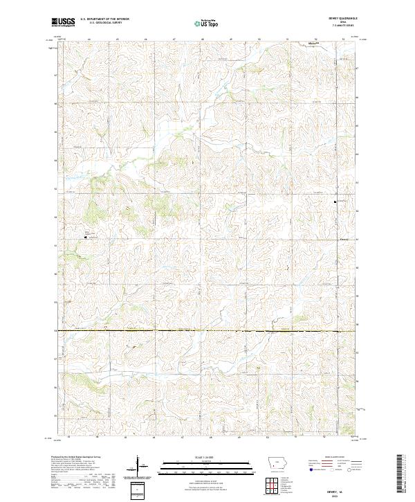 2022 Dewey2022 Print · USGSSouthern Cass County and northern Adams County are captured here in the early twenty-first century, showing the rural grid of an enduring farming landscape. Genealogists can locate family sites near Victoria Cem, Saint Timothy Cem, and the valley of the W Nodaway River.
 - 2022 Map of Atlantic SW, 2022 Print
 2022 Atlantic SW2022 Print · USGSPottawattamie County's rolling farmland is meticulously documented in this contemporary survey of the rural landscape near the Cass County line. Researchers can locate family burial sites at Whipple Cem and Smith Cem or trace the course of the East Nishnabotna River.
 - 2022 Map of Adair South, 2022 Print
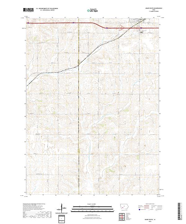 2022 Adair South2022 Print · USGSThe southern outskirts of Adair are shown here as they appeared in the early 2020s, dominated by a network of rural section roads and winding river forks. Genealogists can locate Saint Johns Cem and Sunnyhill Cem or trace family lands along Baltimore Rd and Dallas Rd.
 - 2023 Map of Elk Horn, 2023 Print
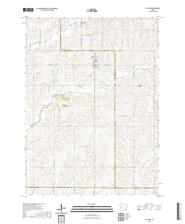 2023 Elk Horn2023 Print · USGSElk Horn and Kimballton anchor this western Iowa landscape at the Shelby and Audubon county line during the early twenty-first century. Researchers can trace rural lineages at Elk Horn Cem and Clay Township Cem or follow the winding courses of Prairie Rose Creek and Elkhorn Creek.
 - 2023 Map of Prairie Rose Lake, 2023 Print
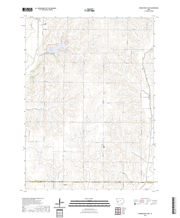 2023 Prairie Rose Lake2023 Print · USGSThis part of Shelby County in the early twenty-first century showcases a landscape defined by the expansive Prairie Rose Lake and the town of Walnut. Genealogists and local historians can trace burial sites like Folck Cem and Monroe Cem or explore the drainage of Indian Creek.
End of results
Showing maps 1-20 of 20
Top cities of Cass County
- Atlantic historical maps
- Griswold historical maps
- Anita historical maps
- Massena historical maps
- Lewis historical maps
- Cumberland historical maps
See more
Frequently asked questions
- What are the different types of historical maps available for Cass County?
- What is the oldest map of Cass County?
- Where can I purchase historical maps of Cass County for my home or office?
- Where can I download high-res historical maps of Cass County?
- Are there historical topographic maps available for Cass County?
- Is there historical aerial imagery available for Cass County?
- Where are historical maps of Cass County sourced from?