Old Maps of Cass County, Iowa for Genealogy
Trace your family roots with 130 historic maps of Cass County. These high-res maps reveal old neighborhoods, homesites, landmarks, and streets — helping you uncover where your ancestors lived and how the area evolved over time.
- Explore historic neighborhoods: Identify where your relatives may have lived in the 1800s or 1900s.
- Compare maps over time: Trace the changes in streets, buildings, and landmarks for multi-generational research.
- Perfect for genealogy & ancestry research: Used by family historians and researchers to map out lineage and migration.
These maps are an incredible resource for exploring your personal connection to Cass County's past.
Cass County, IA maps
(130)- 1954 Map of Omaha, 1967 Print
 1954 Omaha1967 Print · USGSMid-century development radiates from the river bluffs into the agricultural heartland during this period of post-war growth. Genealogists and historians can trace rail-connected towns like Atlantic and Red Oak or locate the sprawling grounds of Offutt Air Force Base and Manawa Lake.3 unique versions available
 - 1957 Map of Omaha
 1957 Omaha1957 Print · USGSWestern Iowa and the Missouri River valley are seen here in the mid-fifties during the height of the rail-and-road era. Researchers can trace the sprawling rail lines of the Chicago And North Western or locate Cold War landmarks like Offutt Air Force Base.
 - 1957 Map of Audubon, 1958 Print
 1957 Audubon1958 Print · USGSCentral Iowa farmland is captured here in the 1950s, centered on the Audubon and Exira rail corridors. You can trace early schoolhouse locations like School No 9 and find local family landmarks such as St Patricks Cem and the County Fairground.2 unique versions available
 - 1958 Map of Omaha
 1958 Omaha1958 Print · USGSOmaha and Council Bluffs stand at the center of this mid-fifties landscape, where the Missouri River splits the urban plains of Nebraska from the rolling hills of western Iowa. Genealogists can trace the rail lines of the Wabash RR and Illinois Central RR to rural settlements like Missouri Valley and Red Oak.2 unique versions available
 - 1971 Map of Walnut, 1973 Print
 1971 Walnut1973 Print · USGSWalnut and its surrounding townships are shown here during a period of transition in the early 1970s. Researchers can trace the local rail economy along the Chicago Rock Island and Pacific Railroad and locate burial sites like Township Cem.
 - 1971 Map of Adair South, 1973 Print
 1971 Adair South1973 Print · USGSThe agricultural landscape between Adair and Cass counties is captured here in the early 1970s. Genealogists and local historians can trace the town’s footprint near St Johns Cem or follow the path of the Chicago Rock Island and Pacific rail line.
 - 1971 Map of Anita, 1973 Print
 1971 Anita1973 Print · USGSAnita and its surrounding townships are shown here in the early seventies as the local landscape evolved with new recreation and transit. Researchers can trace the path of the Chicago and Pacific Rock Island railroad or locate family plots at Highland Cem and St Josephs Cem.
 - 1971 Map of Wiota, 1973 Print
 1971 Wiota1973 Print · USGSThe rural landscapes of Cass County are documented here in the early seventies, centered on the growing town of Atlantic and the East Nishnabotna River. Genealogists and historians can trace rail routes along the Chicago Rock Island and Pacific or locate local landmarks like the Drive-in Theater and Lorah Cem.
 - 1971 Map of Atlantic, 1973 Print
 1971 Atlantic1973 Print · USGSCass County agriculture and rail commerce converge at the junction of the CHICAGO ROCK ISLAND AND PACIFIC in the early 1970s. Genealogists and local historians can locate rural landmarks like Buck Creek Ch, Brighton Cem, and the town's numerous district schools.
 - 1971 Map of Atlantic SW, 1973 Print
 1971 Atlantic SW1973 Print · USGSThe Pottawattamie and Cass County line in the early 1970s is defined by the winding East Nishnabotna River. Researchers can locate family sites at Whipple Cem and Smith Cem, or trace the grounds of Camp Wakonda.
 - 1971 Map of Anita SW, 1973 Print
 1971 Anita SW1973 Print · USGSThe rural townships of Cass County come into focus during the early seventies, showing a landscape of family farms and creek-side acreage. Genealogists and local historians can trace family-named landmarks like Hoyts Branch and locate the Greenwood Cemetery near the headwaters of Sevenmile Creek.
 - 1971 Map of Lewis, 1973 Print
 1971 Lewis1973 Print · USGSThe river valley surrounding Lewis and Grove townships is captured here in the early seventies during a period of established rural stability. Genealogists and local historians can trace the grounds of Oakwood Cem, the old County Home, and the recreational layout of Cold Springs State Park.2 unique versions available
 - 1971 Map of Massena, 1973 Print
 1971 Massena1973 Print · USGSCass County farmland in the early 1970s is centered around the rail-connected towns of Massena and Cumberland. Genealogists can trace family footprints at St Patricks Cem, Pine Grove Ch, and the old crossroads at Norway Center.
 - 1971 Map of Fontanelle SW, 1973 Print
 1971 Fontanelle SW1973 Print · USGSAdair and Cass County farmland is mapped here in the early 1970s as the river valleys meet the rails. Researchers can trace rural life through landmarks like St Marys Ch, the Eureka Cem, and the tracks of the BURLINGTON NORTHERN.
 - 1971 Map of Adair North, 1973 Print
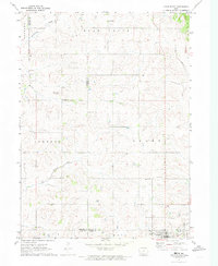 1971 Adair North1973 Print · USGSGuthrie, Audubon, and Adair counties converge in this early 1970s landscape of rolling prairie and winding creek beds. Researchers can locate specific rural landmarks like St Johns Church and Kenfield, or trace the path of the Old RR Grade.
 - 1978 Map of Elk Horn
 1978 Elk Horn1978 Print · USGSThe Danish settlements of the Iowa plains are captured here in the late seventies as established rural communities. Genealogists can trace family roots through sites like Carlsen-Larsen Cem or explore the drainage of Elkhorn Creek and Buck Creek.
 - 1978 Map of Griswold
 1978 Griswold1978 Print · USGSGriswold and Elliott sit along the East Nishnabotna River valley in the late seventies, showing the rail-connected agricultural landscape of southwestern Iowa. Researchers can locate numerous pioneer and local burial grounds including Flint Cem, Waveland Cem, and Hillside Cem near Coe.
 - 1978 Map of Prairie Rose Lake
 1978 Prairie Rose Lake1978 Print · USGSShelby County's rural landscape is captured here in the late seventies, centered on the newly established recreation area at Prairie Rose Lake. Genealogists and local historians can locate community landmarks like Monroe Ch, the settlement of Christensen, and the Townhall.
 - 1978 Map of Griswold NE
 1978 Griswold NE1978 Print · USGSCass and Montgomery counties meet in this late 1970s survey of Iowa’s agricultural heartland. Genealogists and local researchers can trace family lands near Lowman Cem or follow the paths of Sevenmile Creek and the Tarkio River.
 - 1980 Map of Harlan
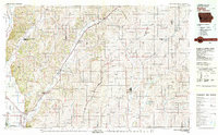 1980 Harlan1980 Print · USGSWestern Iowa and the Nebraska borderlands are shown in the early eighties as a vital corridor of rail and river commerce. Genealogists and local historians can trace family roots through old rural crossroads like Beebeetown and Westphalia, or locate landmarks like Rose Hill Cem.
 - 1980 Map of Grant, 1981 Print
 1980 Grant1981 Print · USGSSouthwestern Iowa farm country is documented here in the late seventies, showing the rural communities at the intersections of Montgomery, Cass, and Adams counties. Genealogists can trace family footprints across several rural burial grounds like Old East Cem, Reno Cem, and Newtons Grove Cem.
 - 1980 Map of Bridgewater, 1981 Print
 1980 Bridgewater1981 Print · USGSBridgewater and its surrounding townships are shown here during the late seventies, a period of established rail lines and preserved pioneer history. Genealogists can locate family burial sites like Winn Cem or explore the area around Mormon Trail County Park.
 - 1980 Map of Dewey, 1981 Print
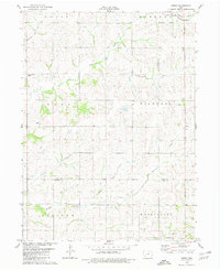 1980 Dewey1981 Print · USGSSouthwestern Iowa farm country is documented here in the late seventies, showing the rural townships of Victoria, Edna, and Union. Researchers can locate the Victoria Cem, the rail line of the Burlington Northern, and local churches like St Timothy Ch.
 - 1983 Map of Exira West, 1984 Print
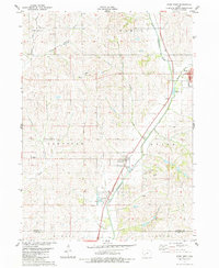 1983 Exira West1984 Print · USGSThe East Nishnabotna River valley in the early 1980s reveals a classic Iowa landscape of river-side towns and rural townships. Researchers can find well-preserved details of Exira, Brayton, and several country cemeteries like St Johns Cem and Oakfield Cem.
 - 1983 Map of Exira East, 1984 Print
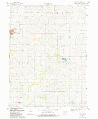 1983 Exira East1984 Print · USGSThe town of Exira and its surrounding townships are shown here in the early 1980s, capturing the structured rural layout of Audubon County. Researchers can trace family history through several local landmarks, including Holy Trinity Cem, Grove Cem, and Littlefield County Park.
Showing maps 1-25 of 130
Top cities of Cass County
- Atlantic historical maps
- Griswold historical maps
- Anita historical maps
- Massena historical maps
- Lewis historical maps
- Cumberland historical maps
See more
Frequently asked questions
- What are the different types of historical maps available for Cass County?
- What is the oldest map of Cass County?
- Where can I purchase historical maps of Cass County for my home or office?
- Where can I download high-res historical maps of Cass County?
- Are there historical topographic maps available for Cass County?
- Is there historical aerial imagery available for Cass County?
- Where are historical maps of Cass County sourced from?