Old Maps of Dallas County, Iowa for Genealogy
Trace your family roots with 109 historic maps of Dallas County. These high-res maps reveal old neighborhoods, homesites, landmarks, and streets — helping you uncover where your ancestors lived and how the area evolved over time.
- Explore historic neighborhoods: Identify where your relatives may have lived in the 1800s or 1900s.
- Compare maps over time: Trace the changes in streets, buildings, and landmarks for multi-generational research.
- Perfect for genealogy & ancestry research: Used by family historians and researchers to map out lineage and migration.
These maps are an incredible resource for exploring your personal connection to Dallas County's past.
Dallas County, IA maps
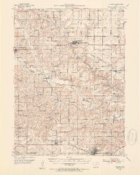
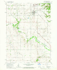
(109)- 1908 Map of Waukee
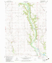
 1908 Waukee1908 Print · USGSDallas County at the turn of the century shows a landscape shaped by competing railroads and the winding Raccoon River. Genealogists and local historians can trace early schoolhouse locations like Valley Grove School and the original rail footprints of Waukee and Van Meter.2 unique versions available
 - 1911 Map of Madrid, 1958 Print
 1911 Madrid1958 Print · USGSBoone and Dallas counties appear here in the early twentieth century as a busy corridor of river-valley agriculture and rail transit. Researchers can trace dozens of early rural school sites like Hull School and Gildea School alongside the path of the Inter-Urban Railway.
 - 1914 Map of Madrid
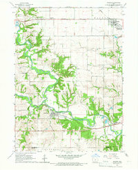
 1914 Madrid1914 Print · USGSCentral Iowa's river valleys and prairie townships come alive in the decade before the Great War, showing a landscape defined by rail lines and rural schoolhouses. Genealogists and historians can trace family roots through specific landmarks like Madrid, Woodward, and the Marcy Center School.3 unique versions available
 - 1949 Map of Adel, 1955 Print
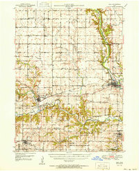
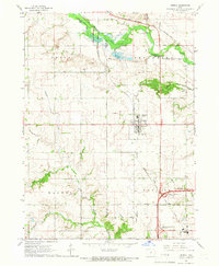
 1949 Adel1955 Print · USGSDallas County in the late 1940s is captured here at a moment when rural school districts and family-named corners still defined the Iowa countryside. Genealogists and historians can trace the foundations of Adel and Wiscotta, or locate landmarks like Blacks Corners and Oakland Cem.3 unique versions available
 - 1950 Map of Perry, 1968 Print
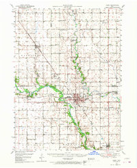 1950 Perry1968 Print · USGSMid-century Dallas and Boone Counties are captured here at a peak of rural development, showing a landscape defined by prairie agriculture and heavy rail. Genealogists can trace family footprints across dozens of country schools like Garfield Sch and churches including Swede Valley Ch.
 - 1951 Map of Perry
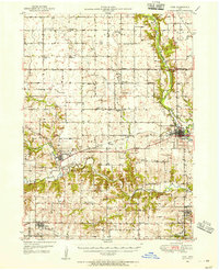
 1951 Perry1951 Print · USGSMid-century central Iowa comes into focus in this detailed study of the rail and river corridors surrounding Perry. Genealogists and historians can trace the locations of dozens of country schools and cemeteries, from Prairie View Sch to the Violet Hill Cem.2 unique versions available
 - 1951 Map of Adel
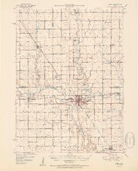
 1951 Adel1951 Print · USGSMid-century Dallas County is defined by the convergence of the three Raccoon River forks and a robust network of rural rail towns. Genealogists can trace family roots at Oakland Cem or Pleasant Hill Cem and locate historic rural schools like Bear Creek Sch.2 unique versions available
 - 1952 Map of Panora, 1954 Print
 1952 Panora1954 Print · USGSGuthrie County and parts of Adair and Dallas counties are shown here in the early 1950s as a thriving rail and river corridor. Genealogists can trace family roots through several rural churches and schools like Victory Union Church, Pioneer Sch, and Rosehill Cem.2 unique versions available
 - 1954 Map of Bagley, 1956 Print
 1954 Bagley1956 Print · USGSGuthrie and Greene counties are shown in the mid-fifties as the railroad network still linked small agricultural towns. Genealogists can trace family roots through Greenbrier Cem and St Marys Ch or locate the many Flowing Well sites across the prairie.
 - 1954 Map of Omaha, 1967 Print
 1954 Omaha1967 Print · USGSMid-century development radiates from the river bluffs into the agricultural heartland during this period of post-war growth. Genealogists and historians can trace rail-connected towns like Atlantic and Red Oak or locate the sprawling grounds of Offutt Air Force Base and Manawa Lake.3 unique versions available
 - 1954 Map of Des Moines, 1973 Print
 1954 Des Moines1973 Print · USGSCentral Iowa's evolving landscape is captured here in the early seventies, just as major reservoirs were reshaping the river valleys. Genealogists and historians can trace the rail corridors of the Burlington Northern or locate family roots near Pella, Indianola, and Knoxville.2 unique versions available
 - 1956 Map of Des Moines
 1956 Des Moines1956 Print · USGSCentral Iowa in the mid-fifties shows a landscape defined by bustling rail hubs and deep-rooted agricultural research. Genealogists and researchers can trace the growth of Des Moines and Ames, locate the Sac and Fox Indian Reservation, or study the paths of the Skunk River and South Skunk River.
 - 1957 Map of Des Moines
 1957 Des Moines1957 Print · USGSCentral Iowa's post-war landscape is defined here by the converging rail lines and river valleys that shaped its earliest settlements. Genealogists and historians can trace the paths of the Rock Island Railroad and locate community landmarks in Des Moines, Ames, and Newton.
 - 1957 Map of Omaha
 1957 Omaha1957 Print · USGSWestern Iowa and the Missouri River valley are seen here in the mid-fifties during the height of the rail-and-road era. Researchers can trace the sprawling rail lines of the Chicago And North Western or locate Cold War landmarks like Offutt Air Force Base.
 - 1958 Map of Omaha
 1958 Omaha1958 Print · USGSOmaha and Council Bluffs stand at the center of this mid-fifties landscape, where the Missouri River splits the urban plains of Nebraska from the rolling hills of western Iowa. Genealogists can trace the rail lines of the Wabash RR and Illinois Central RR to rural settlements like Missouri Valley and Red Oak.2 unique versions available
 - 1965 Map of Granger, 1966 Print
 1965 Granger1966 Print · USGSThe Des Moines River valley in the mid-sixties reveals a landscape undergoing transformation as the Saylorville Reservoir takes shape. Genealogists can locate family sites like Granger Homesteads or rural landmarks such as Hopkins Grove Cem and the Chestnut Ford Bridge.2 unique versions available
 - 1965 Map of Dallas Center, 1966 Print
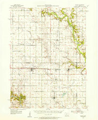
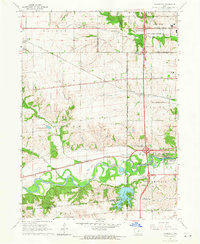
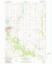
 1965 Dallas Center1966 Print · USGSDallas County was a patchwork of family farms and rail-connected towns in the mid-sixties. Genealogists and local historians can trace burial sites like St Marys Cem and follow the Chicago and North Western rail line through Dallas Center.
 - 1965 Map of Woodward, 1966 Print
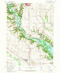
 1965 Woodward1966 Print · USGSThe Dallas County prairie in the mid-1960s is defined by its small towns and the sprawling Woodward State Hospital campus. Genealogists and local historians can trace the early reaches of Saylorville Reservoir and locate several rural burial grounds like Xenia and Greenwood Cemetery.
 - 1965 Map of Waukee, 1966 Print
 1965 Waukee1966 Print · USGSMid-century Dallas County is defined by the convergence of the North and South Raccoon Rivers and the busy rail lines of the era. Genealogists and local historians can locate several family cemeteries like Williams Cem and trace the paths of the Chicago Rock Island and Pacific railroad through Van Meter.2 unique versions available
 - 1965 Map of Grimes, 1966 Print
 1965 Grimes1966 Print · USGSGrimes and northern Urbandale are captured in the mid-sixties during a period of steady suburban expansion and rail-supported growth. Researchers can trace the heritage of local families at Sunny Hill Hill Cem or follow the historic routes of the Chicago and North Western railroad.2 unique versions available
 - 1965 Map of Commerce, 1966 Print
 1965 Commerce1966 Print · USGSSuburban development meets Iowa farmland in the mid-1960s as the Raccoon River valley undergoes rapid change. Trace old rail lines like the Chicago Rock Island and Pacific or locate local landmarks like Valley High Sch and Sugar Creek Lake.2 unique versions available
 - 1969 Map of Des Moines
 1969 Des Moines1969 Print · USGSCentral Iowa's fertile plains and growing capital are captured here during the late sixties, a time of major highway expansion and reservoir construction. Genealogists and researchers can trace rural township boundaries, local cemeteries, and rail lines serving towns like Pella, Grinnell, and Oskaloosa.
 - 1982 Map of Panther, 1983 Print
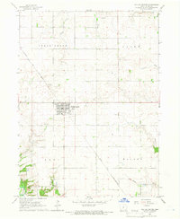
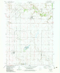
 1982 Panther1983 Print · USGSDallas County farm country and the Raccoon River valley are captured here in the early 1980s. Researchers can trace rural landmarks from Panther to Blacks Corners, including old country anchors like Washington Chapel and Central Dallas Sch.
 - 1982 Map of Panora, 1983 Print
 1982 Panora1983 Print · USGSGuthrie County during the early eighties shows a transition from traditional rail-corridor farming to lakeside recreation. Trace family history at Greenwood Cem or follow the Chicago and North Western line through Panora and Linden.
 - 1982 Map of Yale, 1983 Print
 1982 Yale1983 Print · USGSGuthrie County and its neighbors are shown here in the early eighties, centered on the vital rail corridor connecting Yale and Jamaica. Researchers can trace old family sites near Richland Cemetery or explore the wetlands of Lakin Slough.
Showing maps 1-25 of 109
Top cities of Dallas County
Frequently asked questions
- What are the different types of historical maps available for Dallas County?
- What is the oldest map of Dallas County?
- Where can I purchase historical maps of Dallas County for my home or office?
- Where can I download high-res historical maps of Dallas County?
- Are there historical topographic maps available for Dallas County?
- Is there historical aerial imagery available for Dallas County?
- Where are historical maps of Dallas County sourced from?