2020s Maps of Dubuque, Iowa
Explore 4 historic maps of Dubuque from the 2020s. These maps offer a rare glimpse into what life looked like during the 2020s — showing old roads, neighborhoods, homes, and landmarks that have changed or disappeared over time.
Whether you're researching your family's past, planning a metal detecting trip, or studying how Dubuque's landscape evolved across the 2020s, these high-resolution maps are a powerful tool for exploring the history of this region.
- Focus on a specific era: All maps on this page are from the 2020s, giving you a focused view of this time period.
- See what’s changed: Compare century-old streets, trails, and buildings to today's modern landscape using overlays and satellite layers.
- Research with precision: Use these maps for genealogy, historical research, land use analysis, or educational projects.
- View, download, or print: Maps are fully viewable online in high resolution, and can be downloaded or printed for your own records.
Start exploring Dubuque's history through authentic maps from the 2020s. This is your window into the past.
Dubuque, IA maps
(4)- 2022 Map of Dubuque South, 2022 Print
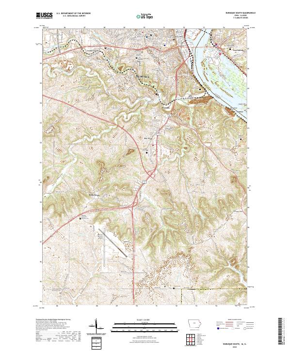 2022 Dubuque South2022 Print · USGSThe bluffs and riverfront of Dubuque come into focus during this modern era, tracing the city's expansion south toward the Jackson County line. Genealogists and local researchers can locate numerous burial sites like Mount Olivet Cem and landmarks such as the University of Dubuque.
 - 2022 Map of Peosta, 2022 Print
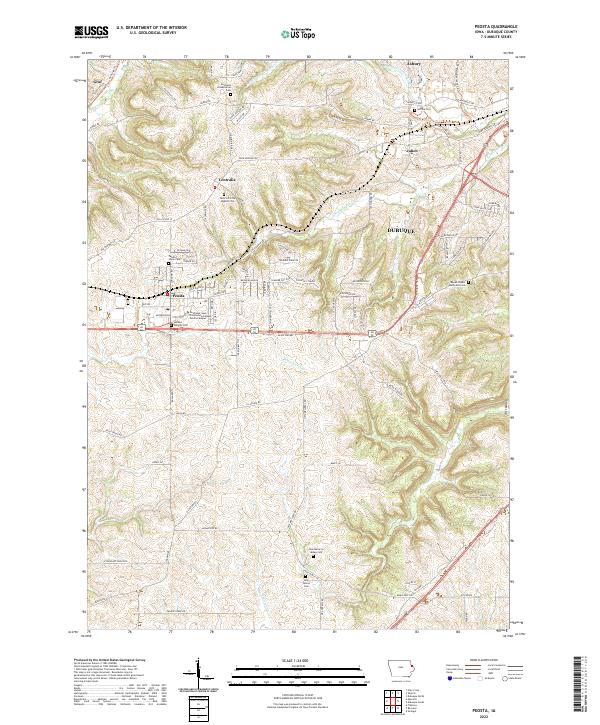 2022 Peosta2022 Print · USGSDubuque County’s rolling upland ridges and historic settlement clusters are mapped here in the modern era. Genealogists and local historians can trace family locations through numerous sites like Centralia Presbyterian Cem, Reeds Chapel Methodist Cem, and the community of Julien.
 - 2022 Map of Sherrill, 2022 Print
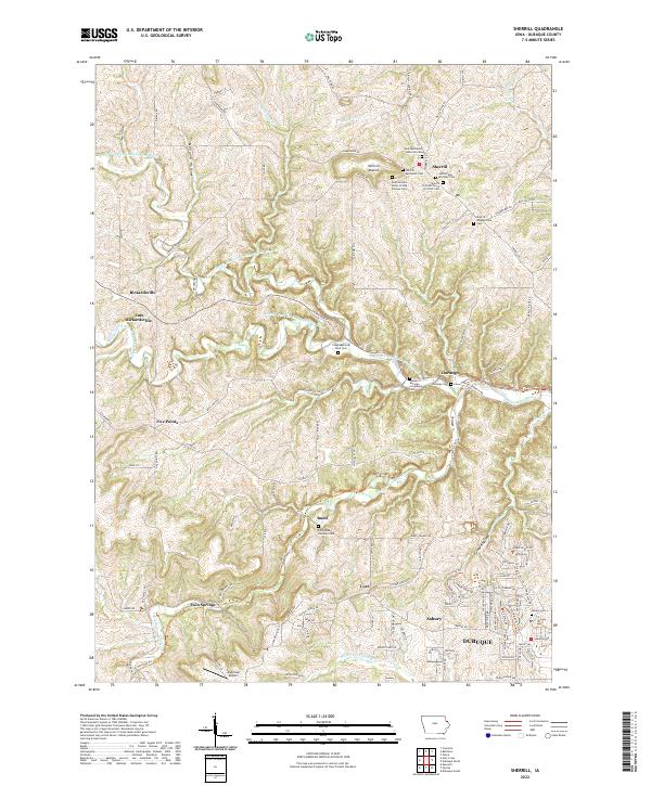 2022 Sherrill2022 Print · USGSThe ridges and river valleys northwest of Dubuque appear here in the early twenty-first century, showing a landscape of tightly clustered rural hamlets. Family historians can locate numerous burial sites such as Saints Peter and Paul Cem and Congregational Rock Cem.
 - 2022 Map of Dubuque North, 2022 Print
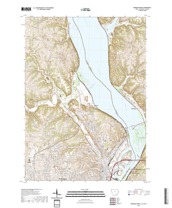 2022 Dubuque North2022 Print · USGSThe tri-state border region of Iowa, Wisconsin, and Illinois comes into sharp focus during the early 2020s. Researchers can trace the civic and educational heart of Dubuque at the Dubuque County Courthouse or explore the rugged topography of Bobs Hollow and Peru Bottoms.
End of results
Showing maps 1-4 of 4
Top cities near Dubuque
- Asbury historical maps
- Jamestown historical maps
- Epworth historical maps
- East Dubuque historical maps
- Peosta historical maps
- Dickeyville historical maps
See more
Top neighborhoods of Dubuque
- South Switch Junction historical maps
- Edmore historical maps
- Eagle Point historical maps
- Rockdale historical maps
- Steeple Square historical maps
- West Brook historical maps
See more
Frequently asked questions
- What are the different types of historical maps available for Dubuque?
- What is the oldest map of Dubuque?
- Where can I purchase historical maps of Dubuque for my home or office?
- Where can I download high-res historical maps of Dubuque?
- Are there historical topographic maps available for Dubuque?
- Is there historical aerial imagery available for Dubuque?
- Where are historical maps of Dubuque sourced from?