2020s Maps of Cass Township, Iowa
Explore 4 historic maps of Cass Township from the 2020s. These maps offer a rare glimpse into what life looked like during the 2020s — showing old roads, neighborhoods, homes, and landmarks that have changed or disappeared over time.
Whether you're researching your family's past, planning a metal detecting trip, or studying how Cass Township's landscape evolved across the 2020s, these high-resolution maps are a powerful tool for exploring the history of this region.
- Focus on a specific era: All maps on this page are from the 2020s, giving you a focused view of this time period.
- See what’s changed: Compare century-old streets, trails, and buildings to today's modern landscape using overlays and satellite layers.
- Research with precision: Use these maps for genealogy, historical research, land use analysis, or educational projects.
- View, download, or print: Maps are fully viewable online in high resolution, and can be downloaded or printed for your own records.
Start exploring Cass Township's history through authentic maps from the 2020s. This is your window into the past.
Cass Township, IA maps
(4)- 2022 Map of Woolstock, 2022 Print
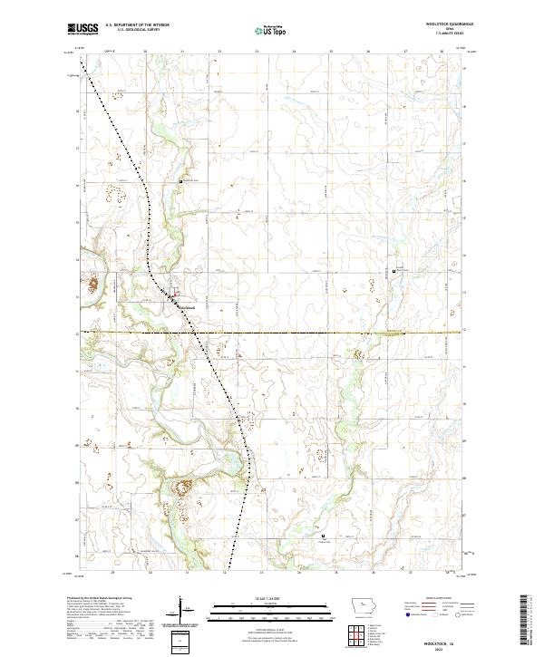 2022 Woolstock2022 Print · USGSWoolstock and the fertile borderlands of Wright and Hamilton counties are shown in this recent topographic study. Researchers can trace family roots at Woolstock Cem and French Church Cem or follow the waters of the Boone River and White Fox Cr.
 - 2022 Map of Clarion SW, 2022 Print
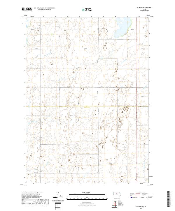 2022 Clarion SW2022 Print · USGSWright and Hamilton counties are shown in this modern survey as a highly engineered agricultural landscape defined by prairie water management. Genealogists and researchers can trace rural property boundaries along Big Wall Lake, Lyons Cr, and Ditch Number 144.
 - 2022 Map of Blairsburg, 2022 Print
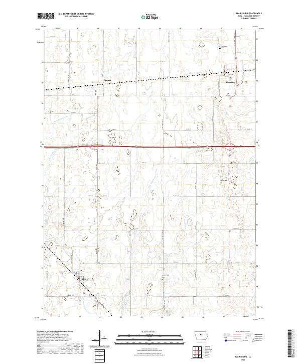 2022 Blairsburg2022 Print · USGSThe agricultural plains of Hamilton County are shown in great detail during the early 2020s, revealing a landscape defined by drainage and rail. Trace the path of the Northwestern Line through Stonega or locate ancestral sites at Blairsburg Cem and Liberty Center Cem.
 - 2022 Map of Webster City, 2022 Print
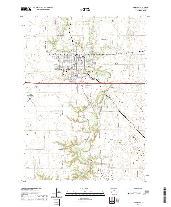 2022 Webster City2022 Print · USGSWebster City and the surrounding Hamilton County farmland are shown here in the early 2020s. Researchers can trace the civic heart of the area near the Hamilton County Courthouse or locate family plots at Graceland Cem and Calvary Cem.
End of results
Showing maps 1-4 of 4
Top cities near Cass Township
- Webster City historical maps
- Eagle Grove historical maps
- Clarion historical maps
- Jewell Junction historical maps
- Jewell historical maps
- Goldfield historical maps
See more
Frequently asked questions
- What are the different types of historical maps available for Cass Township?
- What is the oldest map of Cass Township?
- Where can I purchase historical maps of Cass Township for my home or office?
- Where can I download high-res historical maps of Cass Township?
- Are there historical topographic maps available for Cass Township?
- Is there historical aerial imagery available for Cass Township?
- Where are historical maps of Cass Township sourced from?