1970s Maps of Hancock County, Iowa
Explore 20 historic maps of Hancock County from the 1970s. These maps offer a rare glimpse into what life looked like during the 1970s — showing old roads, neighborhoods, homes, and landmarks that have changed or disappeared over time.
Whether you're researching your family's past, planning a metal detecting trip, or studying how Hancock County's landscape evolved across the 1970s, these high-resolution maps are a powerful tool for exploring the history of this region.
- Focus on a specific era: All maps on this page are from the 1970s, giving you a focused view of this time period.
- See what’s changed: Compare century-old streets, trails, and buildings to today's modern landscape using overlays and satellite layers.
- Research with precision: Use these maps for genealogy, historical research, land use analysis, or educational projects.
- View, download, or print: Maps are fully viewable online in high resolution, and can be downloaded or printed for your own records.
Start exploring Hancock County's history through authentic maps from the 1970s. This is your window into the past.
Hancock County, IA maps
(20)- 1972 Map of Clear Lake West
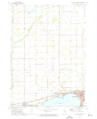 1972 Clear Lake West1972 Print · USGSThe western shores of Clear Lake were well-established by the early seventies, balancing lakeside recreation with a busy rail corridor. Researchers can trace local genealogy at Grant Cem or locate former campus sites like Central Sch and Jr High Sch.
 - 1972 Map of Buffalo Center SW, 1975 Print
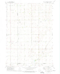 1972 Buffalo Center SW1975 Print · USGSNorth-central Iowa farmland is captured here in the early seventies, centered on the community of Woden. Researchers can trace rural property lines and drainage networks or locate local landmarks like Immanuel Ch, Township Cem, and two private landing strips.
 - 1972 Map of Forest City, 1975 Print
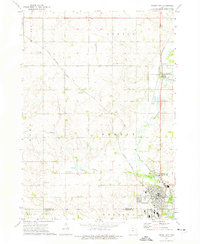 1972 Forest City1975 Print · USGSWinnebago County in the early seventies shows a landscape shaped by the Winnebago River and the intersection of two major rail lines. Researchers can trace rural genealogy and local industry through features like West Prairie Ch, Neils Spur, and Oakland Cem.
 - 1972 Map of Fertile, 1975 Print
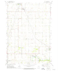 1972 Fertile1975 Print · USGSWorth County farming communities and the rail corridor are captured here during the early seventies. Genealogists and local historians can locate family sites near Elim Cem, Hanlontown, and the Chicago and North Western tracks.
 - 1972 Map of Corwith, 1975 Print
 1972 Corwith1975 Print · USGSCorwith and the surrounding Iowa prairie townships are captured here in the early 1970s, showcasing the intersection of four counties. Researchers can trace family roots at St Marys Cem, follow the Chicago and North Western rail line, or locate Township Cem.
 - 1972 Map of Thornton, 1975 Print
 1972 Thornton1975 Print · USGSNorthern Iowa's agricultural heartland is captured here in the early seventies, centered on the railroad towns of Thornton and Meservey. Researchers can trace the path of the Chicago and North Western rail line and locate landmarks like Pleasant View Cem.
 - 1972 Map of Kanawha, 1975 Print
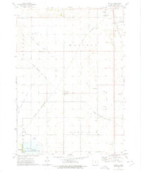
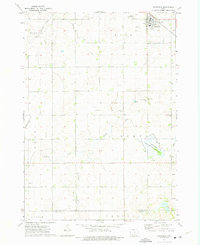
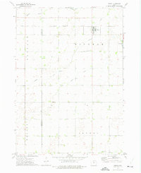
 1972 Kanawha1975 Print · USGSIn the early seventies, the rural landscape of Hancock County was defined by its railroad connections and the winding forks of the Boone River. Researchers can locate the small community of Denhart, the local Township Cem, and the tracks of the Chicago and North Western rail line.
 - 1972 Map of Hayfield, 1975 Print
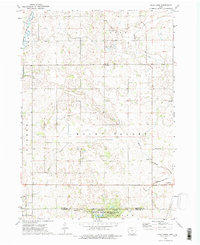
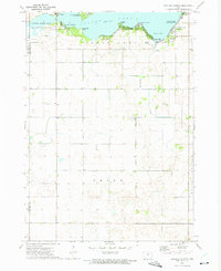
 1972 Hayfield1975 Print · USGSHancock County in the early seventies shows a landscape where rail lines and river branches converge amidst a network of agricultural drainage. Genealogists and local historians can trace the Chicago Rock Island and Pacific through Hayfield or locate family plots at Madison Cem.
 - 1972 Map of Olaf, 1975 Print
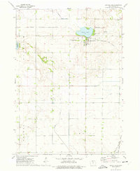
 1972 Olaf1975 Print · USGSHancock and Wright counties in the early seventies reveal a landscape of prairie lakes and rail-dependent farming towns. Genealogists and researchers can locate the Olaf settlement along the Chicago and North Western tracks and find local burials at Hickory Grove Cem.
 - 1972 Map of Crystal Lake, 1975 Print
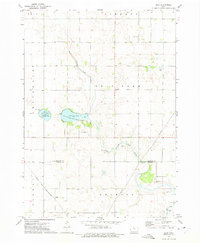
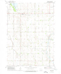
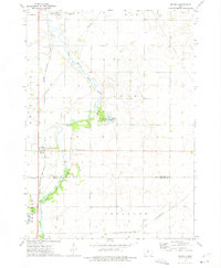
 1972 Crystal Lake1975 Print · USGSHancock County was a thriving agricultural and rail hub in the early 1970s, centered on the waters of Crystal Lake. Researchers can trace old family roots at Township Cem or follow the historic routes of the Chicago Rock Island and Pacific railroad.
 - 1972 Map of Wesley, 1975 Print
 1972 Wesley1975 Print · USGSThe North-Central Iowa prairie is documented here in the early 1970s, showcasing a landscape defined by heavy rail and extensive drainage engineering. Researchers can locate the small communities of Hutchins and Stilson, or trace family roots at St Joseph Cem and Township Cem.
 - 1972 Map of Pilot Knob, 1975 Print
 1972 Pilot Knob1975 Print · USGSNorthern Iowa's glacial topography and rural townships are captured here in the early seventies, spanning the border of Winnebago and Hancock counties. Genealogists and researchers can locate family-named sites such as Forest Home Cem, the Winnebago Ch, and the landmark Pilot Knob summit.2 unique versions available
 - 1972 Map of Thompson, 1975 Print
 1972 Thompson1975 Print · USGSThompson sits at a vital railroad junction in the early 1970s, surrounded by a productive landscape of gridded townships and creek-fed wetlands. Researchers can trace rural lineages through markers like Rose Hill Cem, Grant Ch, and the Myre Slough State Game Management Area.
 - 1972 Map of Ventura Heights, 1975 Print
 1972 Ventura Heights1975 Print · USGSClear Lake's northern and western reaches were well-established for leisure and rural living by the early seventies. Genealogists and local historians can trace the development of Ventura, locate family sites near the Lake Side Ch, or map early property lines in Union township.
 - 1972 Map of Duncan, 1975 Print
 1972 Duncan1975 Print · USGSHancock County farmland is shown here in the early 1970s, organized by the townships of Garfield and Liberty. You can trace the railroad through Duncan, locate family sites at St Boniface Cem, or explore the wetlands of Eagle Lake.
 - 1972 Map of Miller, 1975 Print
 1972 Miller1975 Print · USGSHancock County farmland and river valleys are captured here during the early 1970s, showcasing the region's agricultural and transit layout. Researchers can trace rural lineages through sites like St Johns Ch, the settlement of Miller, and the Ellington Cem.
 - 1972 Map of Woden, 1975 Print
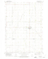
 1972 Woden1975 Print · USGSWoden and the surrounding Iowa townships are shown here in the early seventies, caught in a moment of quiet rural stability. Genealogists and local historians can trace the Chicago Rock Island and Pacific rail line and locate landmarks like Woden Ch or the Township Cem.
 - 1972 Map of Goodell, 1975 Print
 1972 Goodell1975 Print · USGSHancock and Wright counties are shown during the early 1970s as the river-and-rail economy defined local life. Researchers can trace the path of the Chicago Rock Island and Pacific through Goodell or locate the Amsterdam Cem and Eldred Sherwood Park.
 - 1972 Map of Britt, 1975 Print
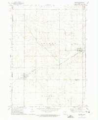
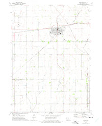 1972 Britt1975 Print · USGSHancock County farmland and the rail-hub of Britt are captured here during the early seventies. Genealogists and local historians can trace the paths of the Chicago and North Western railroad or locate family plots in Evergreen Cem and St Patricks Cem.
 - 1972 Map of Garner, 1975 Print
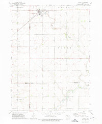
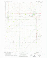
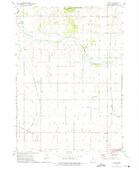
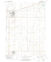 1972 Garner1975 Print · USGSHancock County was a bustling hub of agricultural rail transit in the early 1970s, centered on the crossing of two major lines. Genealogists and historians can trace local landmarks like Concord Cem, Peace Ch, and the town of Klemme.
End of results
Showing maps 1-20 of 20
Top cities of Hancock County
- Garner historical maps
- Britt historical maps
- Kanawha historical maps
- Klemme historical maps
- Corwith historical maps
- Crystal Lake historical maps
See more
Frequently asked questions
- What are the different types of historical maps available for Hancock County?
- What is the oldest map of Hancock County?
- Where can I purchase historical maps of Hancock County for my home or office?
- Where can I download high-res historical maps of Hancock County?
- Are there historical topographic maps available for Hancock County?
- Is there historical aerial imagery available for Hancock County?
- Where are historical maps of Hancock County sourced from?