2020s Maps of Hancock County, Iowa
Explore 20 historic maps of Hancock County from the 2020s. These maps offer a rare glimpse into what life looked like during the 2020s — showing old roads, neighborhoods, homes, and landmarks that have changed or disappeared over time.
Whether you're researching your family's past, planning a metal detecting trip, or studying how Hancock County's landscape evolved across the 2020s, these high-resolution maps are a powerful tool for exploring the history of this region.
- Focus on a specific era: All maps on this page are from the 2020s, giving you a focused view of this time period.
- See what’s changed: Compare century-old streets, trails, and buildings to today's modern landscape using overlays and satellite layers.
- Research with precision: Use these maps for genealogy, historical research, land use analysis, or educational projects.
- View, download, or print: Maps are fully viewable online in high resolution, and can be downloaded or printed for your own records.
Start exploring Hancock County's history through authentic maps from the 2020s. This is your window into the past.
Hancock County, IA maps
(20)- 2022 Map of Wesley, 2022 Print
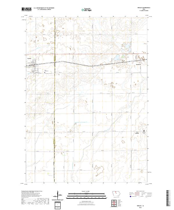 2022 Wesley2022 Print · USGSThe Kossuth and Hancock County line divides this Iowa prairie landscape during the early 2020s. Genealogists can trace family sites at Saint Joseph Cemetery and Boone Township Cemetery or explore the rural rail-side hamlet of Hutchins.
 - 2022 Map of Britt, 2022 Print
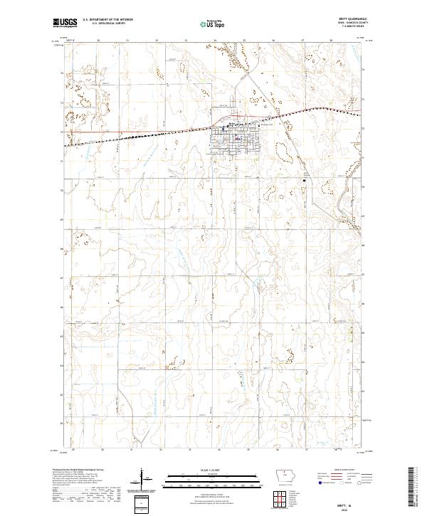 2022 Britt2022 Print · USGSThe community of Britt and the surrounding Hancock County prairie are captured here in the early twenty-first century. Researchers can trace local lineage at Evergreen Cem and Saint Patricks Cem or follow the many forks of the Boone River.
 - 2022 Map of Woden, 2022 Print
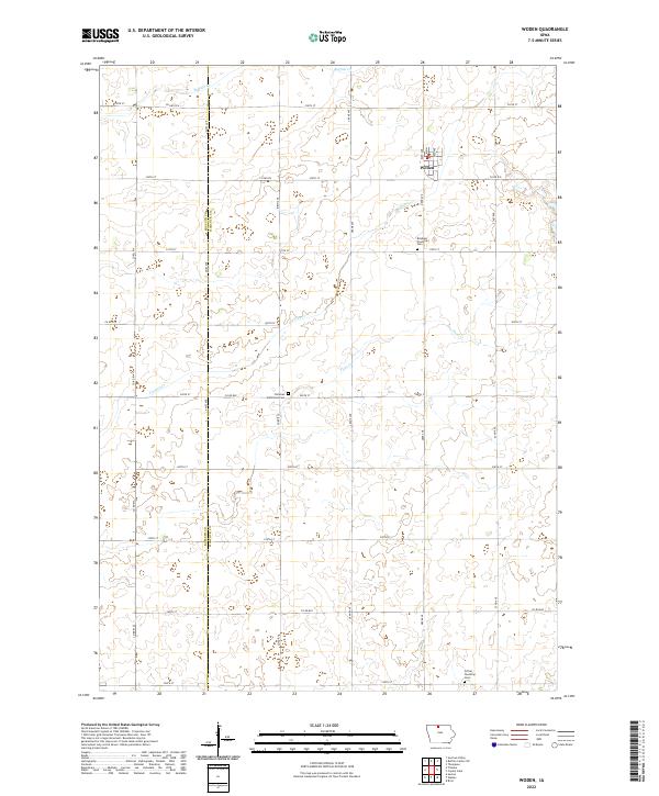 2022 Woden2022 Print · USGSThis rural portion of Hancock and Kossuth counties is shown as it appeared in the early twenty-first century. Genealogists and local historians can locate rural landmarks like Bingham Township Cem and Christian Reformed Cem near the town of Woden.
 - 2022 Map of Clear Lake West, 2022 Print
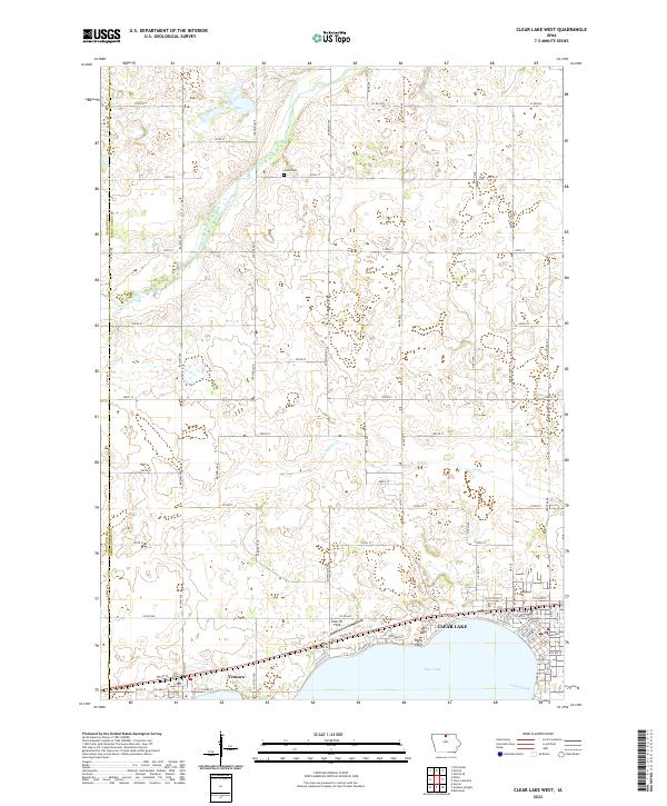 2022 Clear Lake West2022 Print · USGSCerro Gordo County at the start of the 2020s shows a landscape where lakeside leisure at Clear Lake meets steady prairie agriculture. Researchers can trace the layout of Ventura or find family history at Grant Cem and along Buddy Holly Pl.
 - 2022 Map of Duncan, 2022 Print
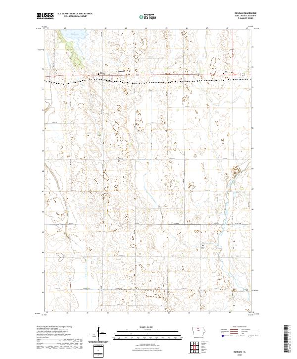 2022 Duncan2022 Print · USGSHancock County farmland and the Iowa River headwaters are captured in this recent survey. Genealogists can locate family sites at Saint John Cem, Saint Boniface Cem, and Liberty Cem, or trace the course of the W Br Iowa River.
 - 2022 Map of Buffalo Center SW, 2022 Print
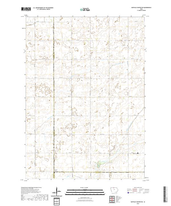 2022 Buffalo Center SW2022 Print · USGSThe rural borderlands of Winnebago, Kossuth, and Hancock counties are documented here in their modern agricultural form. Genealogists can locate family sites at the Immanuel Lutheran Church Cem and trace the drainage patterns of Little Buffalo Cr.
 - 2022 Map of Garner, 2022 Print
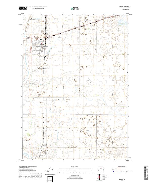 2022 Garner2022 Print · USGSHancock County enters the twenty-first century with its historic agricultural and civic patterns firmly intact. Genealogists and local historians can trace the development of Garner and Klemme or locate family plots in Concord Cem and Calvary Cem.
 - 2022 Map of Kanawha, 2022 Print
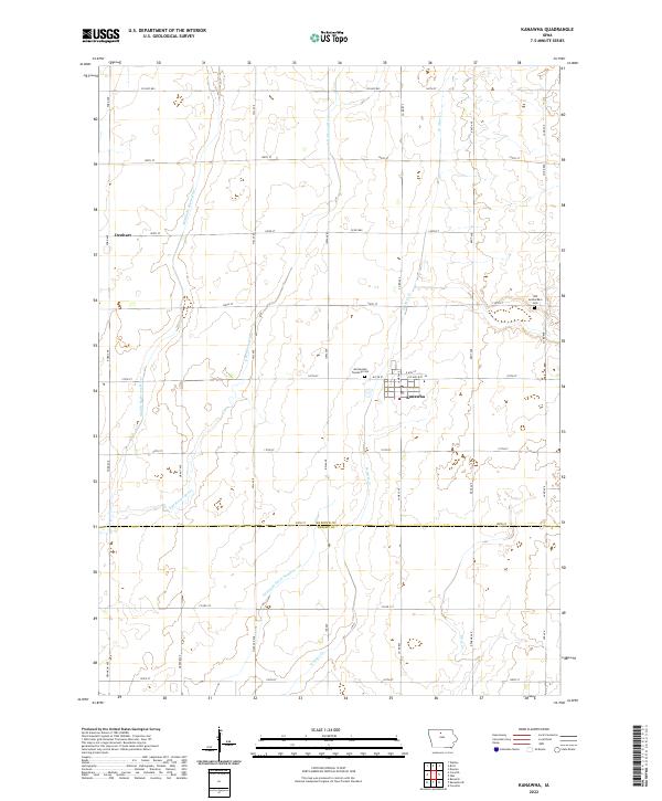 2022 Kanawha2022 Print · USGSKanawha and the surrounding Hancock County farmlands are captured in this recent survey, showcasing the enduring agricultural grid of the Iowa prairie. Researchers can locate the Old Amsterdam Cem, the settlement of Denhart, and the tributaries of the Middle Br Boone River.
 - 2022 Map of Goodell, 2022 Print
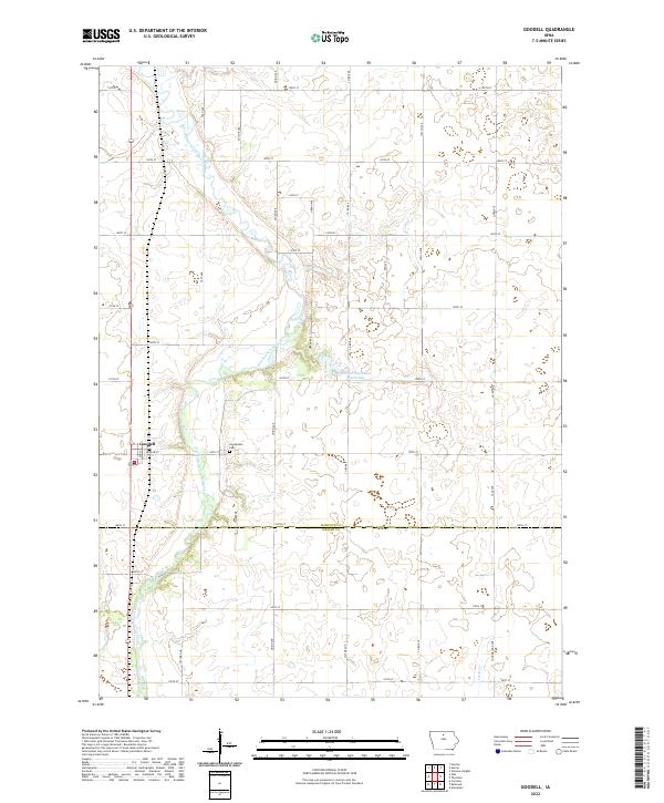 2022 Goodell2022 Print · USGSThe town of Goodell and the surrounding Hancock County farmlands are captured here in the early twenty-first century. Researchers can trace the path of the East Branch Iowa River past the Amsterdam Cem and find local landmarks like Eldred Sherwood Park Lake.
 - 2022 Map of Corwith, 2022 Print
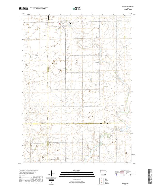 2022 Corwith2022 Print · USGSCorwith and the surrounding Iowa prairie are documented here as they appeared in 2022, where the borders of four counties converge. Genealogists can locate family sites at Saint Marys Cem, Corwith Cem, and Magor Township Cem near the winding Boone River.
 - 2022 Map of Fertile, 2022 Print
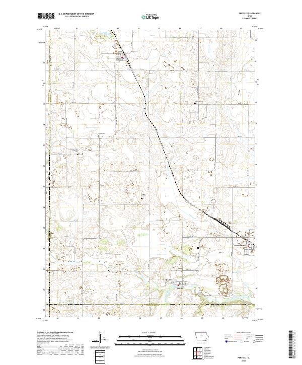 2022 Fertile2022 Print · USGSNorthern Iowa's agricultural heartland is documented here in the early twenty-first century, centered on the communities of Fertile and Hanlontown. Genealogists can locate family landmarks at Beaver Creek Lutheran Cem, Elim Cem, and Brush Point Cem along the Winnebago River.
 - 2022 Map of Crystal Lake, 2022 Print
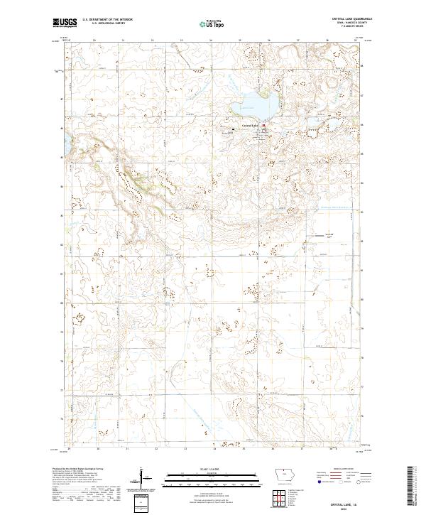 2022 Crystal Lake2022 Print · USGSCrystal Lake and the surrounding Hancock County farmlands are captured in this recent survey of north-central Iowa. Genealogists and local historians can trace family land near Crystal Township Cem or follow the paths of the Boone River and Plum Cr.
 - 2022 Map of Hayfield, 2022 Print
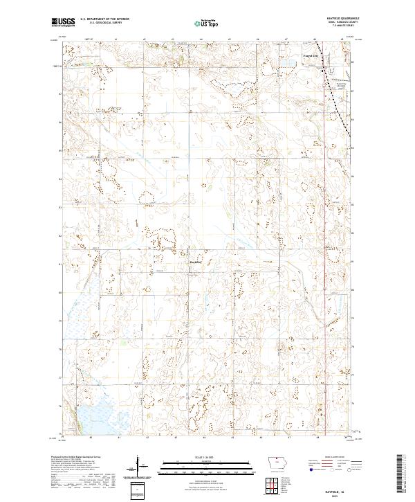 2022 Hayfield2022 Print · USGSHancock County agricultural life and river hydrology are on full display in this 2022 survey of the northern Iowa plains. Researchers can locate Madison Cem, trace the headwaters of the E Br Iowa River, and study the wetlands near Eagle Lake.
 - 2022 Map of Ventura Heights, 2022 Print
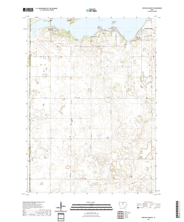 2022 Ventura Heights2022 Print · USGSClear Lake and its surrounding western communities are detailed here during the early twenty-first century. Researchers can trace lakeshore developments at Ventura Heights, find family names at Clear Lake Township Cem, or explore natural features like Woodford Island.
 - 2022 Map of Thompson, 2022 Print
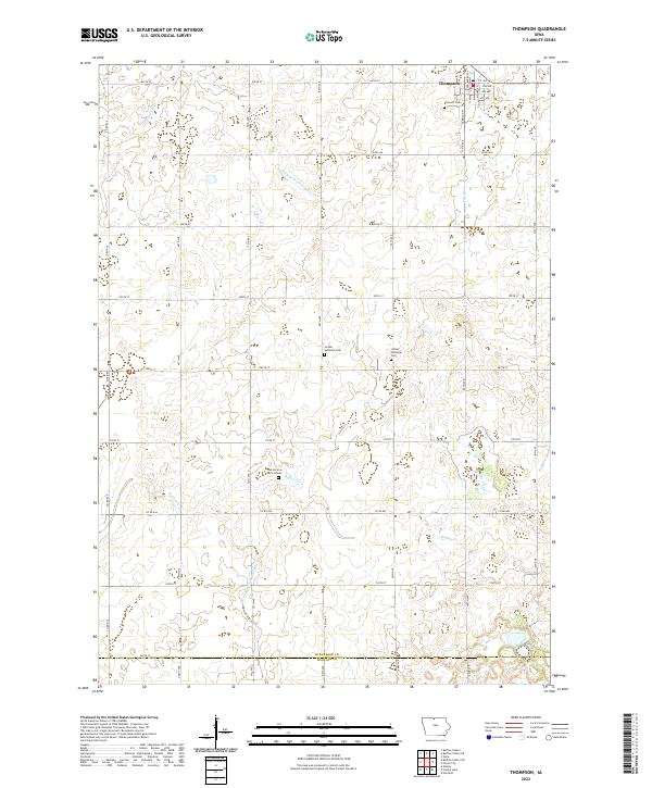 2022 Thompson2022 Print · USGSThompson and the surrounding rural townships of Winnebago County are captured here in the early twenty-first century. Genealogists can locate family landmarks such as Linden Township Cem and the Dan Lemme Farm Graves along the banks of Buffalo Cr.
 - 2022 Map of Pilot Knob, 2022 Print
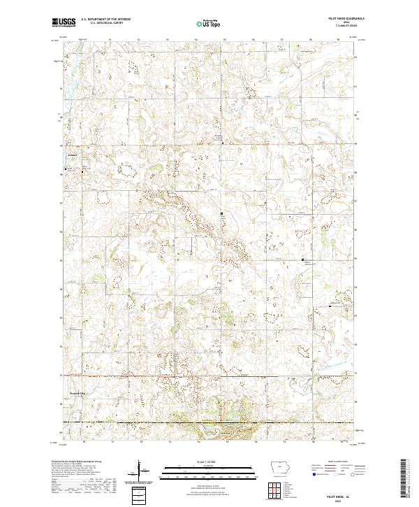 2022 Pilot Knob2022 Print · USGSThe rolling glacial terrain between Leland and Forest City comes into sharp focus in this modern era survey. Genealogists and historians can trace numerous rural landmarks, including Winnebago Lutheran Church Cem, Pilot Knob Lake, and the winding Equestrian Trl.
 - 2022 Map of Miller, 2022 Print
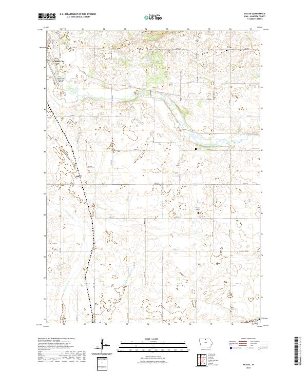 2022 Miller2022 Print · USGSHancock County is shown here as it appears today, preserving a rural landscape of river bends and small prairie settlements. Genealogists can locate several local burial grounds, including Ellington Cem and Pilot Knob Cem near the town of Miller.
 - 2022 Map of Forest City, 2022 Print
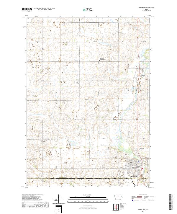 2022 Forest City2022 Print · USGSForest City and the surrounding Winnebago County countryside are documented in the early 2020s, showing a landscape shaped by the river and education. Genealogists can locate family sites at West Prairie Cemetery and Oakland Cemetery, or trace the campus of Waldorf College.
 - 2022 Map of Olaf, 2022 Print
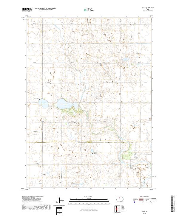 2022 Olaf2022 Print · USGSHancock and Wright counties are shown here as they appeared in the early 2020s, dominated by a strict sectional road grid and glacial water features. Genealogists can locate rural burial sites like the Simenson Family Plot and Hickory Grove Cem near the headwaters of the West Branch Iowa River.
 - 2022 Map of Thornton, 2022 Print
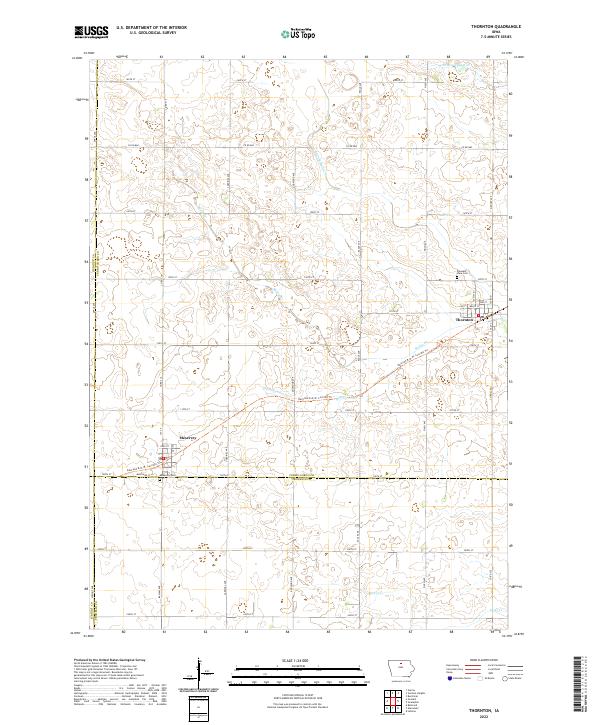 2022 Thornton2022 Print · USGSThe agricultural plains of Cerro Gordo County are captured here in the early twenty-first century. Researchers can trace the legacy of the rails along the Railroad R.O.W. Corridor Trl or locate family roots at Pleasant View Cem and Meservey Cem.
End of results
Showing maps 1-20 of 20
Top cities of Hancock County
- Garner historical maps
- Britt historical maps
- Kanawha historical maps
- Klemme historical maps
- Corwith historical maps
- Crystal Lake historical maps
See more
Frequently asked questions
- What are the different types of historical maps available for Hancock County?
- What is the oldest map of Hancock County?
- Where can I purchase historical maps of Hancock County for my home or office?
- Where can I download high-res historical maps of Hancock County?
- Are there historical topographic maps available for Hancock County?
- Is there historical aerial imagery available for Hancock County?
- Where are historical maps of Hancock County sourced from?