1970s Maps of Hardin County, Iowa
Explore 16 historic maps of Hardin County from the 1970s. These maps offer a rare glimpse into what life looked like during the 1970s — showing old roads, neighborhoods, homes, and landmarks that have changed or disappeared over time.
Whether you're researching your family's past, planning a metal detecting trip, or studying how Hardin County's landscape evolved across the 1970s, these high-resolution maps are a powerful tool for exploring the history of this region.
- Focus on a specific era: All maps on this page are from the 1970s, giving you a focused view of this time period.
- See what’s changed: Compare century-old streets, trails, and buildings to today's modern landscape using overlays and satellite layers.
- Research with precision: Use these maps for genealogy, historical research, land use analysis, or educational projects.
- View, download, or print: Maps are fully viewable online in high resolution, and can be downloaded or printed for your own records.
Start exploring Hardin County's history through authentic maps from the 1970s. This is your window into the past.
Hardin County, IA maps
(16)- 1975 Map of State Center NW, 1978 Print
 1975 State Center NW1978 Print · USGSMarshall County farmsteads and creek valleys are documented here in the mid-seventies, showing the rural landscape before further consolidation. Researchers can locate St Anthony, several Gravel Pits, and local landmarks like Illinois Grove Cem.
 - 1975 Map of Union, 1978 Print
 1975 Union1978 Print · USGSHardin and Marshall counties meet along the winding Iowa River in the mid-seventies, where agriculture and rail lines define the landscape. Genealogists can trace family roots through several local burial sites like Union Cem, Bangor Cem, and Gaer-Ballard Cem.
 - 1975 Map of Zearing, 1978 Print
 1975 Zearing1978 Print · USGSZearing and the surrounding Story County farmland are shown here in the mid-seventies just as the old rail lines were being retired. Genealogists and researchers can locate the Cem, trace the winding Minerva Creek, and find local landmarks like Dakins Lake.
 - 1975 Map of Mc Callsburg, 1978 Print
 1975 Mc Callsburg1978 Print · USGSMid-century Story County farmland comes into focus in this survey of the borders with Hamilton and Hardin. Local historians can trace the layouts of Garden City, Roland, and McCallsburg, along with rural landmarks like Zion Ch and Stavanger Cem.
 - 1979 Map of Iowa Falls West, 1980 Print
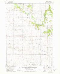
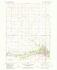 1979 Iowa Falls West1980 Print · USGSHardin and Franklin Counties are defined by the winding Iowa River and a robust rail network in the late 1970s. Researchers can trace the development of Iowa Falls, from its many schools and Ellsworth Community College to the rural Lee Center Ch.
 - 1979 Map of Buckeye West, 1980 Print
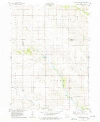
 1979 Buckeye West1980 Print · USGSHardin County agriculture and rail transport intersect in the late 1970s as the Chicago and North Western crosses this prairie landscape. Genealogists and local historians can trace the area around Buckeye, find the Buckeye Cem, and locate the Flowing Well County Park along the river.
 - 1979 Map of Buckeye East, 1980 Print
 1979 Buckeye East1980 Print · USGSHardin County agriculture and rail history intersect here during the late seventies, showing the landscape before significant modern consolidation. Genealogists and local historians can trace family locations near Cottage Ch, Buckeye, and the Lincoln Cem.
 - 1979 Map of Ackley, 1980 Print
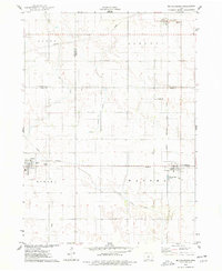
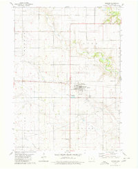
 1979 Ackley1980 Print · USGSThe rural borders of four Iowa counties converge here in the late seventies, centered on a busy regional rail hub. Genealogists and local historians can locate family sites at Blakes Grove (Chapel), Oak Wood Cem, and the small settlement of Faulkner.
 - 1979 Map of Steamboat Rock, 1980 Print
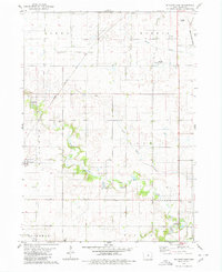
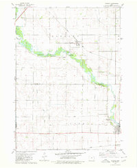
 1979 Steamboat Rock1980 Print · USGSThe Hardin and Grundy county line comes alive in the late 1970s as the Iowa River winds through a series of conservation areas. You can trace family roots at Hazel Green Cem or follow the historic tracks of the Chicago and North Western railroad near Abbott.
 - 1979 Map of Popejoy, 1980 Print
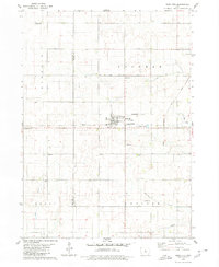
 1979 Popejoy1980 Print · USGSThe prairie landscape around Popejoy and Alden is captured here as it appeared in the late seventies. Family historians and researchers can locate the Otis Grove Cem and trace the paths of the Chicago Rock Island and Pacific railroad.
 - 1979 Map of New Providence, 1980 Print
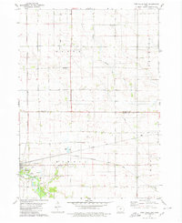
 1979 New Providence1980 Print · USGSHardin County agriculture and institutions define this area in the late 1970s, as the rural townships of Providence and Pleasant were fully established. Researchers can trace family history at Highland Cem or locate the State Training School for Boys and the Chicago and North Western rail line.
 - 1979 Map of Iowa Falls East, 1980 Print
 1979 Iowa Falls East1980 Print · USGSThe rail-and-river landscape of Hardin and Franklin Counties comes alive in the late 1970s as a busy agricultural hub. Researchers can trace the three major rail lines and locate family landmarks like Friends Cem, St Peters Ch, and the settlement of Robertson.
 - 1979 Map of Hubbard, 1980 Print
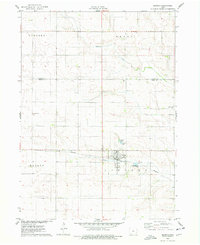
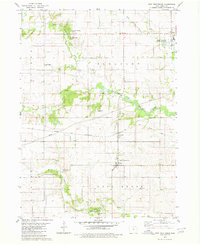
 1979 Hubbard1980 Print · USGSHubbard and the surrounding Hardin County farmsteads are documented here in the late seventies. Family historians can locate several rural burial sites like Sherman Cem and Idaho Cem, or trace the path of the Chicago and North Western rail line.
 - 1979 Map of Radcliffe, 1980 Print
 1979 Radcliffe1980 Print · USGSRadcliffe and the surrounding Iowa prairie are documented here in the late seventies, showing a landscape shaped by rail and agriculture. Researchers can trace family history through several local burial grounds including Bethany Cem and Rorem Cem, or locate the site of the old Salem Ch.
 - 1979 Map of Eldora, 1980 Print
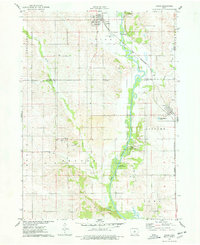
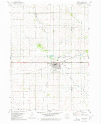
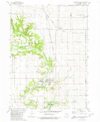
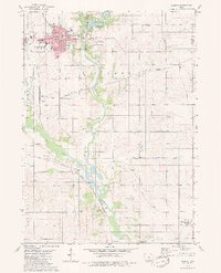 1979 Eldora1980 Print · USGSHardin County's river valley comes into sharp focus in the late 1970s, centered on the county seat and its surrounding townships. Researchers can trace rural lineages through family-named landmarks like Sheppard Cem and explore the site of the State Training School for Boys.
 - 1979 Map of Owasa, 1980 Print
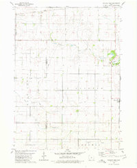
 1979 Owasa1980 Print · USGSHardin County agriculture and river life are frozen in time here during the late seventies. Genealogists and local historians can trace the paths between the Owasa rail siding, the Berlin Community Ch, and rural cemeteries like Kidwiler Cem or Oakwood Cem.
End of results
Showing maps 1-16 of 16
Top cities of Hardin County
- Iowa Falls historical maps
- Eldora historical maps
- Hubbard historical maps
- Alden historical maps
- Radcliffe historical maps
- Union historical maps
See more
Frequently asked questions
- What are the different types of historical maps available for Hardin County?
- What is the oldest map of Hardin County?
- Where can I purchase historical maps of Hardin County for my home or office?
- Where can I download high-res historical maps of Hardin County?
- Are there historical topographic maps available for Hardin County?
- Is there historical aerial imagery available for Hardin County?
- Where are historical maps of Hardin County sourced from?