Old Maps of Jackson County, Iowa for Hiking & Exploration
Hike through history with 152 historic maps of Jackson County. Explore old trails, ghost towns, and forgotten backroads — perfect for outdoor adventurers and local explorers.
- Rediscover forgotten places: Map out old mining camps, roads, and footpaths that no longer exist on modern maps.
- Layer with modern tools: Combine with LiDAR or satellite views to plan hikes through historical terrain.
- Made for exploration: Popular among hikers, overlanders, and local history lovers.
Use these maps to find adventure and explore the hidden past of Jackson County.
Jackson County, IA maps
(152)- 1891 Map of Maquoketa
 1891 Maquoketa1891 Print · USGSJackson County, Iowa, was a thriving agricultural and rail corridor in the years following the Civil War. Trace the early streets of Maquoketa and locate rural landmarks like Cottonville, Andrew, and the river crossing at Bridgeport.3 unique versions available
 - 1891 Map of Baldwin
 1891 Baldwin1891 Print · USGSJackson County at the end of the century shows a rugged landscape transitioning from river-based industry to a railroad economy. Genealogists can trace family footprints in early settlements like Ozark, Clay Mills, and the rail hubs of Baldwin and Monmouth.3 unique versions available
 - 1892 Map of Savanna
 1892 Savanna1892 Print · USGSThe upper Mississippi corridor in the late nineteenth century was a bustling hub of river commerce and competing rail lines. Map enthusiasts can trace the old tracks of the Chicago Burlington and Northern Railroad and locate vanished landmarks like Hickory Grove or Idens Lake.8 unique versions available
 - 1901 Map of Peosta
 1901 Peosta1901 Print · USGSDubuque and Jackson counties were a hub of river commerce and early rail expansion at the turn of the century. Genealogists and historians can trace the foundations of communities like Peosta, St.Donatus, and the mill sites at Washington Mills.4 unique versions available
 - 1911 Map of Galena, 1953 Print
 1911 Galena1953 Print · USGSBefore the decline of the local lead industry, this area was a hub of mining and river commerce. Genealogists can trace family names through dozens of rural schools and mines like Blackjack Mine, or locate long-lost river crossings like Gears Ferry.3 unique versions available
 - 1913 Map of Galena
 1913 Galena1913 Print · USGSThe mining and river districts of Jo Daviess County are captured here just before the First World War. Genealogists and researchers can locate family-named landmarks like Horseshoe Mound, local schools such as Miners School, and industrial sites like the Hoskin Mine.3 unique versions available
 - 1935 Map of East Dubuque, 1957 Print
 1935 East Dubuque1957 Print · USGSThe riverfront and rail lines of Jo Daviess County come alive in this mid-1930s survey of the tri-state border region. Researchers can trace the old tracks of the Chicago Illinois Burlington and Quincy and locate vanished rural schoolhouses like Miller Sch and Sand Ridge Sch.
 - 1935 Map of Miles, 1957 Print
 1935 Miles1957 Print · USGSIn the mid-1930s, the Mississippi River shoreline was defined by military expansion and the rail economy. Genealogists and historians can trace the foundations of the Savanna Ordnance Depot and local landmarks like Whitton and Lost Mound Sch.
 - 1940 Map of East Dubuque
 1940 East Dubuque1940 Print · USGSThe Mississippi River borderlands of Jo Daviess County appear here in the mid-1930s, showing the vital rail and river connections at East Dubuque. Genealogists and local historians can trace rural school districts like Sand Ridge Sch or the riverside community of Menominee Sta.3 unique versions available
 - 1941 Map of Miles
 1941 Miles1941 Print · USGSThe Mississippi River borderlands come alive in this pre-war survey, documenting the small settlements and rail lines that defined the Jo Daviess and Carroll County line. Researchers can trace the river's complex island system or find local landmarks like Whitton, Lost Mound, and the Lost Mound Sch.2 unique versions available
 - 1952 Map of Savanna, 1954 Print
 1952 Savanna1954 Print · USGSThe Mississippi River bluffs and rail corridors define this Illinois riverfront during the early fifties. Genealogists and historians can trace numerous rural schoolhouses and family-named cemeteries like Massbach Cem, Palsgrove, and the sprawling Savanna Ordnance Depot.3 unique versions available
 - 1953 Map of Blackhawk, 1956 Print
 1953 Blackhawk1956 Print · USGSThe river bluffs and backwaters of the Mississippi River come to life in this mid-century survey of the Illinois and Iowa borderlands. Researchers can trace the river's industrial and social pulse through sites like Arnolds Landing, St Mathews Ch, and the winding Chicago Milwaukee St Paul and Pacific rail lines.3 unique versions available
 - 1953 Map of Green Island, 1956 Print
 1953 Green Island1956 Print · USGSThe Mississippi River backwaters and the Savanna Ordnance Depot define this mid-century borderland between Iowa and Illinois. Genealogists and researchers can trace rural life through the Lost Mound Cem, Grand View Sch, and the rail stop at Whitton.3 unique versions available
 - 1955 Map of Menominee, 1956 Print
 1955 Menominee1956 Print · USGSThe tri-state border region along the Mississippi River appears here in the mid-fifties, showing a landscape of river-bottom refuges and blufftop farms. Genealogists can locate several schools and rural settlements like Menominee and Shawondasse, or trace the tracks of the Illinois Central railroad.3 unique versions available
 - 1955 Map of Dubuque South, 1957 Print
 1955 Dubuque South1957 Print · USGSMid-century Dubuque and its Illinois neighbor across the river are shown at a time of significant transition and growth. Genealogists can trace family roots through numerous local landmarks, including Mount Olivet Cemetery, Ballyclough, and several rural schoolhouses like Smith Sch.3 unique versions available
 - 1959 Map of Dubuque, 1982 Print
 1959 Dubuque1982 Print · USGSThe Tri-State region comes alive in the mid-twentieth century as a hub of river commerce and rail transit. Genealogists and historians can trace the paths of the Illinois Central Gulf through Dubuque or locate the Savanna Ordnance Depot and Lock and Dam No 11.
 - 1961 Map of Dubuque
 1961 Dubuque1961 Print · USGSThe Tri-State region's river-and-rail landscape is captured here during the early sixties, showing the convergence of Iowa, Illinois, and Wisconsin. Trace mid-century rail lines like the Chicago Great Western Ry and explore sites like the Savanna Ordnance Depot and Backbone State Park.
 - 1962 Map of Dubuque
 1962 Dubuque1962 Print · USGSThe Tri-State region's river-and-rail economy is captured here in the early sixties, centered on the Mississippi River bluffs. Genealogists and historians can locate Numerous lead and zinc mines, the New Melleray Abbey Monastery, and rural hubs like Saint Olaf.2 unique versions available
 - 1962 Map of La Motte, 1964 Print
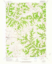 1962 La Motte1964 Print · USGSThe rural landscape of Jackson County is captured here in the early sixties as small communities and family farms dotted the steep ridges. Genealogists and local historians can trace the Old R R Grade or locate sites like St Johns Ch and School No 1.2 unique versions available
 - 1962 Map of Zwingle, 1964 Print
 1962 Zwingle1964 Print · USGSDubuque and Jackson counties come together at the start of the sixties, showing a landscape of rural schoolhouses and parish churches. Trace family roots at St Theresa Ch, follow the Old Railroad Grade, or locate the Biggins Sch.2 unique versions available
 - 1966 Map of Bernard, 1967 Print
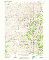 1966 Bernard1967 Print · USGSThe borderlands of Dubuque and Jackson Counties were characterized by small agricultural centers and winding creek valleys in the mid-1960s. Genealogists and local historians can trace the footprint of Bernard, the rural settlement at Garry Owen, and historic parish sites like St Patrick Cem.2 unique versions available
 - 1966 Map of Fillmore, 1967 Print
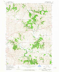 1966 Fillmore1967 Print · USGSEastern Iowa in the mid-1960s reveals a landscape defined by the winding North Fork Maquoketa River and the meeting of three counties. Genealogists and local historians can trace the early footprints of Fillmore and Cascade or locate a riverside Quarry.2 unique versions available
 - 1967 Map of Savanna, 1968 Print
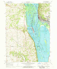 1967 Savanna1968 Print · USGSThe riverfront towns of Savanna and Sabula are captured in the late sixties as bustling rail and river hubs. Genealogists can locate several local burial grounds including St Johns Cem and Canada Hollow Cem near the Plum River.4 unique versions available
 - 1968 Map of Galena, 1970 Print
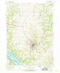 1968 Galena1970 Print · USGSThe Galena area is shown here in the late sixties, where the industrial legacy of mining meets the complex backwaters of the Mississippi. Researchers can trace historic cemeteries like Grant Hill Cem, early crossings at Gears Ferry, and the paths of the Central Illinois Railroad.4 unique versions available
 - 1968 Map of Bellevue, 1970 Print
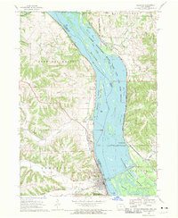 1968 Bellevue1970 Print · USGSThe Mississippi River border between Iowa and Illinois was a center of rail and river industry in the late sixties. Genealogists and historians can trace the foundations of Bellevue, the Savanna Army Depot, and old cemeteries like St Joseph Cem.3 unique versions available
Showing maps 1-25 of 152
Top cities of Jackson County
- Maquoketa historical maps
- Bellevue historical maps
- Preston historical maps
- Sabula historical maps
- Miles historical maps
- Andrew historical maps
See more
Frequently asked questions
- What are the different types of historical maps available for Jackson County?
- What is the oldest map of Jackson County?
- Where can I purchase historical maps of Jackson County for my home or office?
- Where can I download high-res historical maps of Jackson County?
- Are there historical topographic maps available for Jackson County?
- Is there historical aerial imagery available for Jackson County?
- Where are historical maps of Jackson County sourced from?