Old Maps of Jasper County, Iowa
Explore 97 old maps of Jasper County, spanning from 1930 to today. These high-resolution historic maps reveal how streets, neighborhoods, landmarks, and natural features evolved over time — perfect for genealogy, metal detecting, research, and local history exploration.
What you can do with these maps:
- See how Jasper County changed over time: Compare historical maps to modern-day views to trace roads, homesites, rail lines & more.
- View detailed metadata: Each map includes creators, publishers, year, scale, and archive source.
- Overlay maps with satellite & LiDAR: Visualize the past alongside modern tools to explore terrain & human change.
- Trusted historical sources: Maps sourced from the USGS, Library of Congress, and other archives.
- Access maps your way: View online, download high-res files, or order prints for personal or research use.
Start exploring old maps of Jasper County to uncover forgotten places, hidden landmarks, and the deep history beneath your feet.
Jasper County, IA maps
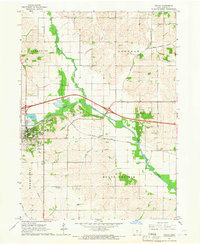
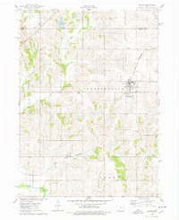
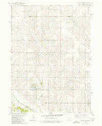
(97)- 1930 Map of Mitchellville
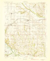 1930 Mitchellville1930 Print · USGSCentral Iowa's fertile prairie and river valleys come alive in this late 1920s survey of the settlements between the Skunk and Des Moines rivers. Researchers can locate dozens of country schools like Nebo Sch and Peacock Sch or trace family roots near Camp Center Ch.3 unique versions available
 - 1954 Map of Des Moines, 1973 Print
 1954 Des Moines1973 Print · USGSCentral Iowa's evolving landscape is captured here in the early seventies, just as major reservoirs were reshaping the river valleys. Genealogists and historians can trace the rail corridors of the Burlington Northern or locate family roots near Pella, Indianola, and Knoxville.2 unique versions available
 - 1956 Map of Des Moines
 1956 Des Moines1956 Print · USGSCentral Iowa in the mid-fifties shows a landscape defined by bustling rail hubs and deep-rooted agricultural research. Genealogists and researchers can trace the growth of Des Moines and Ames, locate the Sac and Fox Indian Reservation, or study the paths of the Skunk River and South Skunk River.
 - 1957 Map of Des Moines
 1957 Des Moines1957 Print · USGSCentral Iowa's post-war landscape is defined here by the converging rail lines and river valleys that shaped its earliest settlements. Genealogists and historians can trace the paths of the Rock Island Railroad and locate community landmarks in Des Moines, Ames, and Newton.
 - 1965 Map of Prairie City, 1966 Print
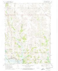
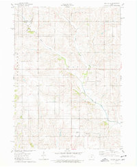
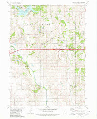
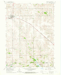 1965 Prairie City1966 Print · USGSPrairie City and the surrounding Jasper County townships are shown in the mid-sixties as the landscape transitioned with new infrastructure and water management. Genealogists can locate family sites at Waveland Cem, Griffis Cem, and the Church of the Brethren.
 - 1965 Map of Newton, 1966 Print
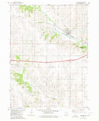
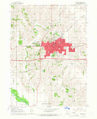 1965 Newton1966 Print · USGSNewton and the surrounding Jasper County landscape are captured in the mid-sixties as the city expanded along the Rock Island rail line. Genealogists can trace family sites at Union Cem or Palo Alto Ch, while researchers can locate the Riverview Honor Farm and the Drive-in Theater.
 - 1965 Map of Monroe, 1966 Print
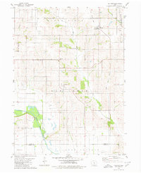
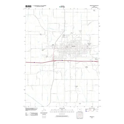
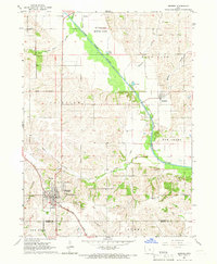 1965 Monroe1966 Print · USGSJasper County farming communities thrive along the river during the mid-sixties as new road infrastructure begins to take shape. Genealogists can trace family roots through several local landmarks like Tools Chapel, Warren Grove Sch, and Gifford Cem.2 unique versions available
 - 1965 Map of Colfax, 1966 Print
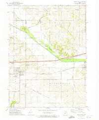
 1965 Colfax1966 Print · USGSJasper County in the mid-sixties reveals a landscape shaped by the South Skunk River and the expanding highway network. Researchers can trace family roots at Slaughter Cem or explore the rail-side settlement of Metz and the streets of Colfax.
 - 1969 Map of Des Moines
 1969 Des Moines1969 Print · USGSCentral Iowa's fertile plains and growing capital are captured here during the late sixties, a time of major highway expansion and reservoir construction. Genealogists and researchers can trace rural township boundaries, local cemeteries, and rail lines serving towns like Pella, Grinnell, and Oskaloosa.
 - 1972 Map of Runnells, 1974 Print
 1972 Runnells1974 Print · USGSRunnells and the southern Polk County borderlands are shown here in the early seventies, just as the regional landscape was adjusting to the presence of Lake Red Rock. Researchers can trace old family sites and rural infrastructure through the Vandalia Cem, the Runnells Sch, and the Norfolk and Western rail line.
 - 1972 Map of Mitchellville, 1974 Print
 1972 Mitchellville1974 Print · USGSAcross the Polk and Jasper County line in the early 1970s, this area shows a landscape defined by rail corridors and the meandering South Skunk River. Genealogists can locate family landmarks like Sams Cem and Fisher Cem or trace the small-town footprints of Valeria and Mitchellville.
 - 1975 Map of Mingo, 1978 Print
 1975 Mingo1978 Print · USGSMid-Iowa's agricultural landscape comes into focus during the 1970s at the junction of Story, Jasper, and Polk counties. Researchers can trace rural genealogy and transport through Mingo, the Old RR Grade at Farrar, and local landmarks like Ashton Ch and Deeter Cem.
 - 1975 Map of Baxter, 1978 Print
 1975 Baxter1978 Print · USGSThe town of Baxter and its surrounding townships are shown here during the mid-1970s, capturing the organized grid of Iowa's agricultural heartland. Genealogists and local historians can locate several rural burial grounds, including Restland Cem and Independence Cem, alongside the CHICAGO AND NORTH WESTERN rail line.
 - 1975 Map of Baxter SE, 1978 Print
 1975 Baxter SE1978 Print · USGSJasper County farmland in the mid-1970s is defined by the winding North Skunk River and a network of rural townships. Genealogists and local historians can locate several family burial grounds including Bethany Cem and the Wittenberg Grange Hall.
 - 1980 Map of Newburg
 1980 Newburg1980 Print · USGSJasper and Marshall counties are captured in the 1980s as rural agricultural centers defined by the Chicago and North Western railroad. Researchers can trace local heritage through landmarks like Newburg, Hickory Grove Ch, and the recreation areas at Rock Creek State Park.
 - 1980 Map of Sully
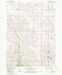
 1980 Sully1980 Print · USGSCentral Iowa farmland meets the North Skunk River in the early eighties, centered on the growing communities of Sully and Lynnville. Researchers can locate numerous family burial grounds like Swans Cem and Dairy Grove Cem, along with local landmarks like the Municipal Landing Strip.
 - 1980 Map of Alloway Creek
 1980 Alloway Creek1980 Print · USGSThe rural borderlands of Jasper and Marshall counties come to life in this 1980 study of the Iowa heartland. Local historians can trace family roots near the Rushville Cem or explore the mid-century development of Mariposa County Park and Ken Wolfe Lake.
 - 1980 Map of Oakland Acres
 1980 Oakland Acres1980 Print · USGSJasper and Poweshiek counties were undergoing modern development in the early 1980s, balancing new highway infrastructure with established farming communities. Genealogists can locate family landmarks like Westfield Cem, Sugar Creek Cem, and the quiet grounds of Bethel Ch.
 - 1980 Map of Kellogg
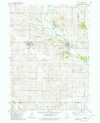
 1980 Kellogg1980 Print · USGSJasper County is captured here in the early 1980s, centered on the river valley and rail corridor of Kellogg. Local historians can trace family roots through numerous burial grounds like Our Silent City Cem and rural landmarks such as Beacon Light Sch.2 unique versions available
 - 1980 Map of Killduff
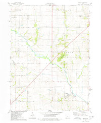
 1980 Killduff1980 Print · USGSJasper County agricultural life and river geography are documented here during the late twentieth century. Genealogists and researchers can trace rural landmarks like St Andrews Ch, Hewitt Cem, and the small community of Galesburg.
 - 1984 Map of Des Moines, 1985 Print
 1984 Des Moines1985 Print · USGSCentral Iowa's heartland is captured in the mid-1980s as suburban growth met long-standing farm and rail infrastructure. Genealogists and researchers can trace the reaches of the Chicago and North Western through Maxwell or locate Laurel Hill Cem and Camp Dodge Military Reservation.2 unique versions available
 - 1984 Map of Grinnell, 1985 Print
 1984 Grinnell1985 Print · USGSCentral Iowa's prairie towns and rail corridors are captured in the mid-1980s, showcasing the agricultural grid and protected marshlands. Researchers can trace historic routes along the Chicago and North Western or locate family roots near the Sac and Fox Indian Reservation and Lake Ponderosa.2 unique versions available
 - 2010 Map of Newton, 2010 Print
 2010 Newton2010 Print · USGSCovers Jasper County, including Newton, Lambs Grove, and other nearby areas
 - 2010 Map of Monroe, 2010 Print
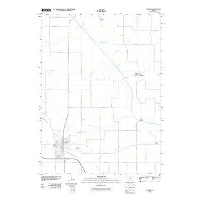 2010 Monroe2010 Print · USGSCovers Jasper County, including Monroe, Reasnor, and other nearby areas
 - 2010 Map of Baxter SE, 2010 Print
 2010 Baxter SE2010 Print · USGSCovers Jasper County, including Independence Township, Malaka Township, and other nearby areas
Showing maps 1-25 of 97
Top cities of Jasper County
Frequently asked questions
- What are the different types of historical maps available for Jasper County?
- What is the oldest map of Jasper County?
- Where can I purchase historical maps of Jasper County for my home or office?
- Where can I download high-res historical maps of Jasper County?
- Are there historical topographic maps available for Jasper County?
- Is there historical aerial imagery available for Jasper County?
- Where are historical maps of Jasper County sourced from?