
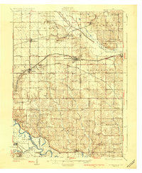
1930 Map of Mitchellville
USGS Topo · Published 1930About this map
The Skunk River and Des Moines River valleys define the agricultural landscape of this central Iowa region just before the Great Depression. At the junction of major rail lines, including the Chicago Rock Island and Pacific and the Chicago Great Western, towns like Mitchellville and Altoona serve as critical hubs for the surrounding farm townships. This survey is exceptionally dense with rural educational history, mapping dozens of named country schools such as Apple Grove Sch, Trullinger Grove Sch, and Prairie Belle Sch.
Find a feature on this map
83 named features on this map. Tap any name to fly to it.
Don’t see what you’re looking for? This feature index may not catch every label — zoom into the map to look around manually.
Map Details
Editions of this 1930 Mitchellville Map
3 editions found
Other maps of this area

1905 · Des Moines
USGS Topo · 1:62,500

1907 · Des Moines
USGS Topo · 1:62,500

1909 · Knoxville
USGS Topo · 1:62,500

1910 · Milo
USGS Topo · 1:62,500

1911 · Slater
USGS Topo · 1:62,500

1912 · Knoxville
USGS Topo · 1:62,500

1913 · Slater
USGS Topo · 1:62,500

1931 · Indianola
USGS Topo · 1:62,500

1954 · Des Moines
USGS Topo · 1:250,000

1956 · Des Moines
USGS Topo · 1:250,000