
1912 Map of Knoxville
USGS Topo · Published 1912About this map
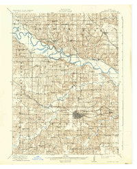
The Des Moines River carves a winding path through this 1912 landscape, serving as the primary geographical anchor for the surrounding townships of Marion County. The city of Knoxville appears as a dense grid of blocks, functioning as a vital transportation hub where the Chicago Rock Island and Pacific RR and the Chicago Burlington and Quincy RR intersect. This rail-and-river economy supported a network of small agricultural and mining settlements such as Red Rock, Percy, and Flagler.
Find a feature on this map
85 named features on this map. Tap any name to fly to it.
Don’t see what you’re looking for? This feature index may not catch every label — zoom into the map to look around manually.
Map Details
Editions of this 1912 Knoxville Map
2 editions found
Other maps of this area

1909 · Knoxville
USGS Topo · 1:62,500

1910 · Milo
USGS Topo · 1:62,500

1910 · Pella
USGS Topo · 1:62,500

1912 · Pella
USGS Topo · 1:62,500

1918 · Chariton
USGS Topo · 1:62,500

1924 · Melcher
USGS Topo · 1:62,500

1929 · Albia
USGS Topo · 1:62,500

1930 · Mitchellville
USGS Topo · 1:62,500

1954 · Des Moines
USGS Topo · 1:250,000

1956 · Des Moines
USGS Topo · 1:250,000