Old Maps of Marion County, Iowa
Explore 137 old maps of Marion County, spanning from 1909 to today. These high-resolution historic maps reveal how streets, neighborhoods, landmarks, and natural features evolved over time — perfect for genealogy, metal detecting, research, and local history exploration.
What you can do with these maps:
- See how Marion County changed over time: Compare historical maps to modern-day views to trace roads, homesites, rail lines & more.
- View detailed metadata: Each map includes creators, publishers, year, scale, and archive source.
- Overlay maps with satellite & LiDAR: Visualize the past alongside modern tools to explore terrain & human change.
- Trusted historical sources: Maps sourced from the USGS, Library of Congress, and other archives.
- Access maps your way: View online, download high-res files, or order prints for personal or research use.
Start exploring old maps of Marion County to uncover forgotten places, hidden landmarks, and the deep history beneath your feet.
Marion County, IA maps
(137)- 1909 Map of Knoxville, 1958 Print
 1909 Knoxville1958 Print · USGSMarion County at the start of the twentieth century is a landscape defined by its river valleys and dense network of country schools. Genealogists and historians can trace family roots through dozens of named landmarks like Stringtown School, Mt Vernon Church, and the river town of Red Rock.
 - 1910 Map of Milo
 1910 Milo1910 Print · USGSWarren and Marion counties are captured here at the height of their early 20th-century rural development, before the modernization of the road network. Genealogists can trace family footprints through numerous country schools like Prairie Creek School and the river-crossing at Hammondsburg Bridge.2 unique versions available
 - 1910 Map of Pella, 1958 Print
 1910 Pella1958 Print · USGSMarion and Mahaska counties at the peak of the rail era show a landscape dotted with country schools and river settlements. Genealogists and historians can locate vanished schoolhouses like Bunker Hill School and trace the paths of the Chicago Rock Island and Pacific through Pella and Leighton.2 unique versions available
 - 1912 Map of Knoxville
 1912 Knoxville1912 Print · USGSMarion County at the dawn of the twentieth century was a landscape of bustling rail towns and river crossings. Genealogists can trace the exact locations of dozens of rural schoolhouses and churches like Stringtown School and Mt Vernon Church alongside the Des Moines River.2 unique versions available
 - 1912 Map of Pella
 1912 Pella1912 Print · USGSThe river valleys of Marion County come alive in this pre-World War I portrait of a thriving agricultural and rail corridor. Researchers can pinpoint early homesteads near dozens of rural landmarks, including Pella, Salem Church, and the West Amsterdam School.2 unique versions available
 - 1918 Map of Chariton
 1918 Chariton1918 Print · USGSChariton and its neighboring townships thrive as a rail-connected agricultural hub during the late First World War era. Trace family roots at Chariton or locate rural landmarks like Indianola Junction and the Horstman School.4 unique versions available
 - 1924 Map of Melcher
 1924 Melcher1924 Print · USGSSouth-central Iowa thrives during the 1920s coal boom, where rail lines and mine shafts transformed the rural landscape. Trace the growth of mining towns like Tipperary and Bucknell, and locate vanished local schools such as Coal Glen School.3 unique versions available
 - 1929 Map of Albia
 1929 Albia1929 Print · USGSMonroe County was a bustling coal and rail corridor during the late twenties, anchored by the junction at Albia. Genealogists and historians can trace defunct mining camps like Hiteman and dozens of rural school sites such as Halfway Prairie Sch.3 unique versions available
 - 1930 Map of Mitchellville
 1930 Mitchellville1930 Print · USGSCentral Iowa's fertile prairie and river valleys come alive in this late 1920s survey of the settlements between the Skunk and Des Moines rivers. Researchers can locate dozens of country schools like Nebo Sch and Peacock Sch or trace family roots near Camp Center Ch.3 unique versions available
 - 1954 Map of Des Moines, 1973 Print
 1954 Des Moines1973 Print · USGSCentral Iowa's evolving landscape is captured here in the early seventies, just as major reservoirs were reshaping the river valleys. Genealogists and historians can trace the rail corridors of the Burlington Northern or locate family roots near Pella, Indianola, and Knoxville.2 unique versions available
 - 1956 Map of Des Moines
 1956 Des Moines1956 Print · USGSCentral Iowa in the mid-fifties shows a landscape defined by bustling rail hubs and deep-rooted agricultural research. Genealogists and researchers can trace the growth of Des Moines and Ames, locate the Sac and Fox Indian Reservation, or study the paths of the Skunk River and South Skunk River.
 - 1957 Map of Des Moines
 1957 Des Moines1957 Print · USGSCentral Iowa's post-war landscape is defined here by the converging rail lines and river valleys that shaped its earliest settlements. Genealogists and historians can trace the paths of the Rock Island Railroad and locate community landmarks in Des Moines, Ames, and Newton.
 - 1965 Map of Pleasantville, 1966 Print
 1965 Pleasantville1966 Print · USGSIn the mid-1960s, this portion of Marion County was undergoing significant hydrological change as the reservoir system began to shape the river valleys. Researchers can trace the paths of three major rail lines and locate local landmarks like Swan Cem, the Scatling Mine, and the village of Beech.
 - 1965 Map of Prairie City, 1966 Print
 1965 Prairie City1966 Print · USGSPrairie City and the surrounding Jasper County townships are shown in the mid-sixties as the landscape transitioned with new infrastructure and water management. Genealogists can locate family sites at Waveland Cem, Griffis Cem, and the Church of the Brethren.
 - 1965 Map of Knoxville NW, 1966 Print
 1965 Knoxville NW1966 Print · USGSThe Des Moines River valley in Marion County is captured here just as the landscape was being reshaped by the reservoir. Genealogists and local historians can locate several burial sites, including Dunreath Cem and Rees Cem, alongside an Old Railroad Grade and numerous creek beds.
 - 1965 Map of Monroe, 1966 Print
 1965 Monroe1966 Print · USGSJasper County farming communities thrive along the river during the mid-sixties as new road infrastructure begins to take shape. Genealogists can trace family roots through several local landmarks like Tools Chapel, Warren Grove Sch, and Gifford Cem.2 unique versions available
 - 1965 Map of Otley, 1966 Print
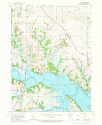 1965 Otley1966 Print · USGSMarion County underwent a massive transformation in the mid-sixties as the Des Moines River valley prepared for the rising waters of Red Rock Lake. Researchers can trace the original landscape through family cemeteries like Ruckman Cem and the small settlement of Teter.2 unique versions available
 - 1965 Map of Knoxville SW, 1966 Print
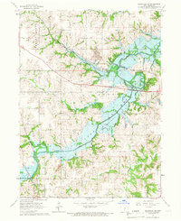 1965 Knoxville SW1966 Print · USGSMarion County comes into focus in the mid-sixties as the newly formed waters of Lake Red Rock reshape the landscape. Researchers can trace the legacy of early settlers and miners at Lincoln Cem, the village of Donnelley, and several local Strip Mines.
 - 1965 Map of Beech, 1966 Print
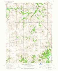 1965 Beech1966 Print · USGSMarion County farming communities and rail lines are documented here in the mid-1960s, just as regional water management began altering the landscape. Genealogists can locate family landmarks like Highland Cem, Motor Ch, and the rural settlements of Beech and Caloma.
 - 1965 Map of Knoxville, 1966 Print
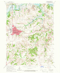 1965 Knoxville1966 Print · USGSKnoxville and its surrounding coalfields are captured in the mid-sixties, just as the landscape was being reshaped by the rising waters of Lake Red Rock. Researchers can trace the era's industry and community through numerous Strip Mines and rural landmarks like Zion Ch and Graceland Cem.2 unique versions available
 - 1969 Map of Des Moines
 1969 Des Moines1969 Print · USGSCentral Iowa's fertile plains and growing capital are captured here during the late sixties, a time of major highway expansion and reservoir construction. Genealogists and researchers can trace rural township boundaries, local cemeteries, and rail lines serving towns like Pella, Grinnell, and Oskaloosa.
 - 1972 Map of Runnells, 1974 Print
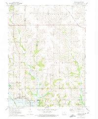 1972 Runnells1974 Print · USGSRunnells and the southern Polk County borderlands are shown here in the early seventies, just as the regional landscape was adjusting to the presence of Lake Red Rock. Researchers can trace old family sites and rural infrastructure through the Vandalia Cem, the Runnells Sch, and the Norfolk and Western rail line.
 - 1980 Map of Leighton
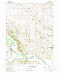 1980 Leighton1980 Print · USGSMahaska County as it appeared in the late 1970s shows a landscape of river bends and active industrial sites. Researchers can trace the rail line through Leighton or locate family plots at Butler Cem and Sand Ridge Cem.
 - 1980 Map of Sully
 1980 Sully1980 Print · USGSCentral Iowa farmland meets the North Skunk River in the early eighties, centered on the growing communities of Sully and Lynnville. Researchers can locate numerous family burial grounds like Swans Cem and Dairy Grove Cem, along with local landmarks like the Municipal Landing Strip.
 - 1980 Map of Peoria
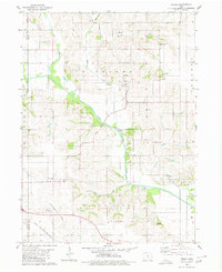 1980 Peoria1980 Print · USGSMahaska County and Marion County farmlands are captured in the late seventies, showing the transition of rural Iowa townships. Genealogists and historians can trace family roots through landmarks like Appel Cem, the Christian Sch, and the South Skunk River.
Showing maps 1-25 of 137
Frequently asked questions
- What are the different types of historical maps available for Marion County?
- What is the oldest map of Marion County?
- Where can I purchase historical maps of Marion County for my home or office?
- Where can I download high-res historical maps of Marion County?
- Are there historical topographic maps available for Marion County?
- Is there historical aerial imagery available for Marion County?
- Where are historical maps of Marion County sourced from?