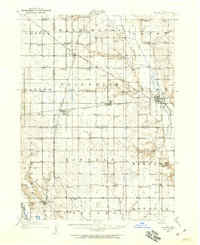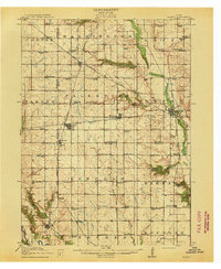
1913 Map of Slater
USGS Topo · Published 1913About this map
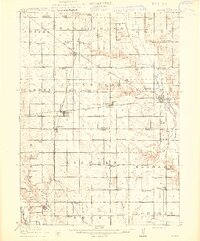
Slater and Huxley anchor a landscape defined by an intensive network of early 20th-century railroads, where the Chicago Milwaukee and St Paul intersects the Fort Dodge Des Moines and Southern electric line. This survey, conducted under George Otis Smith, reveals a rural society organized around a remarkable density of neighborhood schoolhouses. Nearly every section contains a named educational landmark, from the Nip-and-tuck School near the Skunk River to the Victoria School in the west. The terrain transitions from the deeply carved banks of the Des Moines River in the southwest corner near Polk to the flatter, surveyed agricultural plots of Palestine and Lincoln townships. Local transit hubs like Polk City Junction and the small settlement of Sheldahl on the county line reflect the rail-dependent economy of the pre-highway era.
Find a feature on this map
78 named features on this map. Tap any name to fly to it.
Don’t see what you’re looking for? This feature index may not catch every label — zoom into the map to look around manually.
Map Details
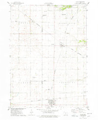
Editions of this 1913 Slater Map
2 editions found
Historical Maps of Ankeny Through Time
8 maps found