1900s (20th Century) Maps of Wyoming, Iowa
Explore 10 historic maps of Wyoming from the 1900s (20th Century). These maps offer a rare glimpse into what life looked like during the 1900s — showing old roads, neighborhoods, homes, and landmarks that have changed or disappeared over time.
Whether you're researching your family's past, planning a metal detecting trip, or studying how Wyoming's landscape evolved across the 1900s, these high-resolution maps are a powerful tool for exploring the history of this region.
- Focus on a specific era: All maps on this page are from the 1900s, giving you a focused view of this time period.
- See what’s changed: Compare century-old streets, trails, and buildings to today's modern landscape using overlays and satellite layers.
- Research with precision: Use these maps for genealogy, historical research, land use analysis, or educational projects.
- View, download, or print: Maps are fully viewable online in high resolution, and can be downloaded or printed for your own records.
Start exploring Wyoming's history through authentic maps from the 1900s. This is your window into the past.
Wyoming, IA maps
(10)- 1900 Map of Anamosa
 1900 Anamosa1900 Print · USGSEastern Iowa is shown here during the peak of its rail-driven development at the end of the century. Genealogists and historians can trace the early layouts of Anamosa and Monticello or locate smaller settlements like Sand Spring and Rockville.4 unique versions available
 - 1901 Map of Peosta
 1901 Peosta1901 Print · USGSDubuque and Jackson counties were a hub of river commerce and early rail expansion at the turn of the century. Genealogists and historians can trace the foundations of communities like Peosta, St.Donatus, and the mill sites at Washington Mills.4 unique versions available
 - 1959 Map of Dubuque, 1982 Print
 1959 Dubuque1982 Print · USGSThe Tri-State region comes alive in the mid-twentieth century as a hub of river commerce and rail transit. Genealogists and historians can trace the paths of the Illinois Central Gulf through Dubuque or locate the Savanna Ordnance Depot and Lock and Dam No 11.
 - 1961 Map of Dubuque
 1961 Dubuque1961 Print · USGSThe Tri-State region's river-and-rail landscape is captured here during the early sixties, showing the convergence of Iowa, Illinois, and Wisconsin. Trace mid-century rail lines like the Chicago Great Western Ry and explore sites like the Savanna Ordnance Depot and Backbone State Park.
 - 1962 Map of Dubuque
 1962 Dubuque1962 Print · USGSThe Tri-State region's river-and-rail economy is captured here in the early sixties, centered on the Mississippi River bluffs. Genealogists and historians can locate Numerous lead and zinc mines, the New Melleray Abbey Monastery, and rural hubs like Saint Olaf.2 unique versions available
 - 1976 Map of Dubuque
 1976 Dubuque1976 Print · USGSThe tri-state borderlands of Iowa, Wisconsin, and Illinois come alive during the mid-seventies, showing a region built on river commerce and mining. Genealogists and historians can trace the paths of the Illinois Central railroad or locate heritage sites like the New Melleray Abbey Monastery and Backbone State Park.
 - 1980 Map of Wyoming East, 1981 Print
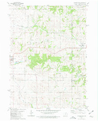 1980 Wyoming East1981 Print · USGSEastern Jones County and neighboring Jackson County appear in the late seventies as a landscape of rural schoolhouses and winding creeks. Genealogists and local historians can trace the Old Railroad Grade past Cady Cem or locate the Midland Sch near Monmouth.
 - 1980 Map of Wyoming West, 1981 Print
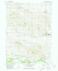 1980 Wyoming West1981 Print · USGSJones County's agricultural heartland is captured here in the 1980s, centered on the historic town of Wyoming and the southern Wapsipinicon River valley. Genealogists and local historians can trace family locations at North Madison Cem or follow the route of the Chicago Milwaukee St Paul and Pacific rail line.
 - 1984 Map of Dubuque South, 1985 Print
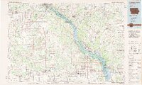 1984 Dubuque South1985 Print · USGSEastern Iowa and Northwest Illinois meet along the Mississippi in the mid-eighties, a landscape defined by river industry and limestone bluffs. Trace the rail lines of the Illinois Central Gulf or explore notable sites like the Savanna Army Depot and Maquoketa Caves State Park.4 unique versions available
 - 1984 Map of Anamosa, 1985 Print
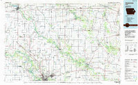 1984 Anamosa1985 Print · USGSEastern Iowa's river valleys and farming communities are captured here in the mid-eighties, showing a landscape defined by the Wapsipinicon River and Maquoketa River. Genealogists and historians can locate legacy landmarks like the Independence State Hospital, Ebys Mill, and the State Penal Farm.2 unique versions available
End of results
Showing maps 1-10 of 10
Top cities near Wyoming
- Monticello historical maps
- Clarence historical maps
- Lowden historical maps
- Wheatland historical maps
- Olin historical maps
- Stanwood historical maps
See more
Frequently asked questions
- What are the different types of historical maps available for Wyoming?
- What is the oldest map of Wyoming?
- Where can I purchase historical maps of Wyoming for my home or office?
- Where can I download high-res historical maps of Wyoming?
- Are there historical topographic maps available for Wyoming?
- Is there historical aerial imagery available for Wyoming?
- Where are historical maps of Wyoming sourced from?