Old Maps of Keokuk County, Iowa for Hiking & Exploration
Hike through history with 135 historic maps of Keokuk County. Explore old trails, ghost towns, and forgotten backroads — perfect for outdoor adventurers and local explorers.
- Rediscover forgotten places: Map out old mining camps, roads, and footpaths that no longer exist on modern maps.
- Layer with modern tools: Combine with LiDAR or satellite views to plan hikes through historical terrain.
- Made for exploration: Popular among hikers, overlanders, and local history lovers.
Use these maps to find adventure and explore the hidden past of Keokuk County.
Keokuk County, IA maps
(135)- 1891 Map of Oxford
 1891 Oxford1891 Print · USGSEastern Iowa in the late nineteenth century was a landscape of burgeoning rail towns and fertile creek bottoms. Genealogists can trace the early township borders of Oxford and York while following the paths of the Chicago Rock Island and Pacific Railroad and Old Mans Creek.
 - 1894 Map of Oxford
 1894 Oxford1894 Print · USGSNorthwestern Johnson County was a landscape of emerging rail towns and winding creek valleys in the late nineteenth century. Genealogists and local historians can trace the early footprints of Oxford and Windham alongside the Old Mans Creek drainage system.2 unique versions available
 - 1903 Map of Fairfax
 1903 Fairfax1903 Print · USGSEastern Iowa's rail-and-river corridor is captured here at the start of the twentieth century, showing the region's transition into an agricultural powerhouse. Genealogists can locate the seven original communal villages of the Amana colonies and old educational sites like Western College.2 unique versions available
 - 1954 Map of Des Moines, 1973 Print
 1954 Des Moines1973 Print · USGSCentral Iowa's evolving landscape is captured here in the early seventies, just as major reservoirs were reshaping the river valleys. Genealogists and historians can trace the rail corridors of the Burlington Northern or locate family roots near Pella, Indianola, and Knoxville.2 unique versions available
 - 1956 Map of Des Moines
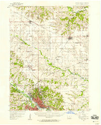
 1956 Des Moines1956 Print · USGSCentral Iowa in the mid-fifties shows a landscape defined by bustling rail hubs and deep-rooted agricultural research. Genealogists and researchers can trace the growth of Des Moines and Ames, locate the Sac and Fox Indian Reservation, or study the paths of the Skunk River and South Skunk River.
 - 1956 Map of Ottumwa North, 1958 Print
 1956 Ottumwa North1958 Print · USGSMid-century Ottumwa and its surrounding townships show a bustling river-and-rail economy as the region expanded in the fifties. Genealogists can trace family sites at Memorial Lawn Cemetery and locate vanished rural landmarks like Shiloh Church.
 - 1957 Map of Des Moines
 1957 Des Moines1957 Print · USGSCentral Iowa's post-war landscape is defined here by the converging rail lines and river valleys that shaped its earliest settlements. Genealogists and historians can trace the paths of the Rock Island Railroad and locate community landmarks in Des Moines, Ames, and Newton.
 - 1958 Map of Davenport, 1968 Print
 1958 Davenport1968 Print · USGSEastern Iowa and western Illinois thrive along the river during the late fifties, defined by the industrial Quad Cities and a robust rail network. Genealogists can trace family roots through settlements like Oasis and Stanwood or along the Cedar River.2 unique versions available
 - 1961 Map of Davenport
 1961 Davenport1961 Print · USGSThe Quad Cities and the eastern Iowa riverlands are captured here in the early sixties, showing the region's transition into a modern industrial and transit hub. Genealogists and historians can trace the paths of major railroads and find river landmarks like Rock Island Arsenal, Huron Island, and the Coralville Reservoir.
 - 1962 Map of Davenport
 1962 Davenport1962 Print · USGSThe Quad Cities and the Mississippi River corridor are shown at their industrial peak just before the interstate era fully transformed the region. Researchers can trace the sprawling rail networks of the Chicago Rock Island and Pacific and find landmarks like the Rock Island Arsenal and Wild Cat Den State Park.
 - 1965 Map of Gibson, 1966 Print
 1965 Gibson1966 Print · USGSThe border of Mahaska and Keokuk counties is documented here in the mid-1960s, showing a landscape defined by river bends and rail lines. Researchers can locate Indianapolis, the Kroses Airpark, and several family cemeteries like Friends Cem.
 - 1965 Map of Rose Hill, 1966 Print
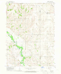
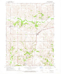
 1965 Rose Hill1966 Print · USGSMahaska County farmland in the mid-sixties is captured here, centered on the village of Rose Hill along the Chicago Rock Island and Pacific tracks. Genealogists can trace local roots through landmarks like Hopewell Cem, White Oak Ch, and the North White Oak Sch.
 - 1965 Map of What Cheer, 1966 Print
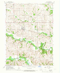
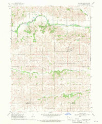
 1965 What Cheer1966 Print · USGSMid-century Keokuk County centers on the industrial and rail patterns of the day, from the local clay industry to the transition of rural townships. Researchers can trace family history through a wealth of cemeteries like Highland Cem or locate the old Kilns and Fairground in What Cheer.
 - 1965 Map of Keswick, 1966 Print
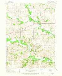
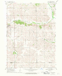
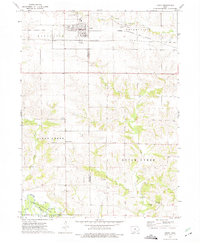
 1965 Keswick1966 Print · USGSKeokuk County at the height of the mid-sixties agricultural era was a busy junction for major Midwestern railroads. Family historians can trace rural roots through several burial grounds like White Pigeon Cem and Lutton Cem, or locate landmarks in the settlements of Keswick and Webster.
 - 1965 Map of Harper, 1966 Print
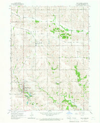
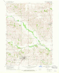
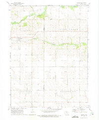
 1965 Harper1966 Print · USGSKeokuk County farmland is captured here in the mid-1960s, centered on the railroad town of Harper. Genealogists and historians can trace local landmarks like St Elizabeth Sch, Baden Cem, and the path of the Chicago Rock Island and Pacific railroad.
 - 1965 Map of South English, 1966 Print
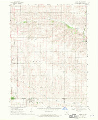
 1965 South English1966 Print · USGSKeokuk County at the height of the mid-sixties reveals a landscape shaped by the Rock Island and Milwaukee Road railroads. Researchers can trace the town of South English alongside the Mennonite Ch and Pleasant Hill Cem.
 - 1965 Map of Sigourney, 1966 Print
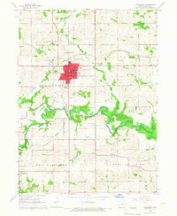 1965 Sigourney1966 Print · USGSSigourney and the surrounding Iowa countryside are captured here in the mid-1960s, showing a landscape defined by rail lines and river valleys. Genealogists can trace family names at Pennington Cem or Conner Cem and locate landmarks like the County Farm.
 - 1965 Map of Delta, 1966 Print
 1965 Delta1966 Print · USGSDelta and the Skunk River valleys are captured here in the mid-sixties, showing a landscape of coal mines, quarries, and small-town rail commerce. Researchers can locate several family burial grounds like Garrett Cem and landmarks such as the Covered Bridge.
 - 1968 Map of Deep River, 1970 Print
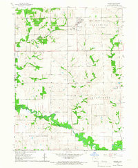
 1968 Deep River1970 Print · USGSEastern Iowa farmland in the late sixties reveals a network of small townships and river valleys. Researchers can trace the path of the Old Railroad Grade or locate family sites at Dresden Cem and the town of Deep River.
 - 1968 Map of North English, 1970 Print
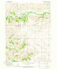
 1968 North English1970 Print · USGSNorth English and the surrounding Iowa countryside are captured here in the late sixties, showing a landscape defined by river valleys and rail lines. Genealogists and local historians can trace rural landmarks like Pleasant Grove Ch, Campbell Cem, and the Chicago Milwaukee St Paul and Pacific railroad.
 - 1968 Map of Barnes City, 1970 Print
 1968 Barnes City1970 Print · USGSMid-century Iowa farm country is captured here during the late 1960s, centered on the tri-county border at Barnes City. Genealogists and local historians can trace family land near Lisor Cem or follow the path of the Chicago Rock Island and Pacific railroad.
 - 1968 Map of Millersburg, 1971 Print
 1968 Millersburg1971 Print · USGSIowa and Keokuk counties appear here in the late sixties as a landscape of structured townships and winding river valleys. Researchers can locate family landmarks such as St Bernards Cath Ch, Mt Zion Cem, and the rural crossing at Armah Ch.
 - 1969 Map of Des Moines
 1969 Des Moines1969 Print · USGSCentral Iowa's fertile plains and growing capital are captured here during the late sixties, a time of major highway expansion and reservoir construction. Genealogists and researchers can trace rural township boundaries, local cemeteries, and rail lines serving towns like Pella, Grinnell, and Oskaloosa.
 - 1973 Map of Keota, 1975 Print
 1973 Keota1975 Print · USGSMid-century Iowa life is centered around the railroad town of Keota and the surrounding agricultural townships in the 1970s. Genealogists can trace several rural burial grounds like St Marys Cem and old settlements such as Talleyrand or the riverside Valley.
 - 1973 Map of Kinross, 1975 Print
 1973 Kinross1975 Print · USGSKinross and the surrounding Iowa farmsteads are shown in the 1970s, a period when local rail lines like the Central Iowa Transportation Coop still shaped the landscape. Researchers can locate family sites and rural landmarks, from St Patricks Cem to the small community of Nira.
Showing maps 1-25 of 135
Top cities of Keokuk County
- Sigourney historical maps
- Keota historical maps
- Hedrick historical maps
- What Cheer historical maps
- Richland historical maps
- Delta historical maps
See more
Frequently asked questions
- What are the different types of historical maps available for Keokuk County?
- What is the oldest map of Keokuk County?
- Where can I purchase historical maps of Keokuk County for my home or office?
- Where can I download high-res historical maps of Keokuk County?
- Are there historical topographic maps available for Keokuk County?
- Is there historical aerial imagery available for Keokuk County?
- Where are historical maps of Keokuk County sourced from?