2020s Maps of Crawford Township, Iowa
Explore 4 historic maps of Crawford Township from the 2020s. These maps offer a rare glimpse into what life looked like during the 2020s — showing old roads, neighborhoods, homes, and landmarks that have changed or disappeared over time.
Whether you're researching your family's past, planning a metal detecting trip, or studying how Crawford Township's landscape evolved across the 2020s, these high-resolution maps are a powerful tool for exploring the history of this region.
- Focus on a specific era: All maps on this page are from the 2020s, giving you a focused view of this time period.
- See what’s changed: Compare century-old streets, trails, and buildings to today's modern landscape using overlays and satellite layers.
- Research with precision: Use these maps for genealogy, historical research, land use analysis, or educational projects.
- View, download, or print: Maps are fully viewable online in high resolution, and can be downloaded or printed for your own records.
Start exploring Crawford Township's history through authentic maps from the 2020s. This is your window into the past.
Crawford Township, IA maps
(4)- 2022 Map of Cumming, 2022 Print
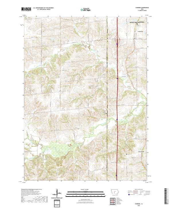 2022 Cumming2022 Print · USGSWarren County at the dawn of the 2020s shows the meeting point of suburban growth and traditional Iowa farmland. Genealogists and local historians can trace family plots at Saint Johns Cemetery or Calvary Cemetery and follow the natural course of North River.
 - 2022 Map of Saint Charles NW, 2022 Print
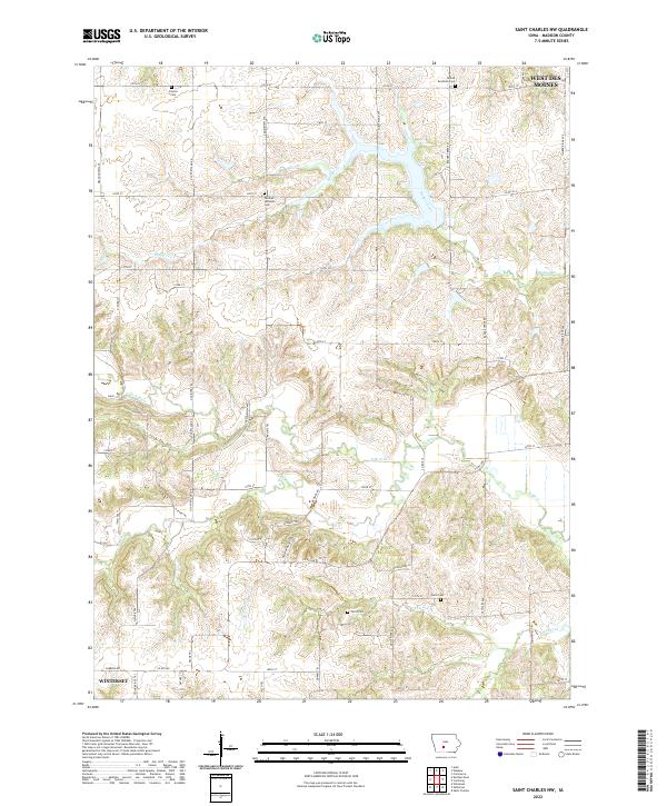 2022 Saint Charles NW2022 Print · USGSMadison County farmland near the North Branch of the North River is documented here in the early 2020s. Genealogists and local historians can trace legacy sites like the German Lutheran Cem, Farris Cem, and Payton Cem.
 - 2022 Map of Patterson, 2022 Print
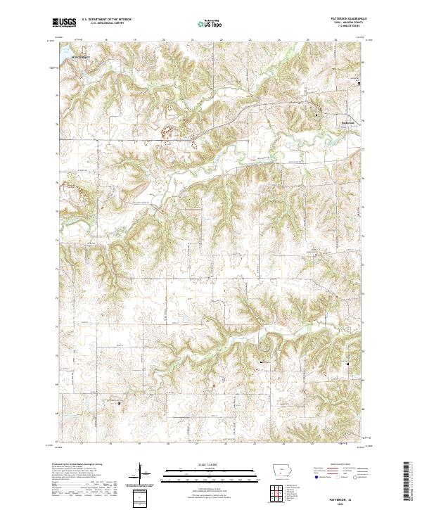 2022 Patterson2022 Print · USGSMadison County's river valleys and timbered ridges are captured here in the early twenty-first century, centered on the Middle River corridor. Genealogists can trace family heritage at several local burial sites, including Beem Cem, Sayre Cem, and Union Chapel Cem.
 - 2022 Map of Saint Charles, 2022 Print
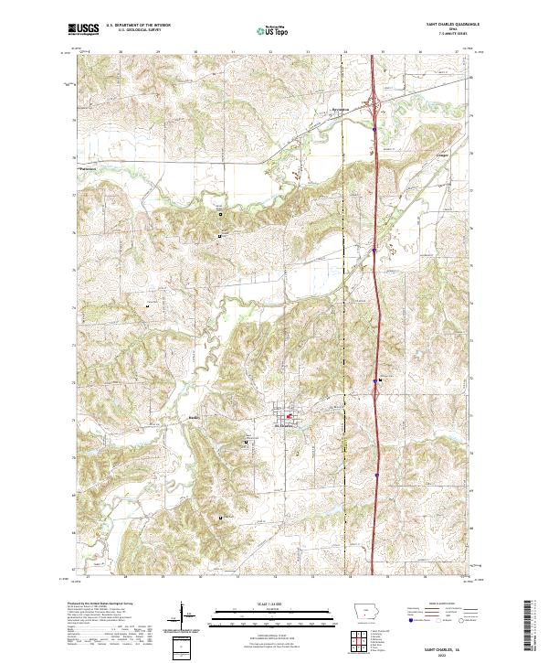 2022 Saint Charles2022 Print · USGSMadison and Warren counties are shown here in the 2020s, centered on the community of St. Charles. Researchers can trace rural lineages through numerous local sites including Saint Charles Cem, Viney Cem, and the crossroads at Hanley.
End of results
Showing maps 1-4 of 4
Top cities near Crawford Township
- Des Moines historical maps
- West Des Moines historical maps
- Waukee historical maps
- Clive historical maps
- Norwalk historical maps
- Adel historical maps
See more
Top neighborhoods of Crawford Township
Frequently asked questions
- What are the different types of historical maps available for Crawford Township?
- What is the oldest map of Crawford Township?
- Where can I purchase historical maps of Crawford Township for my home or office?
- Where can I download high-res historical maps of Crawford Township?
- Are there historical topographic maps available for Crawford Township?
- Is there historical aerial imagery available for Crawford Township?
- Where are historical maps of Crawford Township sourced from?