2020s Maps of Monroe County, Iowa
Explore 12 historic maps of Monroe County from the 2020s. These maps offer a rare glimpse into what life looked like during the 2020s — showing old roads, neighborhoods, homes, and landmarks that have changed or disappeared over time.
Whether you're researching your family's past, planning a metal detecting trip, or studying how Monroe County's landscape evolved across the 2020s, these high-resolution maps are a powerful tool for exploring the history of this region.
- Focus on a specific era: All maps on this page are from the 2020s, giving you a focused view of this time period.
- See what’s changed: Compare century-old streets, trails, and buildings to today's modern landscape using overlays and satellite layers.
- Research with precision: Use these maps for genealogy, historical research, land use analysis, or educational projects.
- View, download, or print: Maps are fully viewable online in high resolution, and can be downloaded or printed for your own records.
Start exploring Monroe County's history through authentic maps from the 2020s. This is your window into the past.
Monroe County, IA maps
(12)- 2022 Map of Moravia, 2022 Print
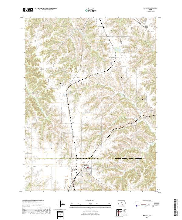 2022 Moravia2022 Print · USGSIn the rural borderlands of Monroe and Appanoose counties, this modern survey details the agricultural landscape surrounding Moravia and its satellite communities. Researchers can trace family history through local landmarks like Hillcrest Cem, Selection Cem, and the settlement at Foster.
 - 2022 Map of Iconium, 2022 Print
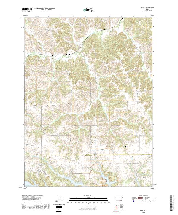 2022 Iconium2022 Print · USGSSouthern Iowa's rural landscape is captured here in the early twenty-first century, spanning the border of Monroe and Appanoose Counties. Researchers can locate numerous historic burial sites such as Mount Carmel Cem and Inghram Cem near Tyrone and Iconium.
 - 2022 Map of Melrose, 2022 Print
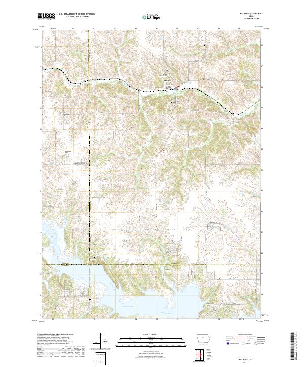 2022 Melrose2022 Print · USGSThe southern Iowa countryside near Melrose is captured here as it appeared in the early 2020s, dominated by the waters of Rathbun Lake. Genealogists and local historians can trace numerous family and community burial grounds, from Melrose Methodist Cem to the secluded Evans Cem near the Chariton River.
 - 2022 Map of Blakesburg, 2022 Print
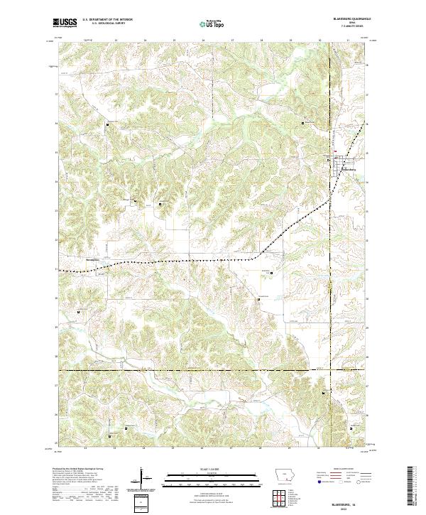 2022 Blakesburg2022 Print · USGSThe agricultural borderlands of Southern Iowa come alive in this survey of the region surrounding Blakesburg. Genealogists can locate numerous family burial grounds including Trussell Cem and Sales Cem tucked away near Buzzard Cr and Brompton.
 - 2022 Map of Buxton, 2022 Print
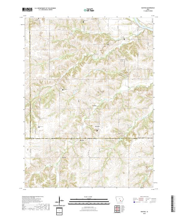 2022 Buxton2022 Print · USGSMahaska County and the surrounding tri-county borderlands are captured here in the contemporary era. Genealogists can trace family footprints across numerous rural burial sites like Buxton Cemetery and Smith Cemetery, or locate the settlements of Buxton and Miami.
 - 2022 Map of Attica, 2022 Print
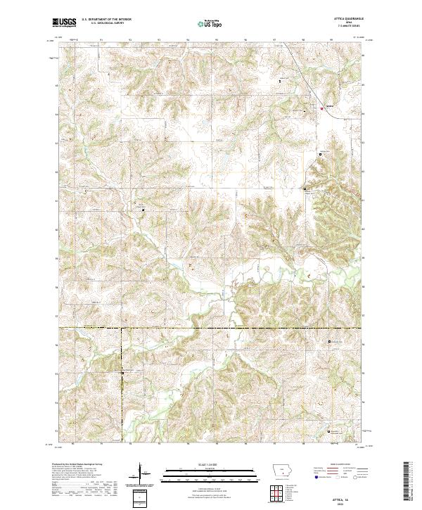 2022 Attica2022 Print · USGSMarion County and the surrounding tri-county border lands are captured here in the early twenty-first century. Genealogists can locate numerous rural burial grounds including Mormon Cemetery, Olive Chapel Cemetery, and Eldorado Cemetery.
 - 2022 Map of Lovilia, 2022 Print
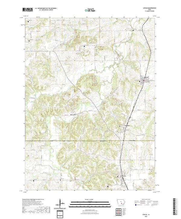 2022 Lovilia2022 Print · USGSThe rural border between Marion and Monroe counties is captured here in the early twenty-first century, showcasing a landscape of dispersed agricultural communities. Genealogists can locate several local burial grounds including Woodlawn Cem, Saint Peters Cem, and Greenlawn Cem near Lovilia and Bussey.
 - 2022 Map of Avery, 2022 Print
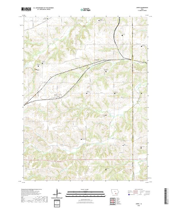 2022 Avery2022 Print · USGSMonroe County, Iowa, retains its rural character in this 2022 survey of its rolling farmland and small settlements. Genealogists can trace deep local roots through family landmarks like Johnston Family Cem, Old Shahan Cem, and the isolated Daggett Grave.
 - 2022 Map of Eddyville, 2022 Print
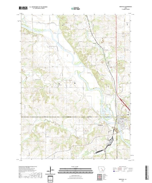 2022 Eddyville2022 Print · USGSThe confluence of Mahaska, Monroe, and Wapello counties comes to life in this recent study of the Des Moines River valley. Genealogists can locate several family burial sites like Henness Cem and Crain Cem near the historic river town of Eddyville.
 - 2022 Map of Hiteman, 2022 Print
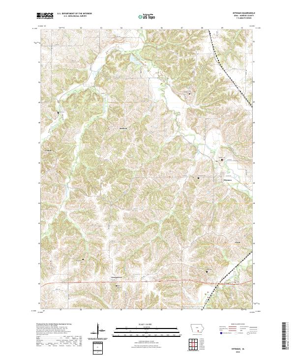 2022 Hiteman2022 Print · USGSMonroe County settlements and family burial grounds are meticulously documented in this contemporary survey of the Iowa landscape. Genealogists can locate specific sites like Saint Patricks Cem, Hiteman Cem, and the historic community of Georgetown.
 - 2022 Map of Weller, 2022 Print
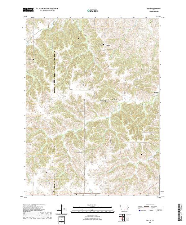 2022 Weller2022 Print · USGSThis part of Iowa along the Monroe and Lucas county line shows a landscape of deep-cut creek valleys and scattered rural settlements. Family historians can trace numerous burial sites like Peterson Cem and Stoneking Cem near Bucknell and Weller.
 - 2022 Map of Albia, 2022 Print
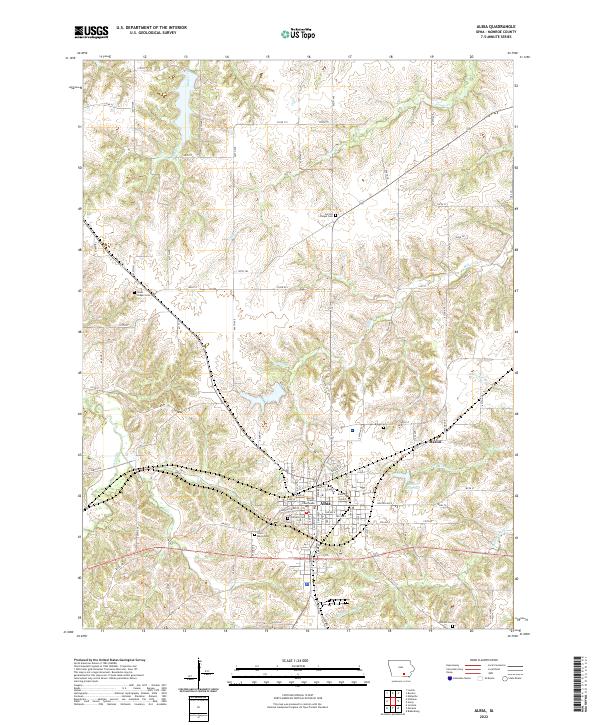 2022 Albia2022 Print · USGSMonroe County, Iowa, is shown in high detail during the early 2020s, centered on the seat of Albia. Researchers can trace local lineage through numerous sites like Oakview Cem and Boggs Cem or locate the historic Monroe County Courthouse.
End of results
Showing maps 1-12 of 12
Top cities of Monroe County
Frequently asked questions
- What are the different types of historical maps available for Monroe County?
- What is the oldest map of Monroe County?
- Where can I purchase historical maps of Monroe County for my home or office?
- Where can I download high-res historical maps of Monroe County?
- Are there historical topographic maps available for Monroe County?
- Is there historical aerial imagery available for Monroe County?
- Where are historical maps of Monroe County sourced from?