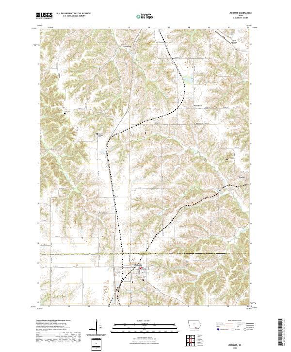
2022 Map of Moravia
USGS Topo · Published 2022About this map
Moravia anchors the southern portion of this landscape, situated just below the Monroe Co Appanoose Co line. This 2022 survey reveals a classic Southern Iowa pattern of small, dispersed settlements like Foster, Selection, and Hocking connected by a grid of county roads. The terrain is defined by a dense network of drainages, including the winding paths of Soap Cr and Kinser Cr, which dictate the local topography.
Find a feature on this map
51 named features on this map. Tap any name to fly to it.
Don’t see what you’re looking for? This feature index may not catch every label — zoom into the map to look around manually.
Map Details
Editions of this 2022 Moravia Map
This is the sole edition of this map. No revisions or reprints were ever made.
Other maps of this area

1929 · Albia
USGS Topo · 1:62,500

1939 · Mystic
USGS Topo · 1:62,500

1942 · Mystic
USGS Topo · 1:62,500

1954 · Centerville
USGS Topo · 1:250,000

1954 · Des Moines
USGS Topo · 1:250,000

1956 · Des Moines
USGS Topo · 1:250,000

1957 · Des Moines
USGS Topo · 1:250,000

1957 · Centerville
USGS Topo · 1:250,000

1958 · Centerville
USGS Topo · 1:250,000

1966 · Hiattsville
USGS Topo · 1:24,000