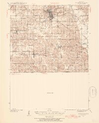
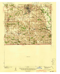
1957 Map of Centerville
USGS Topo · Published 1957About this map
The borderlands of southern Iowa and northern Missouri are defined by a rhythmic series of south-flowing river valleys, notably the Chariton River and the Grand River. In the mid-1950s, this region remained a patchwork of small agricultural hubs connected by an extensive rail network, including the Chicago Burlington and Quincy and the Wabash lines. Larger regional centers like Centerville and Ottumwa serve as anchors in an area where the terrain transitions from the broader Grand River Valley in the west to the more dissected landscapes of the Des Moines River basin in the east.
Find a feature on this map
48 named features on this map. Tap any name to fly to it.
Don’t see what you’re looking for? This feature index may not catch every label — zoom into the map to look around manually.
Map Details
Editions of this 1957 Centerville Map
This is the sole edition of this map. No revisions or reprints were ever made.
Historical Maps of Ottumwa Through Time
6 maps found